Training Log Archive: BashIn the 7 days ending Jul 20, 2014:
| ||||||||||||||||||||||||||||||||||||||||||||||||||||||||||||||||||||||||||||||||||||||||||||
| « | » |
| » now | ||||||||||
| Mo | Tu | We | Th | Fr | Sa | Su | |||||||
Sunday Jul 20, 2014 #
Note
Crash rode in the national mountain bike champs today. Every ride seems short after the Tour Divide! She has so many stories from almost 5,000 km of riding through the mountains. My favourite is from New Mexico where there were black cows wandering all over the place. She rode right up to one, expecting it to move off the trail. Turns out it was a bear. Oops.
9 AM
Running (Trail) 3:26:10 [3] 23.0 km (8:58 / km) +840m 7:35 / km
slept:6.0 shoes: Salomon Speedcross 3 Aqua
Funderstorm and I met for a fun, albeit humid, Hockley Loop. The clouds looked threatening but we only had a little rain. My legs felt good but I'm really looking forward to tomorrow's rest day.
'Bent's workout today was 1 hour hike, 2 hours run, 1 hour hike so he was able to join us for part of our run. Great to catch up with Funderstorm on the trail and even better to enjoy a relaxed lunch at the Black Birch. 'Bent took advantage of FS' expert advice to order a yummy-looking dark beer. I splurged on the beer-batter fish and chips so will have to do penance this week. Not tonight though - we're having dinner with Crash so we can hear stories of the Tour Divide.
Added missing piece of GPS track - user error as usual.
Saturday Jul 19, 2014 #
Note
David Foster - musician, record producer (Céline Dion, Barbra Streisand, Michael Jackson...) and 16-time Grammy winner - headlined a recent charity gala in Caledon. He asked if anyone in the audience thought they could sing. My 19-year-old friend Andie Trépanier put up her hand, and Ben Mulroney handed her his microphone. It went pretty well...
10 AM
Orienteering 2:00:00 [1] 6.5 km (18:28 / km) +181m 16:12 / km
slept:5.25 shoes: Salomon XA Pro - Navy 2nd pair
Browner and I met at Kerncliff Park in Burlington to work on some team navigation techniques in advance of the World Rogaining Champs next month. Once we had located each other in the first place, things went quite well. ;)
When I did a rogaine with Barb Bryant a few years ago, we decided that we wasted time when we showed something to our teammate on our own map. It takes a few seconds to get oriented when you look at someone else's map, then you need to find your place on your own map again. So Barb and I tried to explain ideas clearly enough that the other person could just look at their own map. That's one of the things Browner and I worked on today - also other things like sharing duties on pace counting, bearings, etc. I'm looking forward to a fun weekend in South Dakota!
We had a team bonding experience when a buzzing bug flew into Browner's ear and didn't want to leave! In spite of best intentions, we ended up in Poison Ivy Central when we went west of Kerns Rd. Yecch. This would have been the 4th pair of shoes in the PI contamination pile on our patio but while I was out of town today, my hero 'Bent scrubbed 3 pairs of shoes *and* my bike! Thank you!!!!! :)
(Logged estimated moving time)
Friday Jul 18, 2014 #
2 PM
Mountain Biking (Rail Trail & Single Track) 2:23:31 [3] 47.48 km (19.8 kph) +166m
slept:7.0
Coach LD, 'Bent and I went for a destination / pig-out ride. Appetizer Stop was just 400 m from home at the first field of red and black raspberry bushes. Then we rode 23 km to Inglewood for our Ice Cream Stop. I decided to live dangerously by mixing Salted Caramel Truffle with Cookies and Cream. Sadly, they were out of Moose Tracks. Then we returned on the rail trail and climbed Thinker's Hill for an extended Dessert Stop. So many berries! We stopped again for Second Dessert and Third Dessert. It's tough to resist plump, ripe berries when they're drooping over the trail.
It was really good to have a plan with a friend today. My legs felt fatigued from the last two days, and it would have been easy to talk myself into a rest day. As it was, I did a fair bit of drafting. Glad I went - it was a fun afternoon with beautiful sunshine and good conversation. The evening sky looks ominous; we'll get some weather tomorrow.
It was really good to have a plan with a friend today. My legs felt fatigued from the last two days, and it would have been easy to talk myself into a rest day. As it was, I did a fair bit of drafting. Glad I went - it was a fun afternoon with beautiful sunshine and good conversation. The evening sky looks ominous; we'll get some weather tomorrow.
Thursday Jul 17, 2014 #
4 PM
Mountain Biking (Single Track) 2:12:00 [3] 24.5 km (11.1 kph) +370m
slept:6.5
More trail checking at Albion Hills in preparation for the Star Tracks MTB-O event. Lots of fun and hard work too since I had to ride up a bunch of down trails in order to GPS everything.
I haven't biked much this year and am pleasantly surprised that my legs feel strong on climbs after all the running and strength training. I'm looking forward to getting back to more AR and multisport.
I stopped in Mad Dog Meadow to check on the wild raspberry crop. My search was fruitful. ;)
Btw I can see why Albion Hills closed for so long after the ice storm. This area was just beside some single track.
Wednesday Jul 16, 2014 #
4 PM
Running (Trail and Country road) 4:00:26 [3] 26.26 km (9:09 / km) +1002m 7:41 / km
shoes: Salomon Speedcross 3 Aqua 2
I wanted a change from my usual trail runs and I definitely succeeded! The first change was apparent when I arrived at the starting point an hour from home and discovered that some canine had stolen one of the insoles from my shoes. So my style today could be described as "semi-minimalist".
The route idea was simple: use Dee's awesome Tour de Blue map and go from the bottom of Pretty River Valley Provincial Park up toward Blue Mountain - just to 12&13 Sideroad - then check the time and come back the same way. Much of it would be on the Bruce main or side trails. I was looking at 2.5 to 3 hours, maybe even less with the missing insole since there would be lots of downhill pounding.
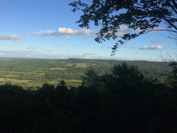
The forest at Pretty River was lush and dark. I started with a podcast on but turned it off because I wanted to be alert for approaching mountain bikes since I wouldn't see them in time. As it turned out, I didn't see any bikes in the woods at all. The route started out with a terrific climb that took me to a famous landmark. Looks like my Ambit2 is working well!

I carried on north on a combination of trails and gravel roads. It was all fun and games until the trail turned into a sea of poison ivy just before 12&13 Sideroad. I made it to the road but didn't want to go back that way; I figured it should be possible to make a loop instead. First I did a hill repeat on 12&13 Sideroad, which is one of the bigger hills in southern Ontario. I noticed some of Bob's signage from the North Face Endurance Challenge piled neatly at a junction. Then I ran on the shoulder of Grey Rd. #19 thinking that I should be able to find a way up to the top of Pretty River Park even though my map didn't show anything.
The sun was getting low in the sky so this was turning into an adventure, given that I only had an iPhone flashlight. My first attempt to find a trail at a dead-end road was unsuccessful and it felt like I would be trespassing. The next one started off well, then emerged onto an unmapped road that ended in what looked like a snowmobile trail with a big "closed" sign. I took it anyway and found myself walking in cold water up to knee deep. The slope in the direction I wanted to go was almost a cliff so the trail veered sharply north. I followed it uncertainly and finally emerged from the water. It felt a lot like WT course testing - except without a headlamp, compass, extra warmth layer and one of the world's best AR navigators keeping me company.
Without a compass, I watched my altimeter until it seemed that I should be at the right altitude and - voilà! - a Bruce Trail blaze appeared. I hurried through the forest, which seemed dark even though there was still light outside on the rare occasions when I got a view.
People who know me will assume that I ran a little extra to get the session up to 4 hours but actually, that was a coincidence since I didn't look at my time at all. However, I *did* make a quick trip up the side trail to the Bruce Trail highest point again to get my elevation gain up to 4 digits. :)
And then I scrubbed and scrubbed with Tecnu, which I'd brought along just in case. Fingers crossed for the next 96 hours. I now have 3 pairs of shoes and a pair of trekking poles waiting for poison ivy decontamination. I guess I can't put it off much longer.
Fun exploration!
The route idea was simple: use Dee's awesome Tour de Blue map and go from the bottom of Pretty River Valley Provincial Park up toward Blue Mountain - just to 12&13 Sideroad - then check the time and come back the same way. Much of it would be on the Bruce main or side trails. I was looking at 2.5 to 3 hours, maybe even less with the missing insole since there would be lots of downhill pounding.
The forest at Pretty River was lush and dark. I started with a podcast on but turned it off because I wanted to be alert for approaching mountain bikes since I wouldn't see them in time. As it turned out, I didn't see any bikes in the woods at all. The route started out with a terrific climb that took me to a famous landmark. Looks like my Ambit2 is working well!
I carried on north on a combination of trails and gravel roads. It was all fun and games until the trail turned into a sea of poison ivy just before 12&13 Sideroad. I made it to the road but didn't want to go back that way; I figured it should be possible to make a loop instead. First I did a hill repeat on 12&13 Sideroad, which is one of the bigger hills in southern Ontario. I noticed some of Bob's signage from the North Face Endurance Challenge piled neatly at a junction. Then I ran on the shoulder of Grey Rd. #19 thinking that I should be able to find a way up to the top of Pretty River Park even though my map didn't show anything.
The sun was getting low in the sky so this was turning into an adventure, given that I only had an iPhone flashlight. My first attempt to find a trail at a dead-end road was unsuccessful and it felt like I would be trespassing. The next one started off well, then emerged onto an unmapped road that ended in what looked like a snowmobile trail with a big "closed" sign. I took it anyway and found myself walking in cold water up to knee deep. The slope in the direction I wanted to go was almost a cliff so the trail veered sharply north. I followed it uncertainly and finally emerged from the water. It felt a lot like WT course testing - except without a headlamp, compass, extra warmth layer and one of the world's best AR navigators keeping me company.
Without a compass, I watched my altimeter until it seemed that I should be at the right altitude and - voilà! - a Bruce Trail blaze appeared. I hurried through the forest, which seemed dark even though there was still light outside on the rare occasions when I got a view.
People who know me will assume that I ran a little extra to get the session up to 4 hours but actually, that was a coincidence since I didn't look at my time at all. However, I *did* make a quick trip up the side trail to the Bruce Trail highest point again to get my elevation gain up to 4 digits. :)
And then I scrubbed and scrubbed with Tecnu, which I'd brought along just in case. Fingers crossed for the next 96 hours. I now have 3 pairs of shoes and a pair of trekking poles waiting for poison ivy decontamination. I guess I can't put it off much longer.
Fun exploration!
6 PM
Note
Wilderness Traverse made the Huffington Post!
http://www.huffingtonpost.com/liftopia/11-adventur...
http://www.huffingtonpost.com/liftopia/11-adventur...
7 PM
Note
slept:6.5
Fyi for those who tried to watch the WT tracker map... It wasn't our imagination; there was a problem with some of the data sent by DeLorme (tracking device company) to our tracker map. The trackers themselves were broadcasting good data, except for a couple that stopped working (they probably got wet). This is great news since it means that it can be fixed for future events.
Our tracking at WT 2013 was so good that I immediately decided to replace my own SPOT with a DeLorme when the time comes. But this year made me think twice about that. Glad to know that future tracking can be as good as it was in 2013.
Our tracking at WT 2013 was so good that I immediately decided to replace my own SPOT with a DeLorme when the time comes. But this year made me think twice about that. Glad to know that future tracking can be as good as it was in 2013.
Tuesday Jul 15, 2014 #
Note
slept:8.25

6 PM
Strength & Mobility (Running-specific) 35:00 [2]
I'd planned to run today too but there's still WT stuff to do, plus all the things I didn't get done last week because I was going away. I will make up for it tomorrow! Really!
7 PM
Note
Checked my phone records - just under 800 texts sent or received as part of managing WT HQ on the weekend! Thank you 'Bent for the external keyboard for my phone.
Monday Jul 14, 2014 #
Note
slept:11.25
Canadian ultrarunner Adam Campbell, who used to be on the Salomon Flight Crew with me, finished 3rd at the gruelling Hardrock 100 ultrarun on the weekend in spite of a little mishap at the highest point on the course... He and his pacer were struck by lightning at 4200 m. They were very lucky; the only serious damage was to Adam's headlamp.
http://www.calgaryherald.com/touch/story.html?id=1...
Btw they mention that the course has 21,000 m of climb and descent in 162 km, by which they mean 10,500 m of elevation gain - the usual number used to describe a race course.
http://www.calgaryherald.com/touch/story.html?id=1...
Btw they mention that the course has 21,000 m of climb and descent in 162 km, by which they mean 10,500 m of elevation gain - the usual number used to describe a race course.