Training Log Archive: BashIn the 31 days ending May 31, 2010:
| ||||||||||||||||||||||||||||||||||||||||||||||||||||||||||||||||||||||||||||||||||||||||||||
| « | » |
| » now | ||||||||||||||||||||||||||||||||||||||||||||
| Sa | Su | Mo | Tu | We | Th | Fr | Sa | Su | Mo | Tu | We | Th | Fr | Sa | Su | Mo | Tu | We | Th | Fr | Sa | Su | Mo | Tu | We | Th | Fr | Sa | Su | Mo | |||||||||||||||||
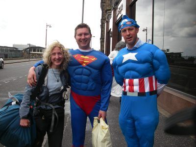
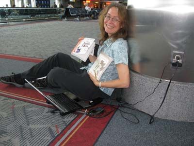
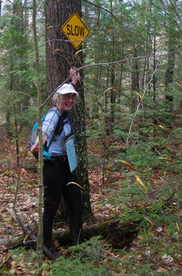
Monday May 31, 2010 #
Note
Unhealthiest items spotted on menus today: Haggis nachos and Deep-fried Mars bars
Weirdest tourist thing we did: Toured museums of surgery and dentistry that were jam-packed with historical instruments and pickled body parts
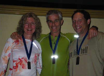
In shopping news, 'Bent and I found some plaid - quite a lot of plaid, actually - to wear to Goose and Coach LD's Robbie Burns dinner next year.
Still haven't had a cup of coffee that rates less than A+. This is not true in Canada and *really* not true in the U.S. I thought they were tea drinkers here.
Bought a fancy tick removal device at an outdoor store. When the clerk heard where we were from, he took it out of the package and showed us how to remove a tick properly because we "will see lots of them" and people often remove ticks incorrectly. Oh yay.
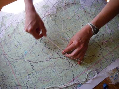
Bought a big stack of 1:50,000 topo maps and can't wait to get into the hills (ticks not withstanding)! We're leaving Edinburgh tomorrow and not sure where we'll end up. Hope we'll have Internet on the weekend to watch our friends racing in and volunteering at Wilderness Traverse. Sure would love to be two places at once! Hope everyone has a great time. (Btw, I just posted an article on WT on Sleepmonsters.ca if you're interested.)
Sunday May 30, 2010 #
Trekking (Trail) 1:00:00 [2]
shoes: Salomon XA Pros - Tomato

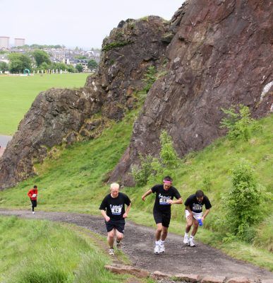
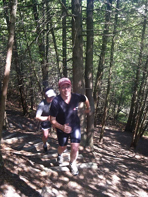
Today the park hosted the Urbanathlon, a 10K trail running race that finished with some special challenges. Wish we'd known about it; when the runners went by on the trail, it gave me itchy feet!
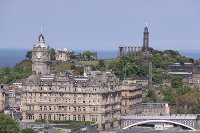
As advertised, this is a scenic city with interesting topography and a mind-blowing amount of history. I'll need to do lots of reading to keep up.

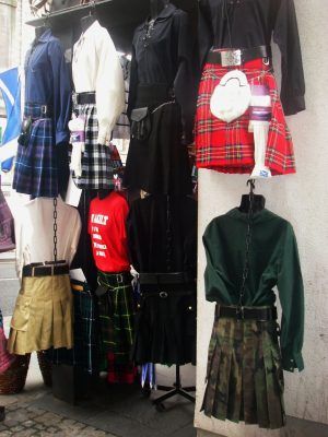
The fashions are a little different here. Note that kilts don't just come in plaid - there's even a camo option. Some of them have handy cargo pockets instead of a sporran. One of the T-shirts in the kilt display says, "If I wore underwear, this would just be a skirt".

The food options are interesting. Haggis is everywhere.


Actually, the food and coffee have been spectacularly good so far. Lots of vegetarian things for 'Bent.
This street performer might have regretted asking 'Bent to help him with his escape artist trick. "Tighten that straitjacket as hard as you can. Ouch!"

Signing off for now.


Friday May 28, 2010 #
Note
Note
Thursday May 27, 2010 #
Note
Leanimal, Hutspot and Wanda will be posting news updates from the event site, and Luis Moreira and William Young will be uploading photos.
Live coverage of the race will be hosted on the main Wilderness Traverse website including maps and SPOT GPS tracking which will broadcast team locations every 10 minutes. I'd rather race but it will be fun to be a spectator too!
Wednesday May 26, 2010 #
Note
Tuesday May 25, 2010 #
Note
Heard a fun piece on CBC Radio about the Tweeting Too Hard site. "Where self-important tweets get the recognition they deserve."
Here's an example of a tweet that was submitted. (People submit tweets they've received that they feel meet the criteria.): 'feeling very loved this week. Check out this blog interview of me by @kempedmonds http://bit.ly/c1opig '
Monday May 24, 2010 #
Note
Running (Trail) 25:00 [3] 4.0 km (6:15 / km)
shoes: Salomon SLAB-2 XT Wings
Sunday May 23, 2010 #
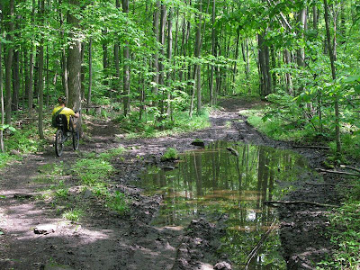
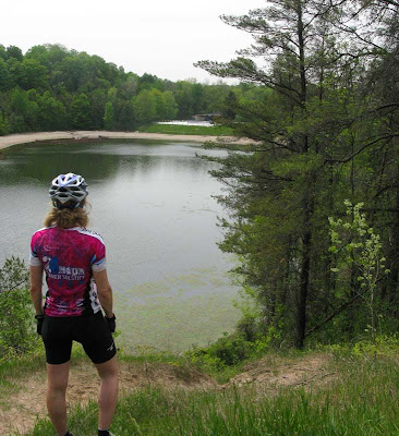
Mountain Biking (Trail) 3:45:00 66.3 km (17.7 kph)
Today was a summer weekend staple - a destination ride to The Shed Coffee Bar in Belfountain, a fantastic place owned by adventure racer Dave Corner.
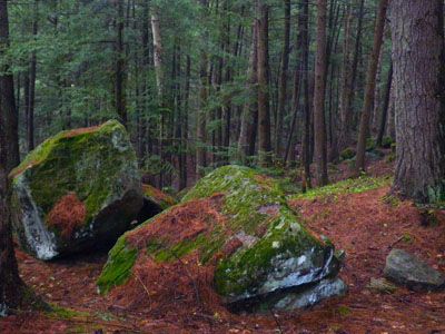
'Bent and I rode to Caledon East (see Wednesday) then continued by rail trail to Inglewood. This ride took us from east Caledon into west Caledon, from the Humber River watershed into the Credit River watershed, from the Oak Ridges Moraine to the Niagara Escarpment. There is some friendly(?) rivalry between Caledon's two solitudes - the escarpment people and the moraine people. We are moraine people. Stoopid rocks and moss.
In spite of our differences, we have a few friends in west Caledon including Knobless and Gorgeous and their four pooches.

From Inglewood, there are several ways to get to The Shed but you can't avoid the big escarpment climb. Knobless joined us but his time was tight due to a lunch date, so we took roads part of the way including the infamous Grange Hill. (BTW, Knobless got his nickname because he uses a hybrid bike for everything, even the gnarliest trails.)
Belfountain is arguably the most beautiful village in Caledon, although I would never admit that in front of someone from western Caledon. Here's the little section of Bruce Trail that leads to Devil's Pulpit overlooking the area around the village. This was a 2-minute side hike from our bike ride.

Wise people generally don't post escarpment pics on Attackpoint because Hammer is so much better at it than everyone else. But I had to because that was the route to this view.

Here's the trail heading down off the escarpment by a big cliff. It gets a lot steeper, which is particularly fun in winter at night.
But we didn't go down. Today's goal was The Shed for iced latte and fresh chocolate zucchini bread.
Turns out a lot of people had the same idea to visit Belfountain, including an even larger number of motorcyclists than usual. It was a little strange to have an OPP officer watching over the village centre. Great news - there is a new ice cream place next to The Shed that has an espresso sundae with chocolate sauce. !!!
Knobless dashed off for his lunch date while 'Bent and I took the beautiful trail route back to Inglewood.

This trail network is great adventure race training. Look familiar?
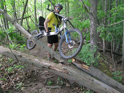
As per tradition, we visited the Caledon Hills Cycling Shop in Inglewood on our way back. Had a nice chat with Don and somehow managed to find yet more gear we "need" that would fit into our bike packs. Best of all, we found Slowrunner out on her singlespeed and convinced her to ride back as far as Caledon East with us.

We stopped at the trail pavilion in Caledon East - the place where the first section of Trans Canada Trail in the country was officially designated about 15 years ago. 'Bent and I were there on that day (on a grade 8 school trip - ha!) and got our names in the first group on the first pavilion for buying a "meter of trail" each for $25.
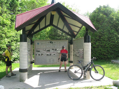
Caledon's Walk of Fame is in the same place, with big carved rocks honouring people who live - or have lived - in Caledon, including Norman Jewison, Robertson Davies and Farley Mowat (who used to live across the road from our place and whose family still owns that house).
Thanks to Urthbuoy for challenging us to show off our back yards this week. It's been fun! It's also been interesting to see where other people play.
Saturday May 22, 2010 #
Note
http://caledonnavigators.heysport.com/
Note

Note

Palgrave East has a decent network of trails including some single track. It's more rustic than Albion Hills - no admission fees, outhouses or garbage pails. It gets more visitors than Palgrave West but it's common to spend an hour biking, running, skiing or snowshoeing without seeing anyone else. 'Bent and I used to come here to ski when we were first married and lived in Schomberg. That inspired our plan to find a house in Caledon where we could ski from the door. After "starting our family", Palgrave East also became a destination for Lab Retrievers eager to swim in ponds and the Humber River.
BulletDog (aka Mocha) spends considerable time in our usual haunts and commutes with 'Bent to work most days. Patients love having a dog in the dental office - it relaxes them. (ThunderDog had that job for years but now she is semi-retired and only works when 'Bent drives to the office.) BulletDog is 7 years old, runs like the wind and acts like a puppy. She had major surgery several years ago to deal with a torn ACL. These days, she could be the poster dog for TPLO (tibial plateau levelling osteotomy). I can't even remember which knee it was. For her first 11 months, she lived in town with people who didn't have time for a dog. It took her awhile to get used to country life; she was nervous of tall meadow grass when we first got her but she's an old hand now!

Friday May 21, 2010 #
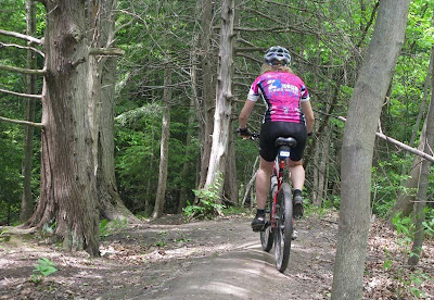
Mountain Biking (Trail) 1:46:00 23.6 km (13.4 kph)
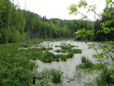
Albion Hills has 1200 acres of forests, wetlands, rivers, creeks, meadows, trails, a public swimming area, campgrounds, picnic areas, and - of course - a lot of hills.
When it opened in 1954, it was the first conservation area in Ontario. Hurricane Hazel struck later that year. Centred north of Bolton, the storm and its flooding killed 81 people and caused devastating property damage across the greater Toronto area. In the aftermath, conservation authorities were established to manage environmental and flooding issues in watersheds across Ontario. As a result, a large amount of green space has been set aside in the Humber River watershed where we live.
Albion Hills is popular with families and hosts two educational field centres for visiting students. Local adventure athletes run, snowshoe, orienteer and ski at Albion Hills, but it's mostly known as a mountain biking destination with 40 km of rolling single and double track. Chico Racing and Superfly Racing (Adam and Sean Ruppel and team) maintain the trails and host weekly races and two huge annual 24-hour mountain bike relays. Not sure if it's still true, but these were the largest and 2nd largest 24-hr MTB relays in North America, attracting thousands of people to the park.
No racing today - just a pre-holiday weekend tour. Trails are in great shape.


Note
<http://www.flickr.com/photos/activesteve/461796337...>
Thursday May 20, 2010 #
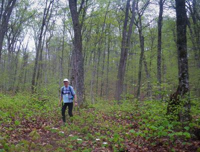
Running (Trail) 1:30:00 [3] 13.0 km (6:55 / km)
shoes: Salomon XA Pro Ultra - Cherry
Continuing the theme of Urthbuoy's "Show Us Your Usual Haunts" photo contest, we ran part of the Humber Valley Heritage Trail today - usually abbreviated HVT in our logs. The trail starts in Albion HIlls Conservation Area in Palgrave and travels 15 km along the Humber River Valley to Bolton. Bolton is the larger town where we usually shop since Palgrave only has limited amenities (including an excellent, high-tech dental office!)
Today we ran from the Caledon Wellness Centre in Bolton to Castlederg Sideroad and back again. This meant we started up high with a great view of the valley then descended to the river. There are some steep hills with wooden steps on this run - a good place for hill training although the hills in Hockley Valley are even higher.

The trail meanders to keep things interesting - down near the river, high on a ridge, in cathedral-tall deciduous forest, in thick cedars and in open fields.


Thanks to Crash and Rocky for letting me join their super-secret Wilderness Traverse training. Hope no other competitors are reading my log!
Wednesday May 19, 2010 #
Note
Mountain Biking (Rail Trail) 1:15:00
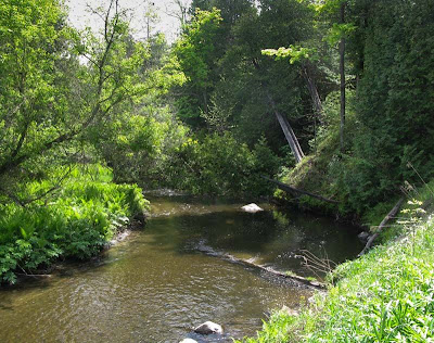
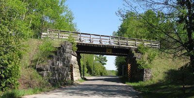
The Caledon Trailway runs 35 km across town. To get there from our place, we ride 3 km through F&M's property (see Monday) and Palgrave West (see Tuesday) to Duffy's Lane. A short fast ride on a quiet country road takes us to this bridge where we climb up a steep hill to the trail.
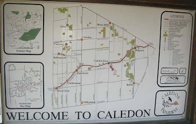
The Town of Caledon is a "community of communities". It's a single municipality covering a large physical area that contains a dozen villages surrounded by rural land and tiny hamlets. The railway used to connect some of the villages, which makes it a great way to run errands by bike, not to mention the opportunities for for ice cream along the way. Caledon Hills Cycling is in Inglewood, about 21 km from our place, so that is a typical bike trip.
Today I had a meeting at Town Hall in Caledon East so I rode over at a much higher pace than usual because I was late and wanted to change out of bike clothes before entering Council Chambers.
My ride home was a more typical small town rail trail ride. I stopped in at Gourmandissimo's in Caledon East for some goodies from Gilles and Adriana, two of our excellent local chefs. They freeze leftover prime rib and chicken from their buffets and give it to 'Bent for his homemade dog food. Like I said, it's a small town.
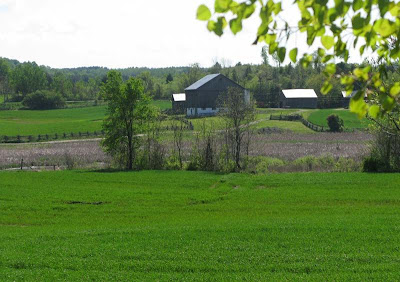
The scenery along the rail trail is rolling farmland, forest and wetlands.


Today it smelled amazing because of all the lilacs that probably ran wild from long forgotten farms. In pioneer days, settlers were awarded land here if they cleared it within a specified period. Where we live on the Oak Ridges Moraine, the sand and gravel made agriculture difficult, so there aren't many crop farms left. We occasionally stumble on old rock piles and rotting logs that show where the old farms were.
When I saw another rider coming toward me near Albion Hills, it turned out to be Coach LD. Small town!

Two cute lost children came up to us with a compass and an inaccurate orienteering map. They had wandered off the map during a game at the Albion Hills Field Centre and now they were worried about missing dinner. Coach LD and I turned back in the direction they needed to go and took them to where they could see the building. It's pretty common for us to encounter lost people in the Palgrave area. I'm told that a 19-year-old guy spent a night lost in Palgrave East recently, which is a little hard to fathom in an area so small.
Instead of going through Palgrave West on my return trip, I rode Duffy's Lane to Finnerty Sideroad. Crash and VO2Max live on Duffy's, which is a beautiful road. The last kilometer before Finnerty, the road becomes almost trail-like. I had to stop my car there once to let a beaver cross. One time in a snowstorm, I realized that I had snowshoed onto Duffy's Lane when I thought I had reached a clearing in the forest. It's a great road!

Tuesday May 18, 2010 #
Note
Running (Trail) 26:00 [2]
shoes: Salomon XT Wings - Tomato
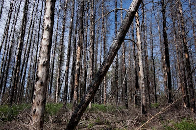
'Bent injured his knee badly on that day - torn MCL and a small fracture. I'd phoned him during a bike ride to let him know that the firefighter had advised me to pack up and leave our home and also to tell him that he couldn't ride through the forest because it was on fire. He came home faster than he should have - skidded out on gravel to avoid some kids and couldn't unclip from the pedal. With 20/20 hindsight, I wish I hadn't called him. He would have noticed that the forest was on fire!
The meadows recovered very quickly. For the most part, the deciduous forests didn't want to burn. The coniferous forests took the brunt of it and they are still dying and falling down today.

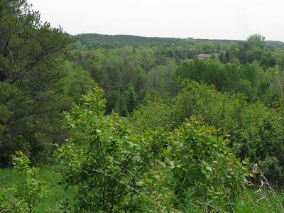
This is the view from Thinker's Hill at the back of F&M's property. F's late father used to come up and enjoy the bench that is still found here. An elderly woman lives in the house below, which was surrounded by flames on 3 sides during the fire. She refused to leave at first but a neighbour finally talked her into getting out. The field and a ruined barn burned but firefighters saved the house.

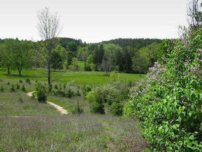
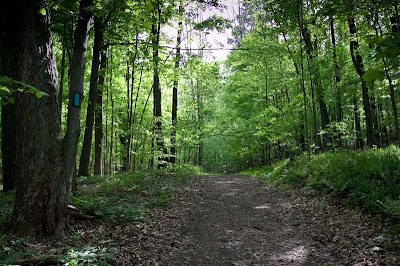
The main Bruce Trail used to run through the Palgrave Forest and Wildlife Area until a few years ago. Now it's a side trail that runs from the main BT in Glen Haffy Conservation Area to the rail trail in the village of Palgrave. It's less than 1 km to this trail from our place. This is all part of 'Bent's daily commute.
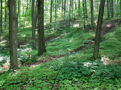
This is the area we call Palgrave West. It's typical Oak Ridges Moraine terrain - hills and depressions, nice forest. There is a good chunk of conservation land but the best trails are found on a couple of private properties to the south - KBash & Wheelies.

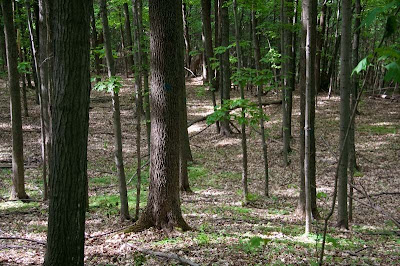
For southern Ontario, I guess you'd call this old growth. It's a great place to see flowers and wild leeks in springtime. Today I surprised a wild turkey at close range and I see deer more often than not. A neighbour saw a cougar in here several years ago - and I believe her.

There is one negative in Palgrave - poison ivy. When we first moved here, I couldn't recognize it and was always being told that I was standing in it. Then I had my first reaction after a MTB fall into a patch of the stuff. These days, I've got finely tuned Ivy Radar. The biggest challenge is watching out for the dogs, since they can easily pass PI to humans.

Monday May 17, 2010 #
Note
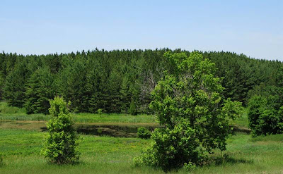
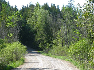
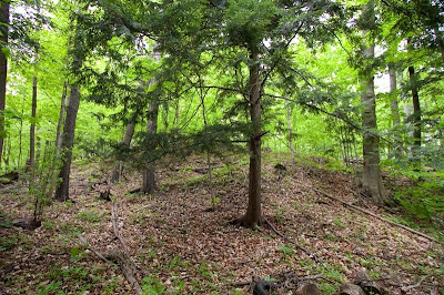
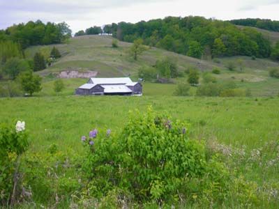
No training today - just a pooch hike around the F&M loop. This is a 1 km trail loop that heads from our house into our neighbours' property (Fred & Melodie - wonderful people), then weaves through their forest and meadows until the turn-off that leads to the back of our property. The return trail goes through some of our forest, then comes down a big toboggan hill toward our house. If you skip the turn-off back to our place, the trail continues a few hundred meters further through F&M's property to the Palgrave Forest & Wildlife Area, which will be featured in a future "Usual Haunts" photo.
This photo was taken about 30 seconds from our front door. I'm standing on the trail.
Here's the turn-off trail that leads back to our property. If I had turned the camera 180 degrees, you would see the dead trees from the 70-acre forest fire that our other neighbours started on Labour Day 2007. It just keeps getting worse as trees continue to die - very sad.

Today's hike buddy was ThunderDog, aka Tobler in real life. She joined our family on 'Bent's birthday a few months after we got married. We'll be celebrating her 14th birthday in August. In her day, she was an avid mountain biker, skier and runner - and sometimes she still tries to gallop. She still loves canoeing - portaging, not so much, although it used to be her favourite part of a canoe trip. Mostly she is happy to amble through the forest, investigate interesting smells and pause occasionally to enjoy the breeze on her face.

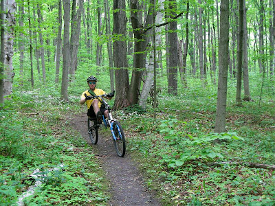
Sunday May 16, 2010 #
Trekking hills 1:30:00 [2]
shoes: Salomon XA Pros - light blue

For bonus points, this photo from one of the trail's high points shows a couple of the regulars in my log - 'Bent and BulletDog (aka "Mocha" in her non-Attackpoint life). She likes to drink from our water bottles - very handy.
'Bent and I wanted to test his knee since we're only a month away from our mountain marathon. At this point, we're expecting to drop to a shorter course but we're not even sure if he should do it at all. So we picked some very steep sections of the Hockley Loop trail and hiked them with trekking poles. He wore his mountain marathon pack with full load. So far tonight he's feeling OK but we'll see how he feels in the morning.


Saturday May 15, 2010 #
Adventure Racing race 8:48:00 [3] **
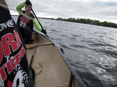
We started with a 14 km paddle along Rice Lake to Bewdley, which would normally be a pleasant, scenic 2-hour canoe trip. But today the wind was blowing like a banshee at 45-60 degrees to our direction of travel. Occasional gusts and areas of choppy, disorganized water added to the challenge.
We took advantage of 2-Min's long canoe instruction experience by putting her in the stern with canoe and kayak paddles available. It was a hard effort for 3 hours as the boat bounced in the waves and water sloshed over the side. We saw a team flip along the shore and we made frequent direction changes relative to the wind to avoid being swamped. We're both quite comfortable in a canoe, so in the midst of this maelstrom, we spent 3 hours enjoyably immersed in "getting to know you" girl talk. Fun!
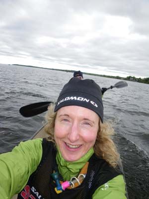
It was nice to see the friendly faces of Phatty and Goose at the TA. We had been fine while paddling but got chilled quickly in our wet clothes as we prepared for a 2 km trek to our bikes. It took quite awhile to feel warm again. This was the last time all day we would see our transition bags, so we needed to take everything from here. We would drop our bikes in two places to do trekking sections, then we'd make our way back to Golden Beach Resort. I opted to just wear my AR bike shoes (the ones with running shoe tread) for the entire race, and I also wore my bike helmet for most of the day. 2-Min doesn't use bike shoes, so it worked out perfectly with neither of us needing to change shoes.
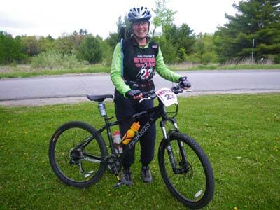

The terrain around Rice Lake is so varied, hilly and scenic. The roads are curvy and interesting - always climbing or descending. We saw some great views and got a good workout on our way to TA3.

It was great to see M&M at the TA. We had a long trail section where we needed to pick up 4 CPs in a county forest. STORM was using SI timing - cool! 2-Min is nursing a longtime knee problem so we hiked instead of running to avoid any further injury. We were at this TA with a couple of our rivals in the female team division, Leanimal and Gosling, but this was our last sighting of them for the rest of the day. Congrats on trouncing us, ladies!

Back on our bikes, we rode to the natural area across from the resort and headed in on foot to find 3 more CPs. 2-Min proved herself to be a true adventure racer by plunging into some thick bushwhacking and swampy ground without complaint.
She was doing so well that I didn't take her seriously at first when she got stuck in knee-deep mud and her shoe threatened to come off! Not so much fun with a bad knee either.


She extracted herself and we finished the trek, then hopped back on our bikes for the short ride to the finish line. After completing the STORM Trek Elite course, 2-Min is officially an adventure racer now!! :-)

Oh, and so is PhattyJR, of course. We had a fun day out there - lots of laughs and good conversation. Thanks for teaming up with me, 2-Min!
One of the great things about this weekend was the chance to see so many friends. Speaking of which... Running Free was the top team overall. Congrats Dee, Relentless, Harps and PhattyJR!
And thanks as always to STORM for working so hard to put on a fun, well-organized and safe event.
Friday May 14, 2010 #
Note
Thursday May 13, 2010 #
Note
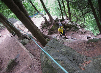
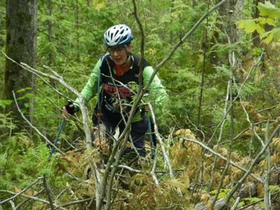
Mountain Biking (Orienteering) 1:11:00 [2] *** 13.7 km (11.6 kph)
Wednesday May 12, 2010 #
Orienteering 1:00:00 [1] ***
shoes: Salomon XA Pros - Tomato
Note
http://www.spotadventures.com/trip/view/?trip_id=1...
Tuesday May 11, 2010 #
Note
Note
Barb Bryant's fun Dakota Rogaine movies. Phatty and Harper make appearances!
Part 1 - pre-rogaine (8 min)
Part 2 including scary pre-race instructions, route planning and getting ready to go. (9 min)
Part 3, doing the rogaine (10 min)
Part 4, short post-rogaine clips (1 min)
Sunday May 9, 2010 #
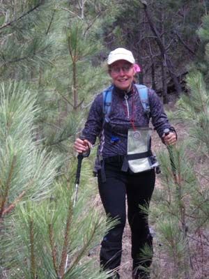
Orienteering race (Rogaine) 11:47:00 [3] **
shoes: Salomon XA Pro GTX 2nd pair -
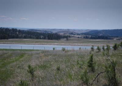
The bottom line... a friendly, well-organized race in fantastic terrain with abundant wildlife and scenic vistas. People who work hard to put on top quality navigation events deserve our support, so please consider travelling to South Dakota on the 3rd weekend of June 2011.
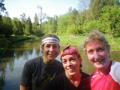
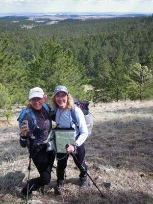
My teammate Barb is someone I “know” through Attackpoint but we’d only met briefly in person a few times before. Barb is a rogaining legend – someone who would happily do 24-hour events on consecutive weekends. This was my seventh 24-hr rogaine so I have some established habits and strategies too, and I’d wondered how our styles would blend. It was cool to see that our different ideas and strengths were complementary rather than causing conflict. It was great fun getting to know Barb in real life.
We’d planned a route that - in theory - would earn us 2,000 of the 2,730 available points in 24 hours. We intended to go at a strong hiking pace. No running. Most of the high-value controls were in the south and our plan was to pick up as many of them as possible, ignoring most lower-value controls and anything at the north end of the map.
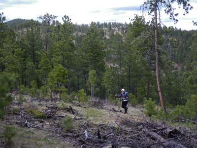
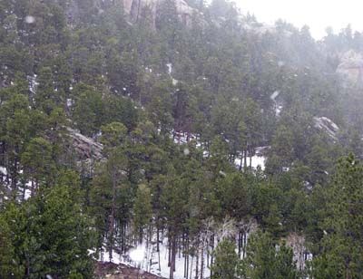
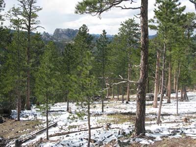
We started in grassy, open terrain with pine trees spread far apart even in the “green” areas of the map.
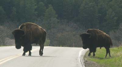
Heading to the 2nd control, I came over a rise and woke up a huge buffalo who had been napping in a little hollow. He leapt to his feet and glared at us.

Oh crap. We moved slowly into a grove of small trees well to the side of our intended route. If the buffalo charged and we climbed one of those little things, it would bend right over like Charlie Brown’s Christmas tree. He kept staring without moving and our confidence grew. Barb filmed him on her video camera while I took his portrait. Then we tiptoed slowly until we were well past him. When something like that happens early in an event, it convinces you that scary wildlife will be hiding behind every rock. As it turned out, we had 23 buffalo-free hours until passing two friendlier-looking buffaloes near the finish line.

We talked a lot about our navigation and practised using precise words so we could keep moving without stopping to look at each other’s map. Our nav went fairly smoothly with the usual small bobbles and parallel errors that are almost impossible to avoid (for me, anyway) in 24-hr rogaines, plus one really silly, inexplicable error - leaving a re-entrant junction in the wrong direction, which cost us a lot of time. We worked well together but Barb was the star. She’s accurate and has a wonderful knack for relocation. Our only defeat was #78 after an hour of searching. Turns out we were at the correct place but needed to scramble up a cliff to see the flag from our direction of approach. We didn’t think that could possibly be right, so we gave up.
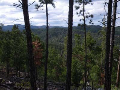
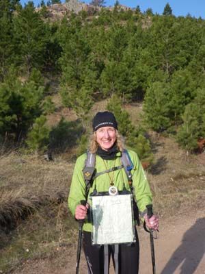
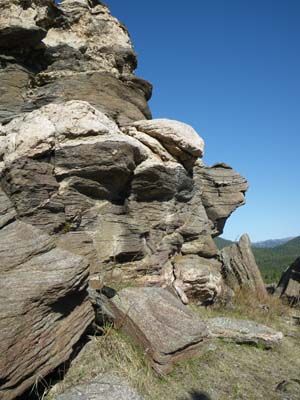
We moved from the grassy plains into rougher, rockier, steeper terrain with some areas of logging debris and fire damage. We had great views of the Black Hills and the plains beyond, and passed some beautiful rock formations.

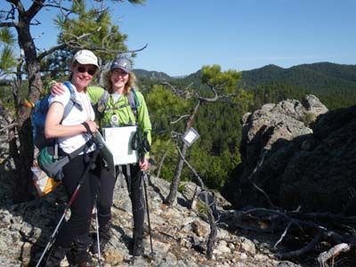
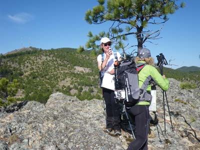
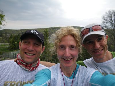
There were only 18 teams in the 24-hour event, so we rarely saw other people. We met Harps and Phatty at a scenic hilltop lookout.
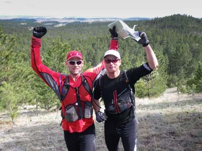
Funny how short we look when a tall person holds the camera!
At dusk we heard cracking sticks and quiet voices, then Phatty jumped from the trees and ROARED like a mountain lion. Through the night, Barb and I held loud conversations whenever we passed the types of rocky areas these nocturnal cats prefer – which was pretty often. And then we saw...

OK, not really. That one was a stuffed poseur in our hotel restaurant. But Barb did see a bunny.
After dark in a rogaine, I like to stop and eat real food (not gels or bars), change socks, adjust my layers and plan routes for the night controls. It was cold and windy, so when we arrived at a horse camp to refill our water and discovered the men’s washroom unlocked and heated, we decided to hold our team meeting inside. You have to be really hungry to enjoy a roast beef sandwich when you’re sitting just a few feet from a urinal. We let our feet dry out nicely then did about 8 knee-high creek crossings over the next hour.


After our rest stop, fine snow flurries swirled around us for several hours. The Wadd Squad said their thermometer measured -6C. With my soaking wet legs, I got chilled and didn’t warm up until I was wearing a regular polypro top, an expedition weight polypro top, a Salomon Pertex (like thin synthetic down) jacket, a nylon jacket and a Paclite waterproof-breathable coat with hood. Michelin woman! Around 3 a.m. the sky cleared and revealed spectacular stars and an orange quarter moon.

At one point we thought we’d aim to the right of a group of picnic tables, then we realized that we were really looking at two dozen pairs of glowing eyes. A blast of my Night Lightning light outed them as harmless deer but during the night there were other pairs of eyes that we couldn’t identify, so we talked loudly to them.
Toward dawn, Barb got sleepy. Finally, silhouettes of hilltops and trees emerged from the darkness, then the sun rose and it was my turn to zone out. Luckily, I’m a night person who can stay conscious in the wee hours and Barb is a morning person who snaps into action at first light. She drew me into conversation and got my brain back in gear.

Our bodies held up pretty well. We both used trekking poles after the first couple hours, transferring load to our upper bodies and improving balance in rough terrain.

The soles of my feet got sore from being wet and wrinkly, but drying them out at our 10 p.m. rest stop limited the damage. With 2 hours to go, Barb’s stomach became unhappy. Fortunately, we’d already adjusted our plans to drop some farther controls. She was tough as nails as we pushed hard to reach the finish line before noon, picking up some low-value controls as we marched the last 5 km along Hwy 16A.
So much fun! And my teammate was awesome.
I was incredibly proud of our Canadian contingent. Harps and Phatty, first-time teammates with no 24-hour rogaine experience, won overall with 2280 points.

Phast Generation (experienced super-veterans Ken Walker and Glen Brake) placed 2nd with 2070 points. The international Team Barbs placed 3rd overall with 1820 points. Team GHOSLO were 3rd Mixed Super Veteran and 11th of 18 teams overall with 890 points.
We had a good post-race meal (buffalo on a bun) in the sunshine. In the evening, the Canadians plus honorary Canadian Barb went to Custer for Mother’s Day dinner. Sue and Barb were Moms without their kids, and Harps, Phatty and I had left our Moms in Ontario, so we all celebrated motherhood together and finished the evening at Dairy Queen. Yum.
Here’s Part 1 of the movie Barb is making of the Dakota Rogaining Champs!
Orienteering 1 [3]
Saturday May 8, 2010 #
Note
The Wadd Squad were Team GHOSLO.

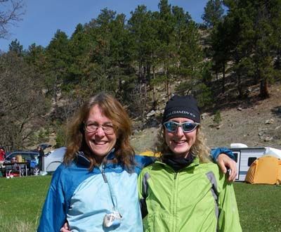
Barb and I were (what else?) Team Barbs.
A park biologist outlined the various ways in which we might meet our death during the event. We listened intently and made mental notes on how to improve our odds:
1) Mountain lions – Make yourself look big. Do not run away from.
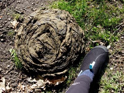
2) Buffalo – Get behind a tree and be prepared to climb. Do not run away from. You *will* step in their rather impressive poop, which is all over the place. (This pic was taken about 1 meter from the front door of our cabin.)
3) Elk – See “Buffalo”. Except for the impressive poop part.
4) Rattlesnakes – Avoid stepping on. They'll be on rocky, south-facing slopes. If bitten, sit still and remain (?!) calm. Phone for help.
5) Wild Turkey Hunters – Avoid gobbling and don't wear royal blue clothing. Do not run away from.
6) Poison Ivy – Won’t kill you so doesn't really belong on this list. No point running away from.
A common theme in these risks was the avoidance of running, which fit perfectly with our race plan.
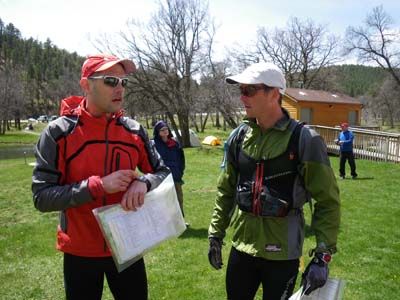
Barb and I took our maps to the lodge and succeeded at blending our different rogaine planning strategies.
We both would navigate but I assumed (correctly, it turned out) that Barb was more skilled, so I asked her to take on the role of primary navigator with final say on route choice after we’d both had our input. Since I’ve done more training on foot recently, I took over ‘Bent’s usual role of carrying team gear and the tow rope.
Back at the Hash House, everyone was doing their final pre-race preparations. Phatty was pumped about their race plan.
At high noon, we were off! Phatty and Harps were running. Apparently that stopped about 8 hours into the race.

The majority of us were speed-hiking. If you squint, you'll see Team GHOSLO.
Orienteering (Rogaine) 12:00:00 [3] **
shoes: Salomon XA Pro GTX 2nd pair -
Friday May 7, 2010 #
Note
Leaving Harps to experience the full excitement of Denver International Airport during his 7-hour stopover, I located my teammate Barb Bryant and her collection of electronic devices, and we flew to Rapid City, South Dakota.
Enroute to Custer State Park, we made the obligatory tourist stop at Mount Rushmore where we paid $10 to see Presidents Washington, Jefferson, Lincoln and Roosevelt (Teddy). The Wadd Squad cleverly avoided the fee and took their photos from a nearby roadside. If not for our need to purchase tacky souvenirs from the official gift shop for our husbands, we could have done that too. I tried to imagine a Canadian equivalent – Trudeau, Chretien and Harper (Stephen, not Forbes) carved onto The Chief at Squamish. Nope, it just couldn’t happen here.

Given our plan to spend tomorrow night outdoors in wet clothing, the frigid blowing snow was a little disconcerting. I hope I brought enough layers. GHOSlow said that today was a record low temperature for the area.

This is our first race together and Barb had tried to convince me that she’s not very fast. Turns out that‘s not true at all! ;-)

We were excessively polite and apologetic, and got off with a verbal warning. Didn’t even have to cry. After our brush with the law, we had a very scenic drive to the historic State Game Lodge, where we'd decided to take a pass on the free group campsite to enjoy a pre-race night of comfort and fine dining. (Fyi, if you look *really* closely at this pic, you might notice some big faces in the mountain in the distance.)
Custer State Park is a home where the buffalo roam and the deer and the antelope play. We saw an impressive collection of wildlife on our way to the State Game Lodge. The race promises to be exciting – maybe a bit scary too, due to the mountain lion factor. The scariest animals we saw today were the bison – absolutely massive. I did my part by ordering buffalo stroganoff for dinner but I'm afraid most of them are still out there.

After a bit of gear consolidation with Barb, we turned out our lights early, which was perfect because I only got 3 hours of sleep last night. I suspect that last-minute sleep deprivation training for a 24-hour race is not as beneficial as one might think.
Thursday May 6, 2010 #
Note
http://share.findmespot.com/shared/faces/viewspots...
Note
I've been reading about how healthy the mountain lion population is, and I'm wondering about the right layers to wear for *that*. The website points out there is little danger because the cats are nocturnal and spend their time off-trail in less-populated areas of the park - completely different from us rogainers.
Looking forward to racing on Team Barbs with Barb Bryant and cheering for fellow GHO members Team GHOSlow. I'm expecting some serious podium action from Harps and Phatty!
Wednesday May 5, 2010 #
Running (Road & Trail) 1:03:29 [3] 10.6 km (5:59 / km) +31m 5:54 / km
Running has felt great lately. (Sorry to be a broken record but this is really unusual for me.) I was glad to feel no residual effects from the heavy weekend. Even so, that will be it for running until after the rogaine.
Note
Note
Tuesday May 4, 2010 #
Note
<http://www.facebook.com/pages/edit/?id=10801601257...>
Monday May 3, 2010 #
Note
(rest day)
Sunday May 2, 2010 #
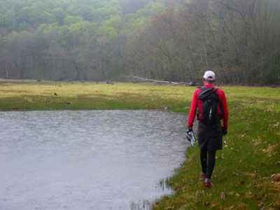
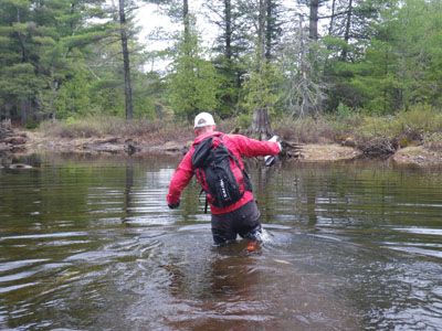
Trekking (Off-Trail) 8:26:12 ** 34.52 km (14:40 / km)
shoes: Salomon XA Pros - Tomato
Here's my original log entry:
Wilderness Traverse course testing with Bob. The weather forecast promised us doom and gloom with constant rain and cooler temperatures plus a nice blast of thunderstorms in the middle of the day. We looked forward to a serious character building experience but - alas - it was not meant to be. Not only did we get less than 2 hours of light rain, the sun came out and we were *way* too warm. Oh well, better luck next time.
Bob carried a heavier pack than I did to "even out" our relative speeds. As if.
We did part of an epic trek from the WT race course and returned to the car by a different route. The landscape was varied and scenic - a classic Ontario wilderness bushwhack. Cliffs, mossy boulders, marshes, huge hills, lakes, wildflowers, creeks - we had it all today. Our navigation-while-chatting-about-totally-different-topics technique has improved so it was relatively smooth sailing.
Surprisingly, my legs still felt energetic after yesterday's 5.5 hr race. Starting about halfway through when we were making good time, I got crafty and began sharing food to lighten my pack. Bob totally fell for it and probably went home with *way* more leftovers than I did!


Only one wildlife sighting - same as last time. Looks like the garter snake will have to be the official animal of the Wilderness Traverse. Bob was so disappointed by the lack of critters that if he knew how to call a bear over, I'm sure he would have done it.

Painted Trilliums were out - pretty.

Bob promised that this time (unlike *last* time), I wouldn't be wading through water more than waist deep.

Unfortunately, he failed to mention that he was talking about *his* waist. Or that he planned to use special techniques available only to long-legged people.
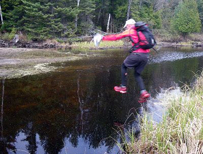
Oh well, at least I'm getting good at it.

More views along this gorgeous trek.

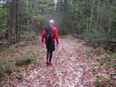


OK, so it can't *all* be nice open forest.

At the end, we had a few kilometers of trail and road back to the car. It was tough but I managed to convince Bob to run the downhills and flats. (Didn't want him to over-exert himself.) He did pretty well but I touched the car first and won the course test. Still, I think he'll make a fine adventure racer some day.
I may have mentioned that I'm only course testing because it lets me eat dessert. So if you're at "That Place" in Carnarvon, I can highly recommend the warm haystack brownie with two flavours of ice cream, chocolate sauce and whipped cream. Yum.
P.S. Thanks for taking a passenger, Bob - it was awesome fun.
P.P.S. Full set of course testing photos is here.
Adventure Racing (Course Testing) 1 [2] **
shoes: Salomon XA Pros - Tomato
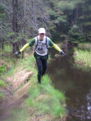
Saturday May 1, 2010 #
Adventure Racing race 5:20:00 [3] **
Once again, 'Bent and I teamed up with Shifty (of Terranaut fame). Gotta love his attitude toward racing and life; a weekend together is guaranteed to be full of laughs and good conversation.
It was nice to see how much the boys enjoyed each other's company.

There were over 90 teams at the starting line this year, which was awesome. Weather forecast wasn't good and the smell of ozone was in the air at the start line, so we knew a thunderstorm was nearby. After a mass dash to the Deerhurst beach, the Tree Huggers made up for our slow run by paddling up to the back of the lead pack as we headed down Fairy Lake.
We'd heard the first rumble of thunder within minutes of leaving Deerhurst. On Fairy Lake, we saw some distant lightning first, then a flash came down over a hilltop beside the lake. I've always dreaded this happening in a race because I've been a wilderness canoe tripper for a lot longer than I've been a racer, and I won't stay on the water in an electrical storm. So I took our team out of the race. :-( We pulled up onshore and waited for 10 minutes, which was 5 minutes after the last major thunder clap. We went back onto the water in dead last place, as no other team stopped. Ever the optimist, Shifty pointed out that we would spend the rest of the day passing teams. That was kinda fun and took some of the sting out of being so far back.
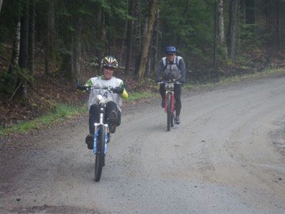
We switched to bikes on the south side of Huntsville then rode down Otter Lake Rd. into a system of ATV trails that led to the TA. Rain was pouring down and the biking was slick and mucky in the rain. I didn't go down today but I worried about doing a reprise of last week's back-twisting crash in the Wild B.O.A.R.
We dropped our bikes and headed out for three nearby CPs set up on smaller orienteering-type features. We could do them in any sequence and I was worried that the 1:50,000 topo map wouldn't support the CP locations sufficiently, so I chose a very safe route to ensure we spiked them all. It wasn't entirely safe as I managed to bash my head hard on a thick branch, which left a big goose egg even though (or perhaps because) I was wearing my bike helmet.

The route also seemed less safe when we met the man on the ATV who bellowed, "What are you doing on my land????" An excellent question, we thought. We spent five minutes trying our best to be charming and explain ourselves. We showed him our map and it turned out that one or more of our CPs were on his 400 acres, so he was not a happy camper. By the end of our conversation, he was friendly to us but it was clear that he needed someone in charge to apologize and acknowledge that he had been wronged. We later saw him at the bike/trek TA and at Deerhurst. As we came off his property, it was clear that he didn't welcome visitors. (Sorry... rain = blurry photos.)

We picked up our bikes for a little more muddy snowmobile trail riding, then a nice, mostly-downhill ride back to Deerhurst.
We were supposed to get our second gear bag there before doing the Advanced Trek section but the bags weren't there. That meant 'Bent was without trekking poles to protect his knee on the trail run and I was without a map for the trek. Thank you, Mr. Gally, for lending me your map so we could keep racing! And thanks to the racers who pointed out that CP A was misplaced. 'Bent found a couple of thick sticks to use as trekking poles and we were off. Shifty's ITB flared up after 10 years of good behaviour, so with both boys hurting, we were glad the trail section was short. We mostly walked it.
Great to reach the finish and see so many good friends during the afternoon and evening. After our "time outs" and injury issues, we were surprised and happy to finish 2nd Coed to the speedy Running Free crew, which had been our race goal anyway.

One of the great things about the Deerhust weekend is the chance to spend time with enthusiastic young adventure racers.

Huge congrats to PhattyJR, Frankenjack and Peter for taking the overall win.

And kudos to Harps, T. Rex and Relentless for winning 1st Coed and an impressive 2nd place overall.

Big smiles after a tough day.