Training Log Archive: BashIn the 31 days ending May 31, 2009:
| |||||||||||||||||||||||||||||||||||||||||||||||||||||||||||||||||||||||||||||||||||||||||||||||||||||||||||||||||||||||||||||||||||
| « | » |
| » now | ||||||||||||||||||||||||||||||||||||||||||||||||
| Fr | Sa | Su | Mo | Tu | We | Th | Fr | Sa | Su | Mo | Tu | We | Th | Fr | Sa | Su | Mo | Tu | We | Th | Fr | Sa | Su | Mo | Tu | We | Th | Fr | Sa | Su | |||||||||||||||||||||
Sunday May 31, 2009 #
Note
I was the race director for this event, so no training today. Because there haven't been many mountain bike orienteering races before, this was a complicated and sometimes frustrating event to organize. I'm soooo relieved that all the riders came out of the woods safely, and that things went relatively smoothly.
35 racers came out on a sunny but chilly day. In contrast to almost every other task leading up to this event, everything that mattered went like clockwork yesterday and today. Lots of volunteers showed up early and pitched in to help in various ways. All of yesterday's controls were still up, and it didn't take long to send out riders to put out the final 9 controls and get them turned on. (Except for #14, which is either broken or else didn't turn on properly.)
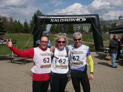
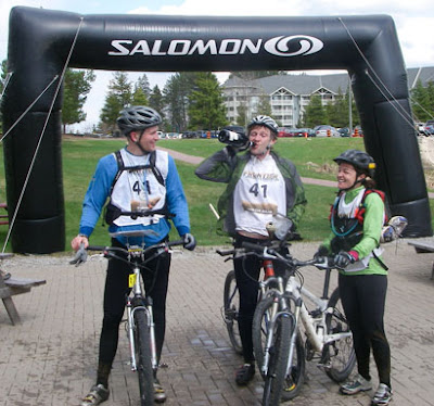
We knew things would move like a runaway locomotive from the time the maps were distributed at 9:30 a.m. until the final starters went out at 10:45, and we correctly guessed that the first finishers would return and start the Advanced course before the final starters went out. But we'd talked through the craziness in advance, and it went fine. Unfortunately, the free Irish SI event software crashed and burned, but Nick and Goose managed to extract our results manually. We had phenomenal support from our sponsors Axis Gear and Salomon, along with a number of private donations from CN members to make the prize table look worthy of the entry fee. Rocky put out a spread of excellent treats, including Crash's famous brownies (as expected, there were leftovers of everything but those).
There were interval starts, and we'd separated Milhouse and Tiny, the two guys I'd expected to battle for the win. Tiny started earlier, but it was Milhouse who appeared first, pedalling hard toward the finish, looking really fit and fully recovered from his injury. He had up to 3 minutes off the clock to download, clear and check, and review the short list of control numbers to visit for the Advanced section. (Not a separate map - just several controls from the Regular course to visit in a specified sequence - longer legs than before.) He headed off, and Tiny flew in looking strong. Turns out he'd had a great race except for forgetting to punch control #1, so he'd had to retrace his steps from control #3 and start over at #1.
The results were closer on the Advanced section, but Milhouse prevailed to take the win, with Tiny in 2nd place. Nick de St. Croix put in an awesome performance to take 3rd overall and the Masters Male win. Leanimal won the Women's category, although she admitted to taking a couple of scenic routes. The Scooby family did very well, with Scooby Junior #2 taking the Junior division. Barbara Steele took the Masters Female prize, but Rocky coulda shoulda taken it, given her awesome finish time - except she didn't see #3 on the bottom of her map. (She picked it up after the race for practice!) 'Bent had a good day on his recumbent bike, finishing 6th of 35 overall. His prize was his own bottle of wine! I'd just bought it for him, then I took it back over his protests, concerned that we might not have enough prizes for the table.
It was great to see people there whose names I didn't recognize, and I'd be interested to know how they got there. The newbies seemed to enjoy themselves. The atmosphere seemed to be laughter about silly mistakes, rather than frustration - and it can go either way with beginners. Probably reading a trail map is more intuitive for novices than cross-country orienteering.
Anyway... it was great to have so much support for a new type of event - thanks to those of you who came out. And now I am going to sleep for a few days...
Saturday May 30, 2009 #
Running hills (Trail) 1:04:00 [3] 8.75 km (7:19 / km)
Mountain Biking (Trail) 1:00:00 [2]
We put out 17 of 26 controls today, and the others are in more visible locations, so we'll wait until tomorrow. A problem with MTB-O is that all controls are along trails, so they're more vulnerable to theft and vandalism.
Looks like we'll get some "weather" tonight, then it should be sunny and cool tomorrow - perfect weather for the event. The Mansfield trails aren't overused, and they're in awesome shape. I've got my fingers tightly crossed that we don't hit some unforeseen glitch, but racers should have a great time tomorrow.
Friday May 29, 2009 #
Note

Thursday May 28, 2009 #
Note
Here's the interesting part... I don't know *how* many times I've heard people complain that entry fees are keeping families away from orienteering. They say juniors should be allowed to orienteer for free or for $5 to keep the sport affordable. People who point out the high costs of kids' soccer and hockey - and the popularity of those sports compared to orienteering - always lose the argument. But so far, over a quarter of our registrants for this Sunday's event are juniors, and that's pretty unusual for an Ontario orienteering event - especially one with a $25 junior entry fee.
Tuesday May 26, 2009 #
Note
Running hills (Trail) 35:00
Monday May 25, 2009 #
Paddling (Kayak) 1:05:00 [2]
Afterward, we had a strategy dinner where we toasted our race, agreed on a team hairstyle, and decided the colours of hats, shirts and pigtail ribbons we will wear.
I think we're pretty much ready to go.
Sunday May 24, 2009 #
Mountain Biking (Trail) 40:00 [2] ***
Now we just need *you*!
CN Mansfield Mountain Bike Adventure
Next Sunday morning, May 31
Mansfield Outdoor Centre
Details and registration at http://caledonnavigators.heysport.com/
Earlybird entry fee available till midnight on Wed. Registration closes Friday night.
Power Yoga 23:00 [1]
Note
Saturday May 23, 2009 #
Running race (Trail) 2:53:04 [4] 25.0 km (6:55 / km)
So... I achieved my goal with startling precision - exactly 1 min/km slower than last year. I started out OK, completing the first 10K in an hour, just a little slower than last year - and then I totally faded away. Last year I'm pretty sure I only walked up the Gulch the second time, but otherwise I ran the whole thing. This year I walked at least a dozen uphills, including both Gulch climbs.
It's interesting to look at the Garmin info from both years. Last year I only ran 4K at a pace slower than 7 min/km, and this year that was my average pace, running 10K slower than that. At the faster end of the range, last year I ran 9.5K faster than 5:30 min/km, and this year I only ran 3K faster than that.
Ah, geeking out is so much more fun than actually training properly. ;-)
As I ran today, the real runners passed me. Then the younger racers and the men passed me. And finally a few grandmothers talking on cell phones while knitting passed me. And I tried to console myself silently, "Oh yeah, speedy runners?!? So did YOU finish a 24-hr race in a different time zone less than 6 days ago with feet that felt like you were walking on broken glass? No, I didn't think so! And I suppose you actually TRAINED for this race, didn't you? Buncha wimps!" Sigh...
My story, and I'm sticking to it (for now), is that I'm not getting older and slower. (OK, maybe I'm getting older.) The rogaine was undoubtedly still in my legs today, but the bigger factor is that we lost our snow early last winter, so by the time Sulphur Springs came along, I'd put in three times as many running hours as I have this year.
So I'll let myself off the hook this time - and since I ran exactly the time I'd predicted, I'm not particularly upset. But it's time to get off my butt and start running again. You heard it here first!
It was great to see so many running friends out there today - Slowrunner and Dee were both looking strong in their 50-miler. I didn't see Sara M or STORM, but they were doing 50 miles too. I saw Spaff running his 100-miler as fast as most 25K runners! Hingo and Mrs. Gally looked good in their 50K, although Mrs. Gally confided that she got lost on her 1st lap - I can see how that could happen. It was great to see Luscious and Hingo's kids carrying a hand-coloured "Run, Daddy, Run!" sign. A number of Caledon runners had good runs, and Jildo was in the massage tent at the finish line. 'Bent came in at 2 hrs even, five minutes slower than last year, which is probably just the rogaine effect. He was still 14th out of about 180 runners - not bad for a slow day! I was 20th of 37 in my age category - better than I deserved.
Race results are going to be a little sketchy, since there was an unfortunate trail marking problem that caused some people to turn around early and miss 5K of the course. Thus the first people to cross the finish line weren't the real winners, and for the most part, the organizers will need to depend on the honour system, asking people to report whether they're one of the people who turned around at the "25K Turnaround" sign, which should have been removed after the initial 5K out-and-back. It's so much work to put on an event this complex, so I feel badly for the organizers.
Friday May 22, 2009 #
Note
Note
Thursday May 21, 2009 #
Mountain Biking (Trail) 2:15:00
Wednesday May 20, 2009 #
Note
(rest day)
Monday May 18, 2009 #
Note
(rest day)
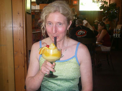
(Mango margarita. Richard had Prickly Pear and Mango.) Mostly, we ate fantastic food, took scenic drives, shopped (but didn't buy) and photographed the red rock scenery.

And photographed each other photographing the red rock scenery.
OK, we actually bought one thing - a present for my little brother. Can't post a photo in case any children stumble across my training log.
http://www.hotsauceworld.com/wafuupco1l.html
Great place! We need to go back there for a week of hiking and biking, i.e. without a race to taper for or recover from. (Although I wouldn't get to eat as many tacos and burritos without a race, so it might not be as fun.)

Sunday May 17, 2009 #
Orienteering (Rogaine) 10:43:00 [2] **
So to recap... at the end of Day 1, I'd decided to switch to a more conservative route for the rest of the night. Looking at the map now, I can see no reason to do this - I'd simply lost confidence after our experience leaving the canyon. I blamed myself for not finding the trail, and my sleep-deprived mind convinced me that I would have trouble finding things from now on. The silly thing is, I'd already had no trouble finding two controls on the east side of the canyon after our climb. I woke Richard from his nap, and we headed out. He'd been following the map closely in the daylight, but between sleepmonsters and the canyon confusion, he was pretty much finished with navigating.
We picked up three controls along our new road route. Two of them went smoothly; on the third, we lost time after heading down the wrong spur to look for a re-entrant. No biggie - it's a long race. Up to this point, the mapped roads continued to be as useful as they had been all day. I pace counted and watched my compass on the roads, and it was easy to keep track of the main roads and ignore the unmapped minor roads. But then (dramatic organ chord) we entered an area where loggers had been at work, and our road started misbehaving. It was supposed to go north, but it only wanted to go east, and I assumed that the north-south road on my map no longer continued north of its intersection with this east-west road, which appeared on the map. I took a bearing toward a control from where I thought we were. Within 300 meters, we'd hit another good east-west road. Crap. We weren't that far from the edge of the map, so now I was uncertain and afraid to take risks.
We started walking east on the road, since that would lead us to the main north-south forest road if we failed to be struck by any insights enroute. Eventually the road started making turns exactly like a road on the map. Even better, I could prove my hypothesis by finding a control in a shallow re-entrant just a few hundred meters away. We headed down and didn't see a flag - just a pair of large eyes staring at us from about 50 m away at bear height. (We'd seen a few elk during the day, but they are taller.) We convinced ourselves rather quickly that we had done a thorough search for the control, returning to our mystery road feeling discouraged. Ironically, we were exactly where I thought we were - but now we thought we weren't. Later on, when we approached that control from a different direction, we saw that it had been hiding behind Mr. Bear Eyes. But in the meantime, we were still in damage control mode - not racing, just trying to relocate so we could begin racing again.
That happened just before morning, and we found a few more controls after that. Unfortunately, we weren't very effective by then - distracted by painful blisters on the soles of our feet, unseasonably hot weather, sleepiness and frustration with our poor performance. If I didn't see it firsthand, I'd find it pretty much unbelievable that we could get as few points in the second part of the rogaine as we did. We scored 940 pts in the first 8 hrs and 450 pts in the final 16 hrs! After we'd wasted too much time on a couple of fruitless searches from inaccurate attackpoints in the hot morning sun, I pulled the plug and told Richard I wanted to hobble back to the Hash House, about 90 minutes away. It felt like I was walking on broken glass, and it was BOILING hot. (Arizona was having a heat wave - it's not normally this bad in May.) Richard was faster as always, but the soles of his feet were hurting too.

Although our race had been a bust from a competitive standpoint, the Arizona flora, fauna and scenery still made the rogaine well worth it.


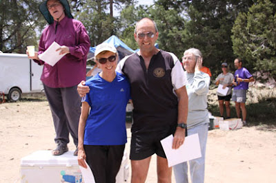
Here's our "after" photo. Looking pretty happy, considering! And waving the Salomon flag once again.
We finished with 1390 pts, 4th of 7 teams in our category. Surprisingly, we were only 10 pts behind 3rd place, and we passed up some easy low value controls near the end because we figured we were totally out of the competition. In fact, winning was never a possibility. The top Veteran Coed team (I'd picked them for the win based on Google) got 2750 pts, about 1000 pts ahead of 2nd place and only 10 pts behind the Male team that won overall. Wow.
Ray and Terri Kitowski of GHO not only kicked our butts with their 1670 pts - they beat out all the other Super Veteran Coed teams to be named North American Champions. Congratulations!
Although this was clearly a bad result for us - the worst rogaine we've ever done - I'm not feeling down about it. We race a lot. In the past 8 weeks, we've done the Rock & Ice Ultra, Giant's Rib Raid, Boston Marathon (Richard), Frontier Adventure Challenge and the Mogollon Rim Rogaine. This was the only competitive disaster. If you do enough races, some of them will go badly. There were a lot of positives about this event:
- The first 8 hrs went really well. I think our planned sequence of controls for the 24 hrs was a good one if it had been executed properly.
- In spite of heat, exertion, sleep deprivation and altitude, I never felt faint, and I'd been worried about that.
- Richard and I had fun together.
- I ate and drank more than usual. I discovered that a wee can of Starbucks espresso is the perfect midnight snack.
- I used most of the stuff in my pack - I was less overpacked than usual.
- It was a beautiful place to trek around for 24 hrs.
- Even with the altitude and heat, it didn't seem physically difficult - except going up those canyon walls!
- It was a well-designed course, and the menu for the post-race food was extensive and varied.
- It gave us an excuse for a fun vacation in Arizona!
- It was nice to see some familiar faces - people I like and respect, but don't often see in real life.
We need to do more analysis to see what lessons we can take away. A few thoughts so far:
- Set a deadline time by which I need to choose the basic outline of my route, i.e. a time to stop trying to optimize it any further and switch to detailed analysis of a particular route.
- Write a list of all the things that need to be done in that last hour before the race, and post it in an obvious place - it would include things like changing my glasses, writing down control sequence on waterproof paper, setting up the map cases, etc.
- As soon as a road starts doing something funny, switch to using bearings and distance estimation. Don't be pathetically hopeful and give the road a second chance.
- Do more rogaines. Get our mojo workin' again! :-)
Saturday May 16, 2009 #
Orienteering race 13:00:00
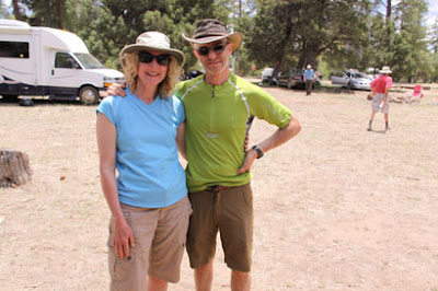
Hard to believe this was my 4th North Am Rogaining Championship already, and my first one racing with my husband and adventure racing teammate Richard. Andrea, Nina and Leanne were excellent partners on female teams in the past 3 championships in British Columbia, New York and Quebec respectively, and we were fortunate to win our category, but I had no illusions that my luck would carry over to the competitive Veteran Coed division.

After my fainting-in-the-woods episode two weeks ago, I was a little uneasy. I'm going to see my doc after passing out during a 30-minute run on a 21C day, but this weekend I planned to be in the woods for 24 hrs at an altitude of 7,500' and 30C for much of the day. Hmm.
We had 2 hours with the map before the race started.

Normally when I get a rogaine map, I'm able to quickly identify a few controls or map areas to ignore because the reward isn't sufficient for the effort. Similarly, there is often a cluster or spine of high-value controls that leap off the page as the best choice to build my route around. Not so this time. John Maier designs great rogaines, and no matter where I moved my distance-measuring string, our points totalled about the same. I ended up wasting too much time looking for the best route when my time would have been better spent fine-tuning any one of the routes I'd considered.
The big decision was whether to cross the 600' deep Chevalon Canyon on the west side of the map. I considered leaving it out entirely, a strategy that worked well for Team Beautiful Hair. On the plus side, that part of the map held 900 of the possible 3440 points, with high-value controls placed a little more densely than in other areas of the map. Controls were all on easy-to-find features with good attackpoints nearby. There were long roads, ridges and valleys to use as handrails with relatively easy walking. (In retrospect, a perfect place to be at night.) We saw two negatives - the 600' climb/descent in each direction on a hot day at altitude, and our estimate that darkness would fall just as we reached the bottom of the canyon on our way back. We decided to go for it - we don't mind climbing, and there was a trail marked at the location where we planned to climb out of the canyon in the dark.
By the time we'd finally settled on the first 75% of our route (leaving the end flexible), there was little time left to document our route choice, set up our map cases properly and so on. We started racing at 11 a.m. in oppressive heat, and I quickly realized that my vision had gone blurry. Eeek! Luckily, this wasn't a southern version of Cathy G's frozen corneas - I'd been so rushed that I'd forgotten to trade my reading glasses for sunglasses. I had the sunglasses with me, so made a quick change.
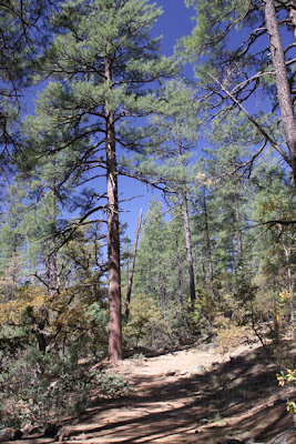
Much of the terrain looked like this open Ponderosa pine forest - really nice to move through. Some areas were rockier, steeper and/or thicker, but this was common.

We picked up two controls, then descended a steep spur into Chevalon Canyon. There were 3 controls along the river.

We took them from south to north. Along the way, we met a male team who advised us to "watch out for the snakes" if we were "going that way". They were unspecific, and I've since wondered if they were playing mind games, but I started watching more closely for rattlers after that. Apparently some other teams saw and heard them. (Snakes, that is. Not the two guys.)
We climbed up a spur on the west side of the canyon at #86. It was long and steep, but not technical.

We decided to do everything over there except #58. We ran into Eric & Mary Smith a couple of times, and also met Sharon Crawford and her brother. I was glad to see that others were building their first day around this part of the map.

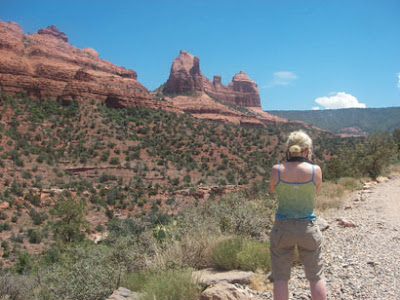
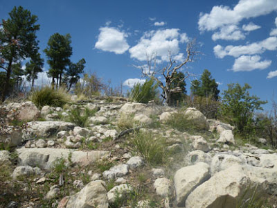
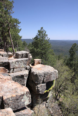
A few of the controls were on spurs on the western rim of the canyon - beautiful views. Note the first photo looking back toward the rugged eastern wall of the canyon. (Foreshadowing!!)
--
--

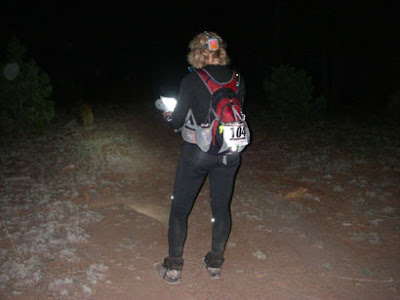
I don't think I would have changed anything in the first 8 hours of the rogaine. We spiked the controls, I drank way more than I usually do, Richard was strong as always, the scenery was gorgeous, and I survived the heat even if I didn't enjoy it. We had 940 points at sunset, and using Jim Waddington's Rogaining Rule of Thumb #5 (or so), our total score should end up approximately double that amount, i.e. 1880 pts in 24 hrs. We were optimistic, given that we still had 16 hrs of racing left when the sun went down, and our race had been going so smoothly. As the sun set, the air felt deliciously cool, and I looked forward to a productive night.

But that's not how it went. We'd estimated that complete darkness would fall at the bottom of Chevalon Canyon on our return crossing. We got to the bottom of the canyon using a fishing trail, then we skirted the southwest shore of the lake just using our night vision before pulling out headlamps. No problem - now we just needed to find the nearby Weimer Ridge Trail. But Richard and I couldn't agree on the point where the narrow lake turned into a wide creek (the lake is dammed at the other end), so our attackpoint was flimsy. The course setter had said that the trail wasn't super-obvious, but from the map, I hadn't anticipated problems identifying the south tip of the lake.
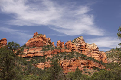
The mapped trail appeared to weave through the cliffs. We weren't sure if we could get up any other way in this part of the canyon, especially in the dark, so we spent far too long looking for the trail. In a photo taken earlier on the west side, here's a reminder of what the 600' canyon wall looks like. Note the band of cliffs near the top.

Finally we decided to just climb straight up. (Turns out we didn't meet anyone who located the trail, day or night, from the top or from the bottom.) It was a long, tough climb, and we had to scramble up a few small cliffy areas, which felt sketchy and nervewracking. But we made it up, and in a 24-hr event, you can waste an hour and still do OK.
However, the climb had been difficult physically and mentally, and I'd lost my confidence from earlier in the day. We found our next two controls with no problem, then stopped for our "dinner" break - pizza, a change of socks, warmer shirt. I pulled out the map and proceeded to ruin our race...
I decided to make things easier for the night, adjusting our route to attack a series of medium-value controls from obvious points along roads. The controls weren't that different from what we'd planned, but we would be taking longer, "safer" routes with less climbing/descending and less mental focus required. We'd heard that some roads on the map were a little off and that other unmapped roads existed, but up to this point, they had been easy to figure out, so I was lulled into a false sense of security. Oops.
Friday May 15, 2009 #
Trekking 2:00:00 [1]

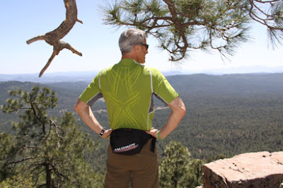
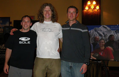
Then we went up to Rim Road and did some walking around Bear Canyon Lake and the edge of the Mogollon Rim - the only time we'll ever out-navigate Peter G, who apparently did not find the Rim on the hike he did with Barb today.

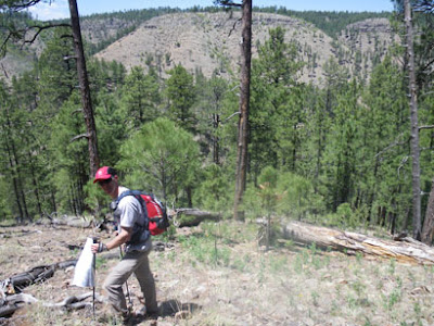
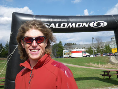
Pete will be glad to see this pic of a loyal Salomon customer.
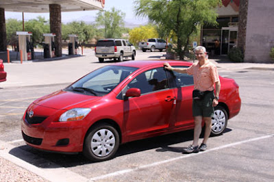
We drove to the rogaine site, including half an hour of slow, bumpy forest roads. We arrived almost an hour after registration was scheduled to open, but the packets hadn't arrived yet, and the promised maps from previous events were not posted. Oh well, we drove back down the bumpy forest roads and headed to our cabin, almost an hour away. Glad the Yaris is easy on gas. We ate a big dinner, finished assembling our packs and got to bed at a reasonable hour. (It doesn't hurt that our bodies still think it's 3 hrs later.)
Thursday May 14, 2009 #
Note
At the Phoenix airport, we were reminded of friends far away.

Other friends weren't far away at all. In fact, on the next escalator over, I thought I recognized the back of Barb's head ("Attackpoint Barb", as we call her to avoid confusion). I tried calling her name, and sure enough, she turned around. Then Peter G materialized a few steps higher. They are racing with Cristina on Team Beautiful Hair - a team with a scary amount of navigation talent and three of the most entertaining logs on Attackpoint - if you like to read well-written slices of life sprinkled with insightful comments, humour, photos, maps, drawings, video and links.

We picked up our cute, gas-sipping Toyota Yaris and headed for Payson, the last large town before the rogaine site (near Forest Lakes).
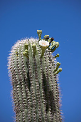
The Sonoran Desert was gorgeous with cacti in bloom. It was really, *really* hot. It turns out that Arizona is having a heat wave. Hmm, I fainted at 21C a couple of weeks ago, and now I'm going to be racing at 30C. Wish me good luck with that!


After a yummy Mexican lunch in Payson, we loaded up on provisions. One of the things I love about the U.S. is the unusual snack foods you can find at convenience stores. Today's discovery was "Pickle in a Pouch" - a big dill pickle in a thick plastic bag, sitting in about 200 ml of brine. It comes in multiple flavours (e.g. "Garlic Gus", "Big Mama") and weighs a ton - it didn't make the cut in my pre-rogaine shopping.
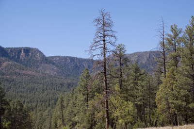
We headed partway up the Mogollon Rim, stopping at Wooden Nickel Cabins in Christopher Creek. This area looks totally different from the earlier part of our drive - almost like Canada.
An exercise physiologist once told me that if you can't acclimatize to altitude for the better part of a week before an event, then you should just sail in and race before your body starts making adaptations. Supposedly, we tend to be at our worst physically around the 3rd day at altitude. So I booked a place within an hour of the rogaine site, but about 350 meters lower. Our 2-storey cabin was beautiful - wood interior, living room, kitchen, back patio with BBQ - and the National Forest was right out the back door. There wasn't much else out there though, which is why we needed to stock up on groceries!
Richard and I went for a short hike to get a feel for the ponderosa pine forests - and of course I had to hug a tree.

We met a friendly fellow on an ATV who told us that he was hosting a youth turkey hunting camp this weekend. Just our luck! We thought we'd left the turkey hunters behind in Palgrave, but now we get to share the forest with kids carrying guns. Yeehaw!
Trekking 30:00 [1]
Wednesday May 13, 2009 #
Note
Tuesday May 12, 2009 #
Note
"At the finish line the participants will be shouted a hamburger and drink."
Note to 'Bent: It sounds like Swedes may not be into vegetarianism. Carbon, is that true?
Note
- 3 wild turkeys
- 2 baby raccoons
- 1 young deer
No partridge, no pear tree. But it's been another one of those Disney movie evenings... (pause to burst into song...)
Monday May 11, 2009 #
Mountain Biking (3 hrs elapsed) 1:45:00 [2]
Mansfield has a marvelous trail system for MTB-O, but now that it is closed to the public for mountain biking, some single track is maintained (mostly by Chico Racing) and other minor trails are not. So I really needed to ride it to see what would work - I couldn't just look at the map. I also encountered an unexpected landowner issue in the SE corner of the map, so had to switch some things around. It's been complicated to pull together, but I think it's going to be a fun event. Be there! :-)
http://caledonnavigators.heysport.com/
Sunday May 10, 2009 #
Note
Running (Trail) 1:21:00 11.4 km (7:06 / km)
I tried to replicate the conditions leading up to my fainting incident (strong effort for awhile, abrupt stop, then stand still a few minutes), but couldn't make it happen. The missing element seemed to be heat - it was about 10 degrees cooler today, and my body is truly Canadian in its love for cold weather. I also carried 'Bent's pulse oximeter and tried it a few times out of interest, although I'm not sure I'm proving all that much when it shows that I'm getting enough O2 to my finger!
Stopped in to visit Crash and her pooches on the way home, then had a morel picking session in the fire-burned field behind our house. Yum, they are good sauteed as an appetizer!! BulletDog did something to herself in the last few minutes that had her hopping on three legs for much of the evening. The pain was in the leg she had knee surgery on last year - the one with steel plates and screws in it. So we were freaking out and contemplating staying home from Arizona. But she started walking on all four legs again about 90 minutes before bedtime - phew!!!!
Saturday May 9, 2009 #
Mountain Biking (Trainer) 1:00:00 [3]
Thursday May 7, 2009 #
Running (Trail) 33:48
Nice sunny day for a short trail run. I felt surprisingly energetic, and my Forerunner confirmed a good pace. I could feel the 21C "heat", but it wasn't a biggie. I stopped to chat with a neighbour, and just after we'd talked about my MTB gash and his recent TIA, I felt a little nauseated and very dizzy. The dizziness felt like the postural hypotension I sometimes get from standing up too quickly. I should have sat down, but instead I turned to leave, and the next thing I knew, I was lying face down on the trail, unsure of how I got there and feeling like I'd just awakened from a pleasant dream. My neighbour was freaked out, but I assured him that I'd just tripped over some unknown divot. I wasn't even sure at first that I was lying to him, but when I realized that I hadn't tried to stop myself from falling hard on my face, I knew I must have blacked out for a second. After a couple of minutes of walking, I finished the run at a slower pace and felt OK, but not great. I've got some nasty road rash on my face and whiplash in my neck. Bizarre.
I'm guessing that it was some combo of stopping too quickly (blood still in the legs, not pumping to the brain), unaccustomed heat, and maybe not enough hydration. Too early to worry, I think. If I'd stopped and sat down for a few seconds, like I do at home, I think the dizzy feeling would have subsided without incident. But I do come from a family where women have heart problems, and I've had all kinds of tests after activity-related arrhythmias, so I'll need to keep track of this stuff.
Note
http://caledonnavigators.heysport.com/
There will be a novice course for people who aren't accustomed to riding on single track. The regular course will be suitable for intermediate riders - nothing too hairy. A good navigator will have an advantage, but all the controls are at points along trails, so any biker who can read a trail map should be able to get around the course - eventually!
Hope you can make it, and please pass this on to your friends who bike and adventure race. I'll be honest - our costs are high for insurance and venue fees, and I'm worried that the club will lose money, so I need to promote the heck out of this!
Wednesday May 6, 2009 #
Mountain Biking 30:00 [3]
Strength & Mobility (Upper body) 11:00 [2]
Tuesday May 5, 2009 #
Mountain Biking (Trails & Road) 1:00:00 [3]
Monday May 4, 2009 #
Note
http://www.attackpoint.org/viewlog.jsp/user_2521/p...
Sunday May 3, 2009 #
Trekking 20:00 [2]
Saturday May 2, 2009 #
Adventure Racing race 5:36:00 **
First summer adventure race of 2009! Since I'd "trained" by doing completely different things for the past 6 months, I wondered how much my body would rebel. 'Bent and I carpooled with Leanimal, Goose and Shifty. Five bikes, five people, great conversation, and tons of gear in and on the Bullfrog van.

We were excited to drag Shifty (Mike) Schaffel out of retirement to join the Tree Huggers for this event. Shifty and I raced together several years ago with the Terranauts, and I knew he'd be a great fit for our team.

We got the maps at 7 a.m. This was our 4th race around Deerhurst, and we recognized some familiar terrain. No problem - it was a terrific spring day, and we didn't mind seeing a few lakes and trails we'd seen before.
Warning: If you weren't there, you'll probably find this report too long and boring.
I could see that CPs 4 (depending on route choice) and 8 would be a bit of a crapshoot. The best way to avoid this problem is for the race designer to set the course using only map and compass, and choose mapped features as CPs - or unique locations closely related to mapped features. And the control descriptions should be very specific. As a final step, if the course isn't going to be marked on the map (thus avoiding a big, easily avoidable source of error), the CPs can be GPSed and checked against the mapped features to ensure that the UTMs will cause no confusion. The reason I expected people to have problems with these CPs was that they relied on UTMs on unmapped features - although there was a longer, more reliable route to CP4 if teams ignored the race instructions on how to get there. (Which few teams did.)
We started off on our bikes, heading toward the Muskoka River that flows from the southwest corner of Fairy Lake. We had 10K of fun riding - rolling hills on mostly dirt road. Our troubles for the day began when Shifty's bike refused to shift on the uphills - a problem that plagued it for the rest of the race. Then in the middle of one of the biggest, steepest downhills, I hit a huge bump, and my map flew from the bike map holder (which wasn't completely closed) and landed in the middle of the road. As the next two teams whizzed past, I dove into the dirt to rescue the map while apologizing profusely to them at the top of my lungs.
After transitioning to the paddle, we found ourselves sitting surprisingly low in the water, given our team's small stature, and the canoe was very short. We had to be cautious about hitting kayak paddles, whacking people's heads, and - worst of all - tipping into the cold water on a breezy day. In spite of our tenuous balance, our Trayling training kicked in. The three of us had spent many 6 a.m. hydrospinning classes together. We passed 4 teams and caught a few more as we paddled across Fairy Lake and through the canal back to Deerhurst. From there, we ran back to the main transition area to start the trek.
I was surprised we got the infamous "cartoon map" from last year's race - the Deerhurst hiking map with skewed 3D perspective that I had liked, but most people detested. This time it was only provided as extra information to help understand the 1:50,000 topo map, and I think most people would agree that it was useful.
I'd decided to just ignore the trail system and take a bearing toward CP3, which was a pond on a golf fairway. We came out too far east on the fairway and wasted some time checking further east to make sure that the pond downhill to our west was the right one, since I didn't think I could have gone that far off my bearing. Also, we'd been told that the map didn't match the ponds. It wasn't enough to just look for a CP flag, since we'd been warned that the flags for the high school race were already out. It turned out to be the pond we'd first seen to the west, and I beat myself up for falling off my bearing, but the next day Dave Zietsma ran the course and changed the UTM for the high school race. Turns out I'd followed the correct bearing, but the UTM was incorrect - PhattyJR ended up too far east as well.
We crossed Hwy 60 to the airfield and ran along the runway. In retrospect, given the way the race ended for us, all I can say is that we'd better *really* enjoy the fun photos we took along the way! :-)

From here, the instructions directed us to enter a trail network and locate a trail that started roughly at a UTM that wouldn't be easily recognizable in the terrain. As I'd expected, some teams got quite lost in this section. We chose one trail and followed it for a minute before abandoning it because it turned too far west. Shifty is a cameraman for "Mantracker" and had filmed a show in the area. He remembered a north-south trail in the area with a steep hill, and I was looking for one with a "D102" snowmobile trail sign (from the Backroads Map Book). A few minutes further east, we came upon a very steep trail with a D102 sign on it. Yay.
From there, it was about 2 km of following a mucky snowmobile trail through beautiful woods. We encountered some trail junctions, but it was possible to follow the major ups and downs of the terrain on the map and figure out where we were, even though no trails were marked. We ran a little, but Shifty fell back, and we noticed him touching his legs, looking confused. Finally, at the top of a hill, he announced that his feet had gone completely numb. Yikes! Luckily, he guessed the right solution - he removed new bike shorts he was wearing over his tights, and the blood returned to his feet and legs, restoring him to top notch Shifty-shape within a few minutes.

At CP4 ("high point on trail not shown"), we met Leanimal and Goose, who rang cowbells to cheer us on! This earned them the Most Spirited CP Award.

Less than a kilometer later, we popped out onto a road where we picked up our bikes. Apparently we were lucky, since the landowner showed up later and freaked out about all the adventure racers passing through his property. Hopefully, Leanimal will share the story in her log. After a major scene, there was an emergency re-route to a neighbouring property, and some of the later teams just went to CP5 without getting CP4.
[Edit: OK, here's Leanimal's excellent report.
http://www.attackpoint.org/viewlog.jsp/user_2521/p...]
We rode our bikes downhill and along a dirt road to the Dyer Memorial, where I think FB sent us in a Raid The North a few years ago. We dropped our bikes at the parking lot, and Geoff looked happy to see us, since he was expecting more teams by now. I was pretty sure they were still looking for CP4!
We went up to the memorial (CP7), then headed for CP8, a classic bingo control - junction of 3 trails, all unmarked, in a bland area. I decided to go up the ridge to the west of the memorial, gambling on finding a north-south trail that might become one of the three trails I needed. If that failed, the UTM was depicted as being due north of where the ridge dropped down, so I hoped that following the ridge would take me to an east-west trail that would be one of the three trails. If that failed, I had nothing - other than wandering around on trails, which I later heard was a popular way of finding CP8. We did find a trail on the ridge eventually, but there had been some nasty blowdown in the forest, so it wasn't easy getting there. The trail dropped us out on an east-west trail, so everything was going according to my pseudo-plan - except for the lack of a CP flag. We went a short distance west and saw other teams looking for it. After 2 minutes, it felt too far, so we turned back east and found the flag at the next trail junction east of the one where we'd come off the ridge. Phew.
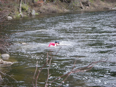
Now it was time for the advanced trekking CP on an island in the Big East River. We mostly bushwhacked on a bearing until we reached the edge of a steep valley where a creek ran into the river. We skidded down the slope clinging to saplings and started to bushwhack along the creek, then quickly abandoned the idea because of the nasty, thick shrubs and deep water. We climbed a short distance back up the ridge and headed south toward the river, which was our real goal. I was thinking that we'd cross the creek closer to the river, but Shifty remembered a road running along the river, and sure enough, we hit it right at the point where it crossed the creek, so we were spared the full immersion that some teams experienced further upstream. Shifty also remembered a trail to the river on the far side of the bridge, and we ran past it Mantracker-style, making tracks on the muddy road for 20 m, then sneaking back along the grass. This was fun. :-)
From here, it was a few minutes to the river's edge, and Shifty had bravely volunteered to swim in the cold, rushing current to the island. It was sketchy and would have been worth stationing a volunteer with a throwbag. Kudos to a true sportsman, Tom Martin, for waiting on the island to help Shifty out of the water after his frigid, numbing swim. 'Bent returned the favour when Tom swam back to the mainland. One top racer was almost swept past the island and saved himself by grabbing some vegetation at the downstream end. To our surprise, we saw MBR arriving as we left. Shock - we were leading the coed division!
We ran back to the Dyer Memorial parking lot on dirt roads. Throughout this entire trekking/bushwhacking/running section, I wore my Pearl Izumi cycling shoes with tread, and they rocked. 'Bent was strong, carrying extra weight and towing. Enroute, a small weather system blew through, pelting us with wind and cold rain. Shifty powered on in spite of the chill from his wet clothing. When we got on our bikes, his body finally rebelled from the frigid swim. His legs cramped horribly when he tried to bend them, so it was impossible to even sit on a bike to be towed. For the next 2 km, 'Bent rode his recumbent with one hand and pushed Shifty's bike with the other. Shifty bravely jogged along in cycling shoes on painful legs that wouldn't bend. Eventually, the combination of Tums, E-Caps and warmth kicked in, and his legs started working again. He was able to start riding just before we passed TA3. During this time, MBR passed us. Easy come, easy go.
There were three final advanced CPs near Deerhurst that we would reach with a combination of bike and foot. CP11 was on top of a ski hill - great way to warm up. Then CP12 was on a shed that required a little guesswork to locate. We came to it from Hwy 60, and while Shifty was punching, MBR arrived from the golf course side- not sure how we passed them again. Game on! We rode together to the final CP at a bridge, and 'Bent ran up the rocks on Tyson's heels while our teams waited together below. Hmm, a 1.2 km bike sprint finish between Tiny and me. Gee, I wonder how *that's* going to go? ;-)
We gave it a good try. It took 'Bent a couple extra seconds to get onto his bike after Tyson had taken off, then he was the only one who had to wait for a car before crossing the main road. We gave it everything we had and crossed the finish line with a big smile about 10 seconds after the very deserving Milton Basement Racers. Given all the challenges we'd faced, we were thrilled to be 2nd Coed and 5th overall of 62 teams, about 50 minutes behind the winners. I also think we were 1st among the teams who stopped to pose for photos along the way, but sadly there wasn't a separate category for that! :-)
MBR got champagne!
Bobkittens were the top female team, as always. Mrs. Gally looked good in leopard skin.

Congrats to PhattyJR, Harper and James for taking the win in a sprint finish. 3rd place male finished just ahead of MBR and us.
Thanks to Hutspot, Goose, Leanimal and all the other hardworking volunteers.

Overall, it was a fun day with two excellent teammates. It was our first time racing all together, but we worked well as a team, with each member making key contributions. I felt reasonably fit, given that I hadn't done much specific training - and our moderate pace kept me feeling fresh. Pre-race, I hadn't thought that my navigation experience would help much in this race, but apparently it did, even though I wouldn't have chosen a couple of the CP locations. At times I felt slightly out of control, relying too much on gut feel because of insufficient information, and I hated that feeling - but it worked out OK in spite of my discomfort. I had some good luck near CP8, and we were also lucky when Shifty recognized a couple of key places from Mantracker. (Although I'm sure he felt unnatural moving through the woods without carrying a 25-lb camera and chasing a horse!) Thanks for a fun day, 'Bent and Shifty!
