Training Log Archive: cmorseIn the 7 days ending Apr 24, 2011:
| |||||||||||||||||||||||||||||||||||||||||||||||||||||||||||||||||||||||||||||||
| « | » |
| » now | ||||||||||
| Mo | Tu | We | Th | Fr | Sa | Su | |||||||
Sunday Apr 24, 2011 #
5 AM
Note
rhr:42 slept:8.25 weight:75.8kg
6 AM
Run - Trail (Hop River) 1:43:00 [3] 19.5 km (5:17 / km) +50m 5:13 / km
weight:74.3kg shoes: old 285 Roclite A
Silk City Striders Easter Fun Run preceded by 7 miles solo. Nice outbound running with Dave M and ran the inbound with Scott L
Saturday Apr 23, 2011 #
8 AM
Run - Trail (Sampler) 44:44 [2] 6.0 km (7:27 / km) +125m 6:45 / km
slept:8.5 weight:74.7kg shoes: old 285 Roclite A
Easy social @ forest w/ Ginny, Jaime, Dave S, Brad and a couple new folks. Rain took a brief hiatus while we ran. Cool standing around, but comfortable running.
10 AM
Note
perusing the ytd stats and note I've run over 550 miles so far this year and 170 hours training is already more than half of last years total. Still have some big events coming up in the weeks ahead - Bear Mtn & Regaine among others. Feeling good and apparently over the Lyme....
Friday Apr 22, 2011 #
6 AM
Run - Mixed long (Shenipsit) 3:11:36 [3] 30.14 km (6:21 / km) +750m 5:39 / km
weight:73.6kg shoes: old 285 Roclite A
3 miles up Webster Rd, then north on the trails up into Somers. Nice morning to run, walked many of the hills even when I knew I could run them just to practice. Pushed the pace a little harder in the final hour. Then 3 miles back home. So about 1/3 roads, 2/3 trails...
Wednesday Apr 20, 2011 #
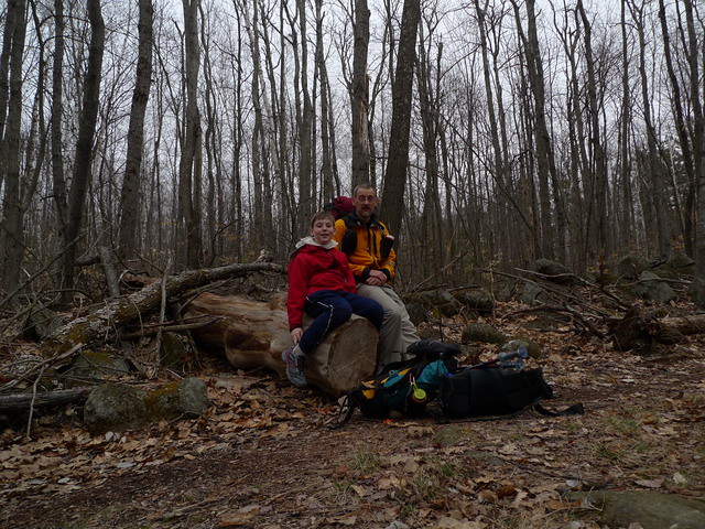
7 AM
Hiking long (MSG Day 3) 1:30:00 [2] 3.5 mi (25:43 / mi)
shoes: old 285 Roclite A
MSG Backpack Day 3
Got colder (30's), more frequent rain and the wind picked up overnight. Cloud ceiling very low in the AM so most of today would be spent in the clouds in less than desirable conditions. 14 miles planned for today. Plus the further north we go, the more remnant ice/snow we're encountering on north sides of hills - largely packed from snowmobile traffic, but slow going nonetheless
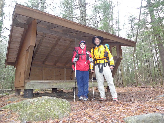
We are having lots of fun so far, in spite of the weather, but things appear to be deteriorating, Jackson had a few minor blisters yesterday and both of us slept fitfully last night due to the showers and raw, damp conditions. Not really cold in sleeping bags, but not exactly toasty warm either.
Decided to bail out to Stoddard (about halfway) today and come back to finish the trail in warmer, hopefully more pleasant weather. Jackson wants to repeat the full trail to take full thru-hiker credit. Walking out to Stoddard on the roads it felt like a cold, raw late November kind of day. OK while you were moving, but got chilly very quickly once you stopped.
Complete Flickr set
Got colder (30's), more frequent rain and the wind picked up overnight. Cloud ceiling very low in the AM so most of today would be spent in the clouds in less than desirable conditions. 14 miles planned for today. Plus the further north we go, the more remnant ice/snow we're encountering on north sides of hills - largely packed from snowmobile traffic, but slow going nonetheless
We are having lots of fun so far, in spite of the weather, but things appear to be deteriorating, Jackson had a few minor blisters yesterday and both of us slept fitfully last night due to the showers and raw, damp conditions. Not really cold in sleeping bags, but not exactly toasty warm either.
Decided to bail out to Stoddard (about halfway) today and come back to finish the trail in warmer, hopefully more pleasant weather. Jackson wants to repeat the full trail to take full thru-hiker credit. Walking out to Stoddard on the roads it felt like a cold, raw late November kind of day. OK while you were moving, but got chilly very quickly once you stopped.
Complete Flickr set
5 PM
Note
weight:75.7kg
Tuesday Apr 19, 2011 #
8 AM
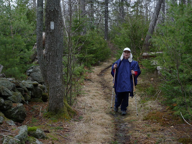
Hiking long (MSG Day 2) 7:00:00 [2] 13.0 mi (32:19 / mi)
shoes: old 285 Roclite A
Day 2 of Monadnock Sunapee Greenway Backpack
Showers on and off overnight, slept somewhat fitfully - not really cold, but the damp chill found its way into the sleeping bags so tossed and turned quite a bit. A leisurely pack up and started out around 8am. Down to Eliza Adams Gorge and then a combo of quiet dirt roads, old logging roads (presumably snowmobile trails in winter) and single track trails. Cool but dry until we got to Nelson Center where we stopped for a quick lunch. Started to drizzle a bit, so we pushed onward and didn't linger too long. A mile or so further on it started to sleet a little bit, so we donned the raingear and kept on going, enjoying the woods and the walking.
Jackson developed a few small blisters between toes in the afternoon, attended to them and moved on. Got into Crider Shelter a bit after 3, brewed up some ramen soup and a bit later had some freeze-dried lasagna. Temps definitely dropping and feeling very 'raw'.
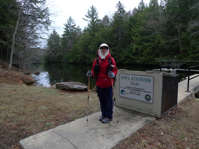
More details later. Complete Flickr set
Showers on and off overnight, slept somewhat fitfully - not really cold, but the damp chill found its way into the sleeping bags so tossed and turned quite a bit. A leisurely pack up and started out around 8am. Down to Eliza Adams Gorge and then a combo of quiet dirt roads, old logging roads (presumably snowmobile trails in winter) and single track trails. Cool but dry until we got to Nelson Center where we stopped for a quick lunch. Started to drizzle a bit, so we pushed onward and didn't linger too long. A mile or so further on it started to sleet a little bit, so we donned the raingear and kept on going, enjoying the woods and the walking.
Jackson developed a few small blisters between toes in the afternoon, attended to them and moved on. Got into Crider Shelter a bit after 3, brewed up some ramen soup and a bit later had some freeze-dried lasagna. Temps definitely dropping and feeling very 'raw'.
More details later. Complete Flickr set
Monday Apr 18, 2011 #
5 AM
Note
rhr:46 slept:6.0 weight:75.8kg
10 AM
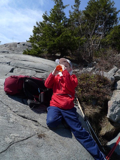
Hiking long (MSG Backpack Day 1) 6:55:00 [2] 8.4 mi (49:24 / mi)
shoes: old 285 Roclite A
Monadnock Sunapee Greenway Trail Backpack with Jackson.
Started from Monadnock State Park where we arranged to leave our car until Friday. Weighed Jackson's pack at the ranger building (20#) only to discover that the buckle on his hip belt was cracked. Pack reasonably light, so we opted to head out anyway without the packbelt.
Up the White Dot trail as it was the shortest route to the summit and the official start of the greenway. Sunny and mild (50's) on the way up, taking it slow and steady to get acclimated to the trail. Stopped for a few snack breaks and it began to get breezy as we cleared treeline. Quite a few folks out on the trails.
As we approached the summit cone, the cloud shield began to roll in and without the sunshine, the temps dropped. Bundled up against the wind we hit the summit and lingered for a quick photo, then headed North on the Dublin Trail towards Mt Sunapee 48 miles in the distance.
A bit more snow and ice headed down the north side of the mountain, mostly not too bad, but definitely a lot slower picking routes down among the rocks. In a couple spots we had to go well off trail to find dryish routes down the rocky bits as the official trail was iced over rock slabs - not navigable without crampons. Once down below the boreal forest the trail got much better with sections of running water to be avoided. Slow, but not difficult. Mid-afternoon by the time we were up and over Monadnock and we were only halfway to the campsite, but the miles came quicker on more level ground and we pulled into Spiltoir Shelter a little after 5pm. Once past Monadnock, we saw no one else on the trail.
Chilly and overcast, but at least the showers held off until after dinner was done.
Complete Flickr set