Discussion: Map
in: Uncle JiM; Uncle JiM > 2008-11-15
Nov 16, 2008 4:39 AM
#
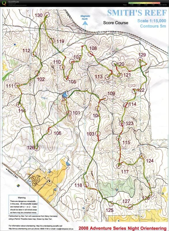
Looks like the exact same sequence of controls as mine (I went to the southeast first, though - I'm guessing from the wanderings that you did the reverse). I imagine the navigation would have been considerably more challenging at night, though, especially in the vaguer stuff (126, for example, would have been pretty scary in the dark).
Nov 16, 2008 10:01 AM
#
126 was facile if you ran down the gully. I found 105 and 113 the scariest. Its interesting that both Jymbo and I made similar sized errors on 113 though mine was on the opposite side of the control.
Nov 16, 2008 10:13 AM
#
I found 129 very vague, and still couldn't work it out after punching it, 117 was very steady, as you can see from the Red/Yellow on the course, I was so glad when we got that one. 113 I agree with, as we were lucky to relocate, 105 was the start of the vague area, so needed to be approached differently than how we had been doing it
Nov 17, 2008 1:33 AM
#
I might have considered 105, 110, 107, 108, 119,....., 106 126, 118, ....., 113, 109, 104, 104, 101 home.
Nov 21, 2008 12:54 AM
#
I don't yet have tracking software downloaded, but will have my Garmin and connector with me on Sunday if anyone feels like bringing a laptop.
This discussion thread is closed.
