Training Log Archive: BashIn the 7 days ending Feb 6, 2011:
| ||||||||||||||||||||||||||||||||||||||||||||||||||||||||||||||||||||||||||||||||||||||||||||
| « | » |
| » now | |||||||||||
| Mo | Tu | We | Th | Fr | Sa | Su | ||||||||
Sunday Feb 6, 2011 #
Note
(rest day)
Sunday - day of rest and boy, was I ready for *that*! 'Bent and I walked to downtown Christchurch through Hagley Park and the Botanical Gardens.
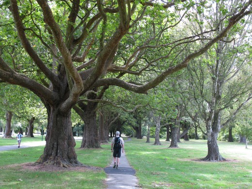


'Bent couldn't resist visiting the pull-up rings he'd found in the park a few days ago.

And I couldn't resist being a Tree Hugger.

We went to the Canterbury Museum's special exhibit of photography from the Scott and Shackleton Antarctic expeditions a century ago. Most Antarctic expeditions past and present have passed through Christchurch and there is some very cool stuff to be seen in the museum and International Antarctic Centre. A year or two ago, I read the #1 book on National Geographic's Top 100 Adventure Books List, "The Worst Journey in the World" by Apsley Cherry-Garrard. It is a fascinating story of the Scott expedition, well worth reading. Today we saw large, beautiful prints from Scott expedition photographer Herbert Ponting, a master of composition. The Shackleton photos were excellent too, although many of the negatives were lost when their ship sank.

This sculpture of Captain Robert Falcon Scott was made by his widow Kathleen and presented to the City of Christchurch.

Downtown Christchurch has a British feel.


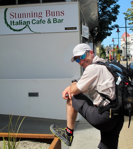
There is also an Italian place.
We've seen earthquake damage and ongoing repairs in many places around town. Some businesses have closed or moved to different locations. Parts of some buildings have been condemned as unsafe. For the most part though, things look surprisingly normal.

Today is a national holiday - Waitangi Day. As one person explained to us, it's not really a celebration since it commemorates a treaty between Maori natives and British settlers, and apparently the treaty was not translated correctly from English to Maori. There are still disputes and Waitangi Day is a popular day for protests. However, it's also a day for family picnics and outdoor concerts and we only saw that sort of thing.

By the Arts Centre, there was an outdoor market and food fair. I bought a jade pendant that combines two traditional Maori symbols, the Koru (spiral) and the Fish Hook.
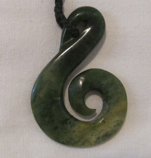
The Koru depicts growth, new beginnings and harmony. The Fish Hook represents strength and determination, and brings peace, prosperity and good health. Best of all, it provides a safe journey over water. That all sounded good to me.
Since I'm going to be doing a lot of journeying over water in C2C, between the river crossings and the whitewater kayaking, I bought another pendant - a Fish Hook made of paua shell. I should be well covered!

'Bent couldn't resist visiting the pull-up rings he'd found in the park a few days ago.
And I couldn't resist being a Tree Hugger.
We went to the Canterbury Museum's special exhibit of photography from the Scott and Shackleton Antarctic expeditions a century ago. Most Antarctic expeditions past and present have passed through Christchurch and there is some very cool stuff to be seen in the museum and International Antarctic Centre. A year or two ago, I read the #1 book on National Geographic's Top 100 Adventure Books List, "The Worst Journey in the World" by Apsley Cherry-Garrard. It is a fascinating story of the Scott expedition, well worth reading. Today we saw large, beautiful prints from Scott expedition photographer Herbert Ponting, a master of composition. The Shackleton photos were excellent too, although many of the negatives were lost when their ship sank.
This sculpture of Captain Robert Falcon Scott was made by his widow Kathleen and presented to the City of Christchurch.
Downtown Christchurch has a British feel.
There is also an Italian place.
We've seen earthquake damage and ongoing repairs in many places around town. Some businesses have closed or moved to different locations. Parts of some buildings have been condemned as unsafe. For the most part though, things look surprisingly normal.
Today is a national holiday - Waitangi Day. As one person explained to us, it's not really a celebration since it commemorates a treaty between Maori natives and British settlers, and apparently the treaty was not translated correctly from English to Maori. There are still disputes and Waitangi Day is a popular day for protests. However, it's also a day for family picnics and outdoor concerts and we only saw that sort of thing.
By the Arts Centre, there was an outdoor market and food fair. I bought a jade pendant that combines two traditional Maori symbols, the Koru (spiral) and the Fish Hook.
The Koru depicts growth, new beginnings and harmony. The Fish Hook represents strength and determination, and brings peace, prosperity and good health. Best of all, it provides a safe journey over water. That all sounded good to me.
Since I'm going to be doing a lot of journeying over water in C2C, between the river crossings and the whitewater kayaking, I bought another pendant - a Fish Hook made of paua shell. I should be well covered!
Saturday Feb 5, 2011 #
9 AM
Running long (Trail) 5:48:22 29.45 km (11:50 / km) +1087m 9:59 / km
shoes: Salomon XA Pro Tomato 3
Back to the Deception/Mingha route in Arthur's Pass National Park. Frankenjack's brother-in-law Chris generously agreed to join me for a training "run" version of this route.
I'm using quotes because there were many places where we hauled ourselves over big boulders, crossed rivers, made our way over loose scree slopes or rock fields, or carefully balanced on slimy tree roots on steep, twisty forest paths. There are stretches where the running is relatively good but on the way up the Deception Valley, they rarely last long. On the descent from Goat Pass into the Mingha Valley, we were able to run more.
I carried my race pack with mandatory gear so I'm afraid I need to break the news gently to FB... I didn't take any photos. However, you can refer back to Tuesday to see exactly what it looked like. :)
The Deception River was higher today. I'd hoped to do all the crossings by myself, which I will need to do in the race unless I find a friendly fellow racer at the crucial moment. I succeeded on the first one but the next few crossings were swift, deep and treacherous. If Chris hadn't been there to link arms and fish me out of the current when things went awry, I would have turned back. Apparently, the most common type of wilderness death in NZ is hikers who screw up river crossings and go cartwheeling downriver away from their friends. Ironically, after having zero swims on a 70 km whitewater kayak paddle yesterday, my feet got swept out from under me and I went for two unplanned swims today. Guess I should stick with the kayaking!
Seems I'm always trying new stuff lately and today was no exception. Frankenjack taped my ankles, somewhat against my will. (He and 'Bent were insistent but I don't like making changes right before a race - especially to my feet.) It felt funny for the first few kms but then it was really good and I felt it save me from a couple of bigger ankle twists. Cool!
Also good for my ankles was Coach Frankenjack's latest advice: when you look ahead in rocky terrain and plan to take a step, take three smaller steps instead. Amongst other things, this can save you if a rock rolls when you step on it.
We added the extra 3 km from the Mingha parking lot to Klondyke Corner so this was almost all of the mountain run section with the exception of the first 2.5 km, which is on flat private farmland and is unavailable for training.
I hope to go a little faster on race day but I can't climb boulders or cross thigh-deep rivers any faster. To make cut-offs comfortably, I was hoping for a 5-hour mountain run and that doesn't appear possible for me in this terrain. So now I'm going to have to hope that the Waimakariri River is *really* big and fast on race day, and that I don't go for any swims. (Is that *me* saying this?!?) The paddle seems to be the only leg where I might be able to beat my time estimate if conditions are right. Who'd have thunk it?
Friday Feb 4, 2011 #
6 AM
Note
Looks like paddling is a go! See SPOT link to follow us starting around 4pm Ont time. Nervous...
10 AM
Paddling (Kayak) 5:07:44 [3] 70.44 km (13.7 kph)
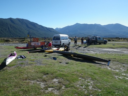
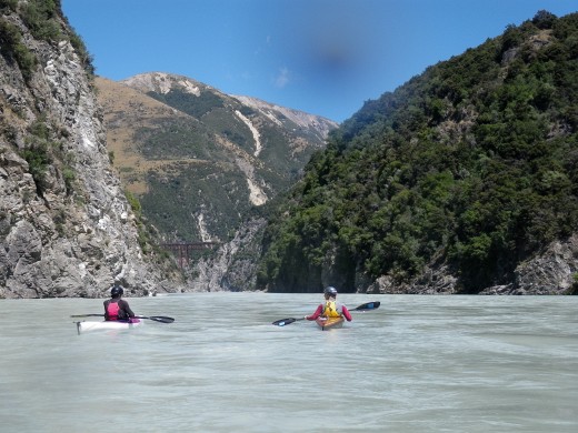
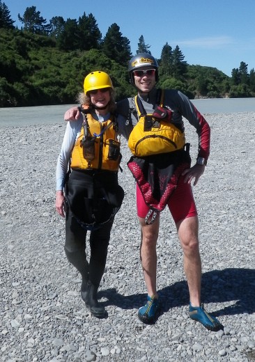
At last the weather cooperated so that Jack and I were able to paddle the Waimakariri River on a guided trip with Paddlerzone. Sunny and warm but the water was frigid.
It's helpful for Coast to Coast racers to go down the river with someone who is familiar with the way the rapids are running this year and the way they change from day to day depending on water levels. Our awesome guide Gaz knew his stuff inside out. Upon seeing the river level at our put-in at Mt. Whyte, he said, "I'll be honest - that's big. We'll do the first 15 km but we might have to pull the plug before the Gorge for safety reasons. If we're able to go in there, it'll be flowing really fast."

As you can imagine, that news increased my heart rate a little.
Note my fashionable look. To solve the problem of having no knee braces in my kayak and no glue to make them, I put pieces of closed cell foam into the knees of my fuzzy rubber pants. Worked like a charm. Looked ridiculous. I'll do this on race day.
In addition to Jack and me, there were two other paddlers. Bryce is in the 1-day race with us and Neil is doing the 2-day race. Both were using plastic sea kayaks; that seems like a common choice.


We did 70 km on the river, which had several distinct zones. Near the start and finish, there are braided sections where it's important to choose the right channel to avoid hitting shallow rocks or a dead end. Not far from the start are several rapids that can be significant, Boulder Gardens #1, 2 and 3.

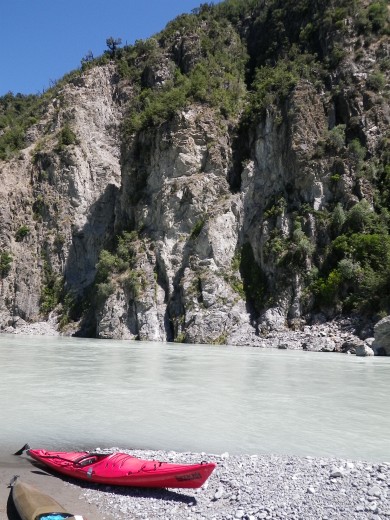
About 25 km into the paddle, you enter the Gorge, a 25 km section where the river narrows and gets twisty. There are a few rapids but mostly the challenge comes from the fast-moving, often disorganized waves that build up along the outside of the curves and beneath cliffs, and from the resulting eddies and boils.

In addition to talking about how to approach specific rapids, Gaz went over some of the same whitewater tips that Urthbuoy had discussed with me, which was handy because I've been reviewing my course notes. :)

One of the key skills for the Waimak is going around bends safely while getting good speed. Nasty water, debris and sweepers tend to be on the outside of the curves. We'd stay near the inside of the bend as we approached it while aiming for the outside. There is nearly always an eddy on the inside of a bend and we wanted to just skim past its edge without getting sucked in. As soon as we'd paddled past the nastiest stuff on the outside of the bend, we'd turn the nose of our boats slightly toward the outside riverbank to get a free ride in the fast current. If you do this too soon or go too close to the outside edge, the waves - and, near the end of the paddle, the sweepers - can make this risky. Early on, I tended to sacrifice speed in favour of stability but I got braver as the day went on.

The recommended line would sometimes be in the narrow area between the edge of a wave train and an eddy line. For maximum speed, we're supposed to try to avoid the biggest waves but we need to stay close to them. If we get sucked into nasty water, the important thing is not to fight it - to aim the nose of our boat straight down it and paddle, paddle, paddle. Many racers tip because they've turned sideways trying in vain to avoid something. These long downriver boats are much more stable nose to tail than side to side.

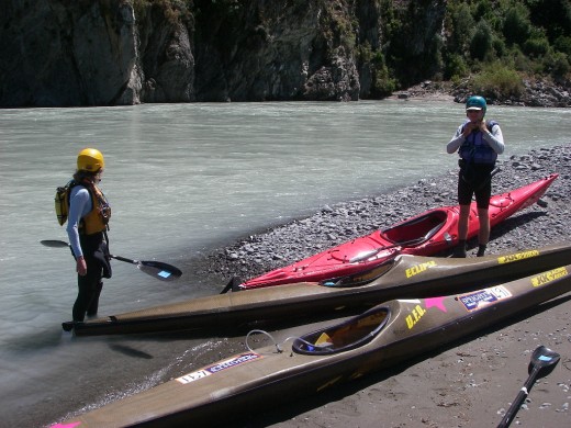
We had lunch in the Gorge.

I was impressed by my new boat. It takes some getting used to because of all the things I need to do with my lower body - brace my knees against the sides, brace my feet on the foot braces and steer the rudder with my toes. It's way worse than chewing bubble gum and walking at the same time. It's weird not being able to control the boat with paddle strokes. It's important to remember that the rudder only works when the boat is moving - even better when it moves faster. That influences the way you have to approach whitewater - and not necessarily for the better.
I got bounced around by a lot of big waves, often getting hit from several directions at once. I took a few big waves that washed right over my head. Although my Eclipse feels tippier than the kayaks I'm used to, it seems to have excellent final stability. I had a couple of near tips in the first two hours when I was super lucky to regain my balance. There was a near disaster after lunch when I got sucked too close to a huge rock on the outside of a bend with fast water flowing over it and cascading off the sides. It knocked me to the left then I tilted way off balance to the right toward the rock and was 100% convinced that I was going to swim in some of the fastest water of the day. According to the guide, I executed an "awesome high brace". Although I do know how to do a high brace, I wish I could say I did it on purpose. It was just an unconscious "keep the paddle in the water and push hard toward an upright position to postpone the inevitable swim until I'm past this nasty stuff" thing. Amazingly, it worked. Huh. The guy behind me swam at the same rock so Gaz would have been busy if I'd gone in too. He said he's dealt with up to 4 swimmers simultaneously.

For obvious reasons, we didn't pause to take any photos of the big rapids so you'll just have to use your imagination.
So I still haven't tipped my new kayak. It will almost certainly happen in the race when I'm tired and don't have an experienced guide showing me the safest lines. Although I was ecstatic to make it down the river upright, I almost wished that I had gone for a swim just to get that experience out of my system while I had a guide watching me. The Waimak moves quickly and there are few breaks in the action. It's not easy to swim a boat to shore in the fast-moving current. In the Gorge, it just keeps moving. There are no pools at the bottoms of the rapids where you can take a break and get back into your kayak.
One fellow on our trip had two swims - not unusual on a day when the flow was so high and the waves were so big. Both times, he and our guide floated well past the rest of us as we waited by the riverbank. The procedure is to flip your kayak upright, stick your paddle into the cockpit, then swim hard for shore using one arm and kicking your feet. If you have to make a choice, swim for your paddle. Your boat is easier to locate.
Jack had a great paddle in his new JKK UFO, which is a speedier, tippier kayak than mine. No swims for him although he disappeared into a hole at one point and had us wondering until he popped back into view.
Although it was mentally exhausting since I had to be alert for 5 hours straight, it was a super fun day. We're heading back to do the mountain run again tomorrow. We might paddle part of the river again but otherwise we are ready to taper. Only one more week!
It's helpful for Coast to Coast racers to go down the river with someone who is familiar with the way the rapids are running this year and the way they change from day to day depending on water levels. Our awesome guide Gaz knew his stuff inside out. Upon seeing the river level at our put-in at Mt. Whyte, he said, "I'll be honest - that's big. We'll do the first 15 km but we might have to pull the plug before the Gorge for safety reasons. If we're able to go in there, it'll be flowing really fast."
As you can imagine, that news increased my heart rate a little.
Note my fashionable look. To solve the problem of having no knee braces in my kayak and no glue to make them, I put pieces of closed cell foam into the knees of my fuzzy rubber pants. Worked like a charm. Looked ridiculous. I'll do this on race day.
In addition to Jack and me, there were two other paddlers. Bryce is in the 1-day race with us and Neil is doing the 2-day race. Both were using plastic sea kayaks; that seems like a common choice.
We did 70 km on the river, which had several distinct zones. Near the start and finish, there are braided sections where it's important to choose the right channel to avoid hitting shallow rocks or a dead end. Not far from the start are several rapids that can be significant, Boulder Gardens #1, 2 and 3.
About 25 km into the paddle, you enter the Gorge, a 25 km section where the river narrows and gets twisty. There are a few rapids but mostly the challenge comes from the fast-moving, often disorganized waves that build up along the outside of the curves and beneath cliffs, and from the resulting eddies and boils.
In addition to talking about how to approach specific rapids, Gaz went over some of the same whitewater tips that Urthbuoy had discussed with me, which was handy because I've been reviewing my course notes. :)
One of the key skills for the Waimak is going around bends safely while getting good speed. Nasty water, debris and sweepers tend to be on the outside of the curves. We'd stay near the inside of the bend as we approached it while aiming for the outside. There is nearly always an eddy on the inside of a bend and we wanted to just skim past its edge without getting sucked in. As soon as we'd paddled past the nastiest stuff on the outside of the bend, we'd turn the nose of our boats slightly toward the outside riverbank to get a free ride in the fast current. If you do this too soon or go too close to the outside edge, the waves - and, near the end of the paddle, the sweepers - can make this risky. Early on, I tended to sacrifice speed in favour of stability but I got braver as the day went on.
The recommended line would sometimes be in the narrow area between the edge of a wave train and an eddy line. For maximum speed, we're supposed to try to avoid the biggest waves but we need to stay close to them. If we get sucked into nasty water, the important thing is not to fight it - to aim the nose of our boat straight down it and paddle, paddle, paddle. Many racers tip because they've turned sideways trying in vain to avoid something. These long downriver boats are much more stable nose to tail than side to side.
We had lunch in the Gorge.
I was impressed by my new boat. It takes some getting used to because of all the things I need to do with my lower body - brace my knees against the sides, brace my feet on the foot braces and steer the rudder with my toes. It's way worse than chewing bubble gum and walking at the same time. It's weird not being able to control the boat with paddle strokes. It's important to remember that the rudder only works when the boat is moving - even better when it moves faster. That influences the way you have to approach whitewater - and not necessarily for the better.
I got bounced around by a lot of big waves, often getting hit from several directions at once. I took a few big waves that washed right over my head. Although my Eclipse feels tippier than the kayaks I'm used to, it seems to have excellent final stability. I had a couple of near tips in the first two hours when I was super lucky to regain my balance. There was a near disaster after lunch when I got sucked too close to a huge rock on the outside of a bend with fast water flowing over it and cascading off the sides. It knocked me to the left then I tilted way off balance to the right toward the rock and was 100% convinced that I was going to swim in some of the fastest water of the day. According to the guide, I executed an "awesome high brace". Although I do know how to do a high brace, I wish I could say I did it on purpose. It was just an unconscious "keep the paddle in the water and push hard toward an upright position to postpone the inevitable swim until I'm past this nasty stuff" thing. Amazingly, it worked. Huh. The guy behind me swam at the same rock so Gaz would have been busy if I'd gone in too. He said he's dealt with up to 4 swimmers simultaneously.
For obvious reasons, we didn't pause to take any photos of the big rapids so you'll just have to use your imagination.
So I still haven't tipped my new kayak. It will almost certainly happen in the race when I'm tired and don't have an experienced guide showing me the safest lines. Although I was ecstatic to make it down the river upright, I almost wished that I had gone for a swim just to get that experience out of my system while I had a guide watching me. The Waimak moves quickly and there are few breaks in the action. It's not easy to swim a boat to shore in the fast-moving current. In the Gorge, it just keeps moving. There are no pools at the bottoms of the rapids where you can take a break and get back into your kayak.
One fellow on our trip had two swims - not unusual on a day when the flow was so high and the waves were so big. Both times, he and our guide floated well past the rest of us as we waited by the riverbank. The procedure is to flip your kayak upright, stick your paddle into the cockpit, then swim hard for shore using one arm and kicking your feet. If you have to make a choice, swim for your paddle. Your boat is easier to locate.
Jack had a great paddle in his new JKK UFO, which is a speedier, tippier kayak than mine. No swims for him although he disappeared into a hole at one point and had us wondering until he popped back into view.
Although it was mentally exhausting since I had to be alert for 5 hours straight, it was a super fun day. We're heading back to do the mountain run again tomorrow. We might paddle part of the river again but otherwise we are ready to taper. Only one more week!
Thursday Feb 3, 2011 #
10 AM
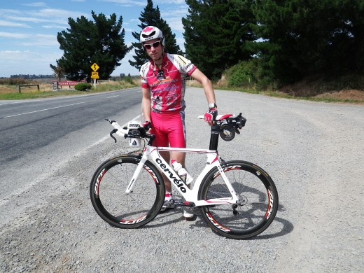
Road Biking 21:00 [2]
Quick ride around Hagley Park with 'Bent to make sure Princess was assembled properly after the flight. I tested the tri bars for the first time off the trainer. I feel OK when I'm in them but I'm a little wobbly moving on and off them - something I need to do smoothly since I don't have brakes on the tri bars. It'll take practice.
12 PM
Road Biking 1:39:21 [4] 43.9 km (26.5 kph) +53m
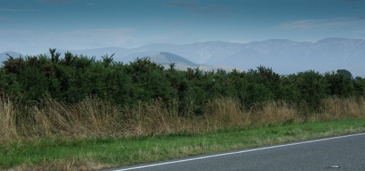
The phone rang at 6 a.m. to advise us that the Waimakariri River was too high to paddle today. It would not be good to paddle it for the first time in the race so my fingers are tightly crossed that the heavy rainfall warnings and severe gale warnings will stop. I'm not sure if the huge cyclone in Australia is affecting us here but this unstable weather is apparently quite unusual for February.
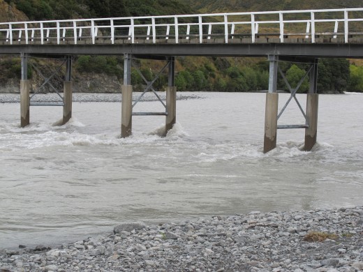
Our Plan B was a bike ride starting at the Gorge Bridge, which is where we start the final 70 km bike section after 67 km of paddling on the Waimak. The time cut-off here is 8:15 p.m. which means that if I make it to this point, I will be riding into Christchurch in the dark. The roads are open to traffic and about a third of the ride passes through the city so it isn't the part of the race that appeals to me most!
'Bent had borrowed a recumbent road bike from a friendly guy he'd heard about online.

Frankenjack looked very professional and speedy, of course.
He set off in the lead with the plan of doing the whole 70 km. I wanted to drive the route through Christchurch but had no interest in riding the city streets outside the race. Once will be enough.

So 'Bent and I planned to ride to Yaldhurst just inside Christchurch city limits, then Chris and Nelvia would pick us up and continue to Sumner Beach where we would meet Frankenjack.
This ride is a gentle downhill to the sea but - as warned by Getawaystix - we ran into killer headwinds and crosswinds, so we worked our butts off the entire time. I used the tri bars on and off for the first 7-8 km then gave up because I was being buffeted by gusts of wind and needed to hang on tight to Princess.
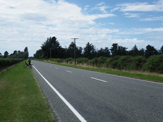
Most of our ride was on a relatively narrow 2-lane paved highway with a speed limit of 100 kph. Traffic was light at first but we were being passed constantly near the end. One truck with trailer whizzed by so close that I went off the road and used some foul language.
On a scale of 1 to 10 where 10 is a good day of mountain biking and 1 is a trainer ride (sometimes a 2 if Jon Stewart's interview is particularly insightful), I'd give today's ride a 2. As I rode along with the speeding trucks, I was thinking about the skills I had to beef up for C2C. Training whitewater paddling made me want to do more of it but road bike training made me want to do more mountain biking! I know I'm lucky to be in NZ and lucky to be able to ride a bike, etc., etc. But my bike *is* named Princess and I just feel like whining a little... OK, I'm done.
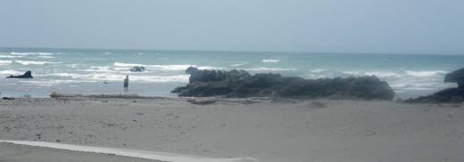
We drove the route to Sumner Beach with C&N, following the race maps closely and watching for landmarks, bike lane locations, railroad tracks, nervewracking roundabouts, etc. C&N were awesome at pointing out useful details. Assuming I get to this point on the race course, I should be able to find my way to the finish line, no problem. Sumner Beach is beautiful although there are big signs with the warning, "Polluted Water - Avoid Contact". I don't care - if I make it all the way from coast to coast, I *will* be dipping my toe in the ocean.

Our Plan B was a bike ride starting at the Gorge Bridge, which is where we start the final 70 km bike section after 67 km of paddling on the Waimak. The time cut-off here is 8:15 p.m. which means that if I make it to this point, I will be riding into Christchurch in the dark. The roads are open to traffic and about a third of the ride passes through the city so it isn't the part of the race that appeals to me most!
'Bent had borrowed a recumbent road bike from a friendly guy he'd heard about online.
Frankenjack looked very professional and speedy, of course.
He set off in the lead with the plan of doing the whole 70 km. I wanted to drive the route through Christchurch but had no interest in riding the city streets outside the race. Once will be enough.
So 'Bent and I planned to ride to Yaldhurst just inside Christchurch city limits, then Chris and Nelvia would pick us up and continue to Sumner Beach where we would meet Frankenjack.
This ride is a gentle downhill to the sea but - as warned by Getawaystix - we ran into killer headwinds and crosswinds, so we worked our butts off the entire time. I used the tri bars on and off for the first 7-8 km then gave up because I was being buffeted by gusts of wind and needed to hang on tight to Princess.
Most of our ride was on a relatively narrow 2-lane paved highway with a speed limit of 100 kph. Traffic was light at first but we were being passed constantly near the end. One truck with trailer whizzed by so close that I went off the road and used some foul language.
On a scale of 1 to 10 where 10 is a good day of mountain biking and 1 is a trainer ride (sometimes a 2 if Jon Stewart's interview is particularly insightful), I'd give today's ride a 2. As I rode along with the speeding trucks, I was thinking about the skills I had to beef up for C2C. Training whitewater paddling made me want to do more of it but road bike training made me want to do more mountain biking! I know I'm lucky to be in NZ and lucky to be able to ride a bike, etc., etc. But my bike *is* named Princess and I just feel like whining a little... OK, I'm done.
We drove the route to Sumner Beach with C&N, following the race maps closely and watching for landmarks, bike lane locations, railroad tracks, nervewracking roundabouts, etc. C&N were awesome at pointing out useful details. Assuming I get to this point on the race course, I should be able to find my way to the finish line, no problem. Sumner Beach is beautiful although there are big signs with the warning, "Polluted Water - Avoid Contact". I don't care - if I make it all the way from coast to coast, I *will* be dipping my toe in the ocean.
Wednesday Feb 2, 2011 #
Paddling (Kayak) 50:00 [2]
Frankenjack picked up his loaner kayak this morning so we went to a beach in Lyttelton to test our new boats on the South Pacific. (!!) Our whole crew came along to carry gear and take photos in case we did anything silly.

Frankenjack's boat belongs to a woman who has painted huge pink stars and put the name "Mary" on her kayak deck. The rudder is hot pink. A guy really has to be secure in his masculinity to paddle this boat in public.

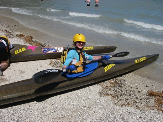
My JKK Eclipse 5.2 is challenging to climb into because of its small cockpit but once I got in, it wasn't as unstable as I'd expected.

The beach was crowded so the first thing we did was paddle through some rough, disorganized, 1 meter surf to get to a quieter beach where we could get a feel for our boats in calmer water.


I leaned back and forth to test the stability of my kayak and practised my low braces. Frankenjack worked on his roll. Then we went back out into the choppy water for awhile. No photos of the waves for obvious reasons!


I didn't tip while paddling today and didn't have any close calls, other than when I was getting into the boat at the beach. After awhile, I started purposely hitting waves at bad angles to see how the boat would respond. This is the kind of rough water I'm accustomed to from sea kayaking so I'd expect it to feel easier than going through rapids. It will be interesting to see how this long boat behaves when part of it crosses an eddy line and the rest of it doesn't. I used to think whitewater playboats were too cramped but I will be missing H's boat when I get onto the Waimakariri River!
This kayak has a relatively roomy cockpit even though the opening is small. There isn't a good way to wedge my knees along the sides of the boat so I can control the side-to-side motion so we're going to pick up some foam tomorrow to make some knee braces. Frankenjack wants to do some boat customization too.
In the town of Lyttelton, we were reminded of absent friends.

We're booked to do the guided paddle down the Waimak. tomorrow if the weather holds. I'm nervous but can't wait to see what it's like and find out how I'm going to manage in Class 2 in a long, tippy boat. I'm *hoping* it will be a confidence building experience...?
Frankenjack's boat belongs to a woman who has painted huge pink stars and put the name "Mary" on her kayak deck. The rudder is hot pink. A guy really has to be secure in his masculinity to paddle this boat in public.
My JKK Eclipse 5.2 is challenging to climb into because of its small cockpit but once I got in, it wasn't as unstable as I'd expected.
The beach was crowded so the first thing we did was paddle through some rough, disorganized, 1 meter surf to get to a quieter beach where we could get a feel for our boats in calmer water.
I leaned back and forth to test the stability of my kayak and practised my low braces. Frankenjack worked on his roll. Then we went back out into the choppy water for awhile. No photos of the waves for obvious reasons!
I didn't tip while paddling today and didn't have any close calls, other than when I was getting into the boat at the beach. After awhile, I started purposely hitting waves at bad angles to see how the boat would respond. This is the kind of rough water I'm accustomed to from sea kayaking so I'd expect it to feel easier than going through rapids. It will be interesting to see how this long boat behaves when part of it crosses an eddy line and the rest of it doesn't. I used to think whitewater playboats were too cramped but I will be missing H's boat when I get onto the Waimakariri River!
This kayak has a relatively roomy cockpit even though the opening is small. There isn't a good way to wedge my knees along the sides of the boat so I can control the side-to-side motion so we're going to pick up some foam tomorrow to make some knee braces. Frankenjack wants to do some boat customization too.
In the town of Lyttelton, we were reminded of absent friends.
We're booked to do the guided paddle down the Waimak. tomorrow if the weather holds. I'm nervous but can't wait to see what it's like and find out how I'm going to manage in Class 2 in a long, tippy boat. I'm *hoping* it will be a confidence building experience...?
Tuesday Feb 1, 2011 #
Running 1:30:00 [2]
This covers the portion of the Deception/Mingha route that I ran (slowly) but I've logged the full distance and GPS track with the trek portion.
10 AM
Trekking (time deducted for stops) 5:45:00 [2] 28.1 km (12:17 / km) +1014m 10:24 / km
shoes: Salomon XA Pro Tomato 3
We headed back to Arthur's Pass to hike/jog the Deception/Mingha route, which makes up all but 6 km of the C2C mountain run leg.
Today we were travelling in the footsteps of Richard and Elina Ussher. I'm not saying that in the metaphorical sense. The Usshers started up the Deception Valley shortly before we did and we occasionally saw their footprints in the sand. Cool!
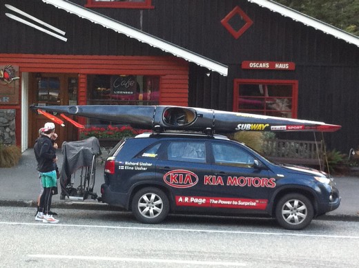
We met their support vehicle in Arthur's Pass and Jack headed right over to see if he could extract any secrets from the competition. We were curious about why their driver was putting a blanket on their bikes while he went for coffee. Turns out it prevents keas (parrots) from eating the seats! The Usshers are doing both the mountain run and kayak paddle legs today. Elina's kayak (other side of the truck) is hot pink - love it!
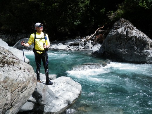
We'd been told that the rivers were running a little high today but we should be able to get over the pass - unlike yesterday when it was considered to be unsafe. We started by crossing the Otira River which runs west from Arthur's Pass to the Tasman Sea. The Deception River runs into it here. All five of us linked arms but this was still a tough crossing.

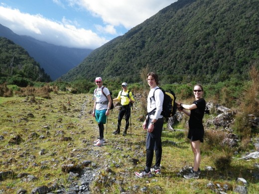
I'll pause here to introduce the cast of characters since I know some new people are reading my AP blog to learn about Coast to Coast. Many of you know Jack VD, aka Frankenjack, the winner of GUATS Logs Rocks and Steel. He wore the "King of the Mountains" polka dot cap he earned by climbing K2 the fastest a couple of weeks ago. (That's the K2 in Hamilton, not the one in Pakistan.) Today he was aiming to be first up Goat Pass - and he was.

Jack's big sister N.and her husband Hodgepodge have generously come to NZ to support Jack and me in Coast to Coast.

My husband Richard Ehrlich wouldn't miss this for the world.
Those of you who know me won't be surprised to learn that I carried a copy of our route and read it as we went.
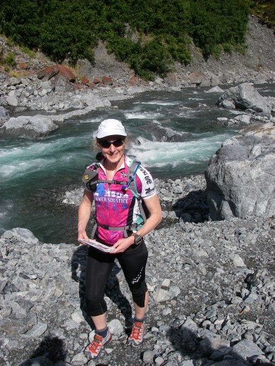
But you might be surprised that I was reading a C2C guidebook where the map played only a minor role. The route up the Deception involves a lot of river crossings, rock scrambling and small sections of trail. Local knowledge can save you a lot of time. This remarkable race guidebook includes detailed photos and shows you exactly where to go, occasionally showing "low river" and "high river" options. If you're interested, click on the photo below then click on the magnifying glass to see the amount of detail in the book. It is incredible.

However, it isn't 100% accurate because the river has been flooding recently. In fact, people were kayaking on Arthur's Pass a couple of weeks ago. On the highway, not in a river!
http://www.stuff.co.nz/the-press/news/4499866/Floo...
OK, back to our trip up the Deception Valley.

Jack remembered much of the route from last year and shared lots of good info with me.
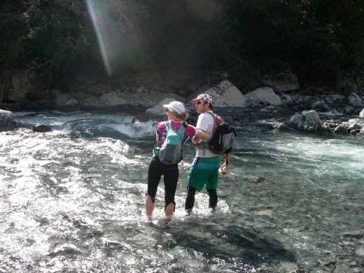
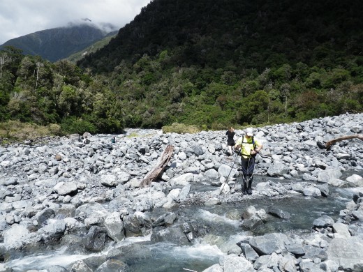
We did about 25 river crossings and some of them were thigh-deep - not the sort of thing I'd usually try alone. The first few were the hardest and we did them together. Nelvia is only 5'2" so the river was a lot deeper on her.
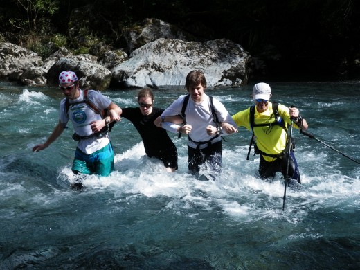
This was the first time I've thought about river crossings as being another way of doing whitewater. I'd look for eddies behind rocks where I could take a break partway across.

As the tallest member of our crew, Jack loved the crossings.
But even *he* looked a little concerned when the rushing river got waist deep at one point.
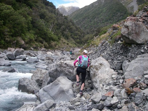
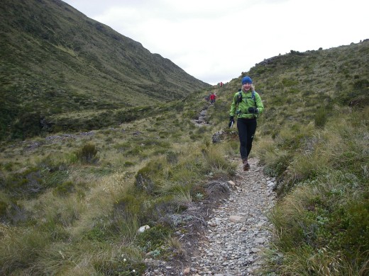
When we weren't busy trying to avoid a swim, we enjoyed the fantastic scenery.
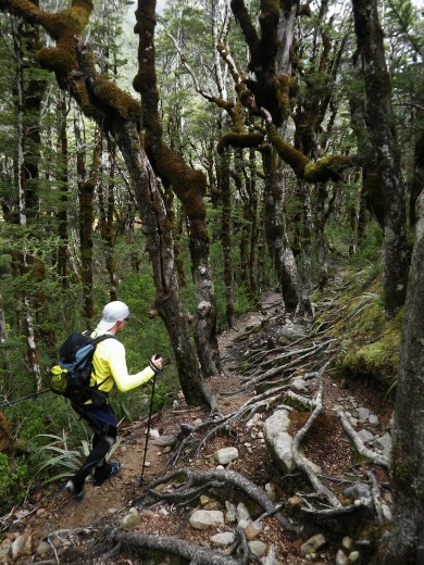
In between sections of the route that went in or along the river, there were pieces of trail of varying quality. Some trail was heavily overgrown and barely visible. This was a really good one.
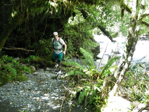
Much of the footing in the first 8 km was like this - medium-sized rocks. Jack coached us to invest an additional 10-15% effort to step up on top of the rocks to get a 40% increase in speed. His other good advice was to look 3-4 steps ahead and modify what you're doing to prepare for what's coming up.
The rocks got bigger as we went up the valley.
The views got more and more spectacular.


We kept on crossing the river back and forth, usually because it got too steep on the side we were on.


There were a few good sections for running.


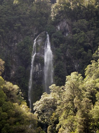
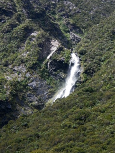
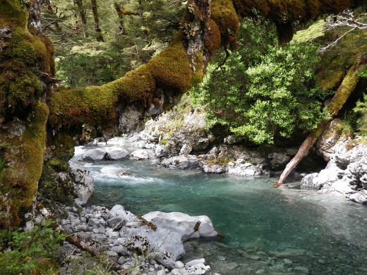
The scenery along the trails was rain forest gorgeous.

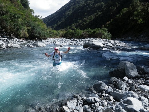
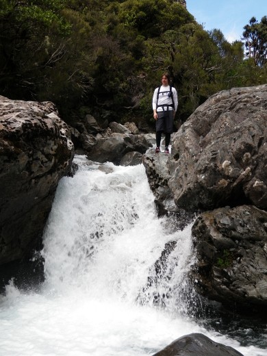
The river got much narrower as we moved further up the valley. Although there was less flow, we still had to deal with some impressive rapids and big drops.


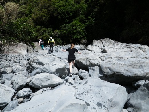
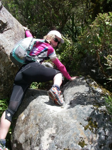
There is a section called The Boulders where we did some scrambling.

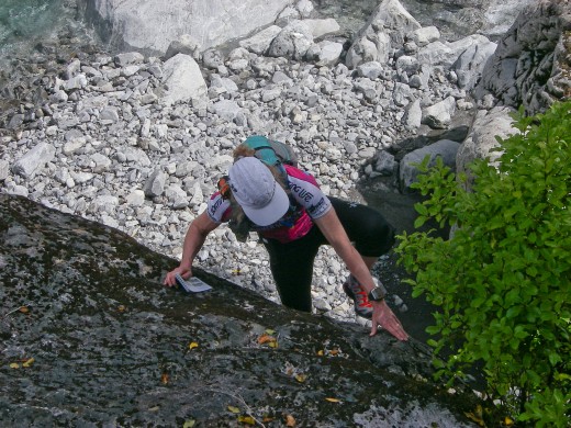
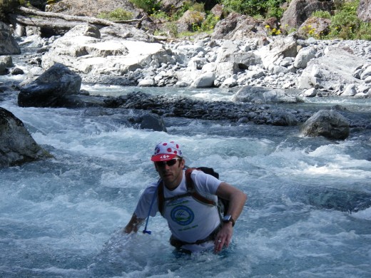
Does this cliff make my butt look big?
By this point, the trail sections were all quite rough.

But it was really pretty.

We crossed a few scree slopes.

For the last part of the climb, we left the Deception River to climb up Goat Creek - mostly travelling right in the creek!


At last we made it up to Goat Pass and ducked into the hut for a quick lunch. It was cold and we were wet. I put on a few toasty layers and we didn't stay long.


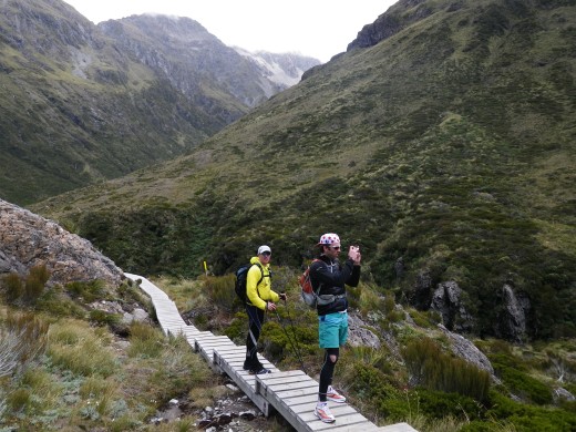
The first part of the descent down the Mingha River Valley should be easy because of the boardwalks.
However, it's not so good if you turn around to see where your friends are, then slip off the boardwalk and smash your good knee really hard on the wood. I'm just sayin'. Luckily, there were lots of creeks where I could ice it.
There were some good stretches of trail at first. In the race, I'm going to have to push as hard as I can whenever I hit a trail like this, because there are other sections where it will be difficult to do more than power walk.

The Mingha Valley has a different feel and different vegetation.


The easy trail doesn't last. The path gets rougher and there is a final knob to climb in addition to a number of steep creek gullies to descend/ascend.


There are only a few river crossings on the Mingha - much easier navigation here. Naturally, since things were a little easier, I slacked off and managed to smash both my knees - even twisted an ankle.
We followed the Mingha River down until it met the Bealey River. In the race, there were be 3 additional km of running along rocky river flats including two more crossings of the Bealey.

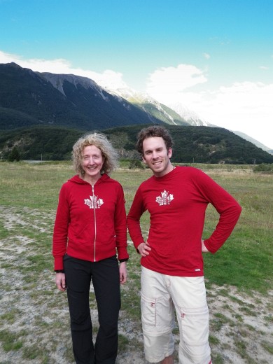
Because we stopped our trek short of the run finish at Klondyke Corner, we drove over there on our way back. Jack and I were rocking our new GUATS wear.
What a great day! Jack and I hope to go back to do this section as a run while somehow (?!) staying within range of one another. Once that's happened, I'll officially declare this to be the most technical run I've ever done. My target time for this leg in order to make later cut-offs is 5 hours. In addition to what we did today, the race day route will include 6 km through farmers' fields and along rocky river flats. It's going to be really, really tough to do the run fast enough to finish the race.
Today we were travelling in the footsteps of Richard and Elina Ussher. I'm not saying that in the metaphorical sense. The Usshers started up the Deception Valley shortly before we did and we occasionally saw their footprints in the sand. Cool!
We met their support vehicle in Arthur's Pass and Jack headed right over to see if he could extract any secrets from the competition. We were curious about why their driver was putting a blanket on their bikes while he went for coffee. Turns out it prevents keas (parrots) from eating the seats! The Usshers are doing both the mountain run and kayak paddle legs today. Elina's kayak (other side of the truck) is hot pink - love it!
We'd been told that the rivers were running a little high today but we should be able to get over the pass - unlike yesterday when it was considered to be unsafe. We started by crossing the Otira River which runs west from Arthur's Pass to the Tasman Sea. The Deception River runs into it here. All five of us linked arms but this was still a tough crossing.
I'll pause here to introduce the cast of characters since I know some new people are reading my AP blog to learn about Coast to Coast. Many of you know Jack VD, aka Frankenjack, the winner of GUATS Logs Rocks and Steel. He wore the "King of the Mountains" polka dot cap he earned by climbing K2 the fastest a couple of weeks ago. (That's the K2 in Hamilton, not the one in Pakistan.) Today he was aiming to be first up Goat Pass - and he was.
Jack's big sister N.and her husband Hodgepodge have generously come to NZ to support Jack and me in Coast to Coast.
My husband Richard Ehrlich wouldn't miss this for the world.
Those of you who know me won't be surprised to learn that I carried a copy of our route and read it as we went.
But you might be surprised that I was reading a C2C guidebook where the map played only a minor role. The route up the Deception involves a lot of river crossings, rock scrambling and small sections of trail. Local knowledge can save you a lot of time. This remarkable race guidebook includes detailed photos and shows you exactly where to go, occasionally showing "low river" and "high river" options. If you're interested, click on the photo below then click on the magnifying glass to see the amount of detail in the book. It is incredible.
However, it isn't 100% accurate because the river has been flooding recently. In fact, people were kayaking on Arthur's Pass a couple of weeks ago. On the highway, not in a river!
http://www.stuff.co.nz/the-press/news/4499866/Floo...
OK, back to our trip up the Deception Valley.
Jack remembered much of the route from last year and shared lots of good info with me.
We did about 25 river crossings and some of them were thigh-deep - not the sort of thing I'd usually try alone. The first few were the hardest and we did them together. Nelvia is only 5'2" so the river was a lot deeper on her.
This was the first time I've thought about river crossings as being another way of doing whitewater. I'd look for eddies behind rocks where I could take a break partway across.
As the tallest member of our crew, Jack loved the crossings.
But even *he* looked a little concerned when the rushing river got waist deep at one point.
When we weren't busy trying to avoid a swim, we enjoyed the fantastic scenery.
In between sections of the route that went in or along the river, there were pieces of trail of varying quality. Some trail was heavily overgrown and barely visible. This was a really good one.
Much of the footing in the first 8 km was like this - medium-sized rocks. Jack coached us to invest an additional 10-15% effort to step up on top of the rocks to get a 40% increase in speed. His other good advice was to look 3-4 steps ahead and modify what you're doing to prepare for what's coming up.
The rocks got bigger as we went up the valley.
The views got more and more spectacular.
We kept on crossing the river back and forth, usually because it got too steep on the side we were on.
There were a few good sections for running.
The scenery along the trails was rain forest gorgeous.
The river got much narrower as we moved further up the valley. Although there was less flow, we still had to deal with some impressive rapids and big drops.
There is a section called The Boulders where we did some scrambling.
Does this cliff make my butt look big?
By this point, the trail sections were all quite rough.
But it was really pretty.
We crossed a few scree slopes.
For the last part of the climb, we left the Deception River to climb up Goat Creek - mostly travelling right in the creek!
At last we made it up to Goat Pass and ducked into the hut for a quick lunch. It was cold and we were wet. I put on a few toasty layers and we didn't stay long.
The first part of the descent down the Mingha River Valley should be easy because of the boardwalks.
However, it's not so good if you turn around to see where your friends are, then slip off the boardwalk and smash your good knee really hard on the wood. I'm just sayin'. Luckily, there were lots of creeks where I could ice it.
There were some good stretches of trail at first. In the race, I'm going to have to push as hard as I can whenever I hit a trail like this, because there are other sections where it will be difficult to do more than power walk.
The Mingha Valley has a different feel and different vegetation.
The easy trail doesn't last. The path gets rougher and there is a final knob to climb in addition to a number of steep creek gullies to descend/ascend.
There are only a few river crossings on the Mingha - much easier navigation here. Naturally, since things were a little easier, I slacked off and managed to smash both my knees - even twisted an ankle.
We followed the Mingha River down until it met the Bealey River. In the race, there were be 3 additional km of running along rocky river flats including two more crossings of the Bealey.
Because we stopped our trek short of the run finish at Klondyke Corner, we drove over there on our way back. Jack and I were rocking our new GUATS wear.
What a great day! Jack and I hope to go back to do this section as a run while somehow (?!) staying within range of one another. Once that's happened, I'll officially declare this to be the most technical run I've ever done. My target time for this leg in order to make later cut-offs is 5 hours. In addition to what we did today, the race day route will include 6 km through farmers' fields and along rocky river flats. It's going to be really, really tough to do the run fast enough to finish the race.
4 PM
Note
Hiking/running the Deception/Mingha route today (mountain run in C2C). See Jan. 20 log entry for SPOT link - I'm testing it today so you should be able to see us go.
[ Later: Yes, it worked. I was on my iPhone before and didn't have time to post the link. Lots of photos to come but I need to zzzzzzz!
http://share.findmespot.com/shared/faces/viewspots... ]
P.S. My new kayak paddle and Salomon pack were found at the hotel in Arthur's Pass and they're here with us now. It's very rare that I hug a strange man! (The hotel manager.)
Monday Jan 31, 2011 #
Note
Finally got my laptop on the Internet. Photos and reports have been posted from Fri. Jan. 28 to today.
7 AM
Strength & Mobility (Legs) 15:00 [2]
Didn't feel like getting my gear wet in the lashing rain this morning after drying it out overnight so I skipped running and did some of my leg strength routine before we left Arthur's Pass.
4 PM
Note
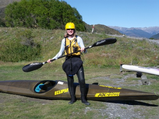
We picked up my kayak today - a JKK Eclipse 5.2. It's a demo model that I bought directly from JKK - Jans Kees Kirpensteijn, the guy who builds them. That's him standing with me beside my new boat. It's narrow enough that I just fit into it widthwise but I've got a fair amount of leg room.

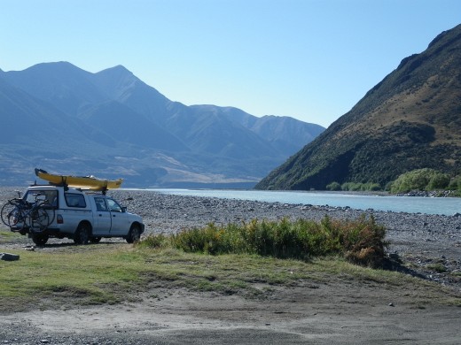
We met a couple of people today who are doing C2C in plastic sea kayaks. When they heard which boat I was getting, they thought I was "very brave". They were wrong. Earlier today, we visited the race put-in point on the Waimakariri River. When I saw how silty and high the river was after the rain, I did not feel brave at all.
There were a couple of guys there who had done C2C before. They had kayaks tied to their vehicle but after seeing the river today, they were going to go running instead. However, they said that the race would still be held if the water was at this level.
Kayaking may be more difficult than expected. We discovered tonight that the big box containing my Salomon vest pack and fancy new kayak paddle didn't make it into the van at Arthur's Pass. The hotel room was empty so it must have gone outdoors as we cleared out. I was inside the hotel paying the bill so I didn't see the final gear go into the van. The box had previously been in my duffel bag so it probably wasn't recognized as belonging to us. I called the hotel and they don't know anything about it. Crap.
5 PM
Running (Trail) 21:00 [3] 3.8 km (5:32 / km)
shoes: Salomon XA Pro Tomato 3
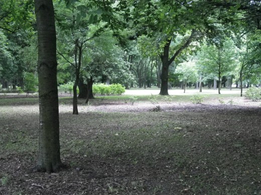
We've rented a townhouse in Christchurch across from Hagley Park, a huge green area just west of downtown. 'Bent and I went for a quick run before dinner to check out the trails. It's flat but there are dirt trails beside the paved trails and the park is full of fantastic, huge old trees. It's going to be nice to head out here on foot and bike.
'Bent and I both ran so fast that the camera couldn't focus. Even the trees behind us are blurry.


'Bent and I both ran so fast that the camera couldn't focus. Even the trees behind us are blurry.