Training Log Archive: SandyIn the 31 days ending Oct 31, 2018:
| |||||||||||||||||||||||||||||||||||||||||||||||||||||||||||||||||||||||||||||||||||||||||||||||||||||||||
| « | » |
| » now | |||||||||||||||||||||||||||||||||||||||||||||||||||
| Mo | Tu | We | Th | Fr | Sa | Su | Mo | Tu | We | Th | Fr | Sa | Su | Mo | Tu | We | Th | Fr | Sa | Su | Mo | Tu | We | Th | Fr | Sa | Su | Mo | Tu | We | ||||||||||||||||||||||||
Wednesday Oct 31, 2018 #
Note
hiking 1:44:32 [3] 4.23 mi (24:43 / mi) +157m 22:09 / mi
Tuesday Oct 30, 2018 #
Note
cardio 35:00 [3]
strength & stretching 15:00 [3]
Monday Oct 29, 2018 #
trail 47:42 [3] 2.9 mi (16:27 / mi) +89m 15:01 / mi
Sunday Oct 28, 2018 #
hiking 3:09:59 [3] 8.22 mi (23:07 / mi) +295m 20:48 / mi
I'm going to be doing some day hiking in Patagonia over Christmas so need to keep those hiking muscles in shape!
Saturday Oct 27, 2018 #
strength & stretching 40:00 [3]
Have not felt motivated to orienteer so did not make plans to go to Harriman or to the Stumble. Hopefully, I will get back to wanting to orienteer soon.
Thursday Oct 25, 2018 #
cardio 8:00 [3]
strength & stretching 30:00 [3]
Wednesday Oct 24, 2018 #
hiking 55:00 [3] 2.94 mi (18:43 / mi) +91m 17:05 / mi
Tuesday Oct 23, 2018 #
cardio 25:00 [3]
strength & stretching 30:00 [3]
Monday Oct 22, 2018 #
hiking 1:45:44 [3] 4.97 mi (21:17 / mi) +209m 18:49 / mi
I wonder if stretching would make a difference.
Sunday Oct 21, 2018 #
walk/jog 56:08 [3] 3.19 mi (17:36 / mi) +105m 15:58 / mi
Friday Oct 19, 2018 #
hiking 59:07 [3] 3.04 mi (19:27 / mi) +86m 17:52 / mi
Wednesday Oct 17, 2018 #
hiking 52:03 [3] 2.89 mi (18:01 / mi) +88m 16:28 / mi
Sunday Oct 14, 2018 #
Note
Note
Saturday Oct 13, 2018 #
Note
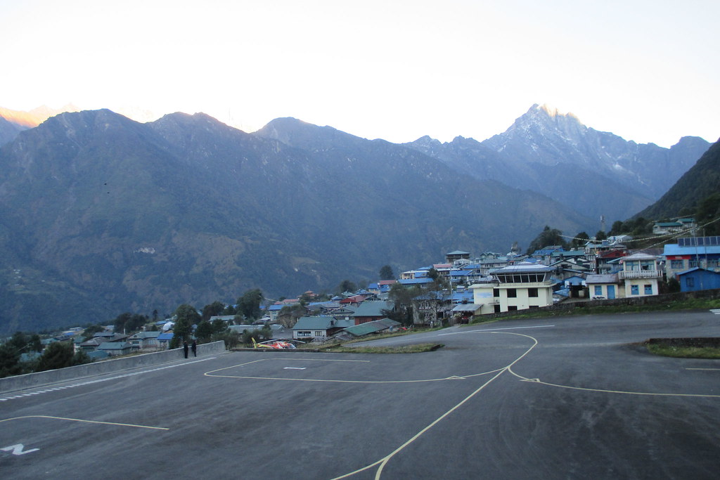
We were scheduled on the first planes out of Lukla back to Kathmandu. The airport at Lukla is a total trip. The runway is on an angle (I'll try to add pictures soon) and planes would land and people and luggage would come off the plane and then people and luggage would be put on the plane and the plane would take off. The planes held 16 people I think, so very small planes. And they would try to turn them over as quickly as possible - land, unload, load, take off - all day long as long as the weather held. We were probably on the 5th and 6th planes that day but the first two of the particular airline we were using. The airport was crazy busy and you felt like there was no organization but it all worked and eventually we and our luggage got on a plane and took off. The runway goes downhill and we only left the runway with a very little bit left. A little bit spooky but I figured they did this all the time so nothing to worry about.
It was sad to leave the Khumbu valley and head back to Kathmandu. Many of the Sherpas were going to be on another WWT tour that was starting in a few days so they were just hanging around in Lukla; others went back to their village which was a day's hike (for them - 2 or 3 for me) from Lukla. Many of the Sherpas winter in Kathmandu going to college but work on treks during the spring and fall.
Got back to Kathmandu and checked into the Hyatt which seemed like a paradise. It was walled off from the surrounding neighborhoods and manned by guards so very much a place separate from anything else in Kathmandu. I confess that I took a hot shower and felt clean for the first time in weeks, rested a bit and took a bath, rested a bit more and then took another hot shower just because I could. Very decadent of me I know but I just didn't want to venture out into the city for shopping or sight seeing. I had kind of had enough.
I'm planning to add a bunch of pictures in the next few days and try to capture more of what it was like. In looking back now, I can't really remember how uncomfortable and cold and tired I was, I only remember the feeling of accomplishment when I finally got to base camp. I know it was hard because that's what I was writing in my journal each evening, but all I remember now is the spectacular scenery and the completely different way of life of the people in the Khumbu.
I wasn't nearly as well trained as I could have been for this trek; I really should have trained a lot harder. But I guess I trained hard enough to succeed. Not everyone did - two people didn't make it to base camp and 2 people made it to base camp but helicoptered down the mountain afterwards and met us near the end. All of them were suffering from something to do with altitude so I guess I trained hard enough to avoid that. I think I would have enjoyed it more if I had been a little more fit. But maybe I don't have it in me to train any harder than I did. Don't know the answer to any of that and don't know if there are any other adventures that I want to go on that require the same kind of fitness. Guess I'll just have to see.
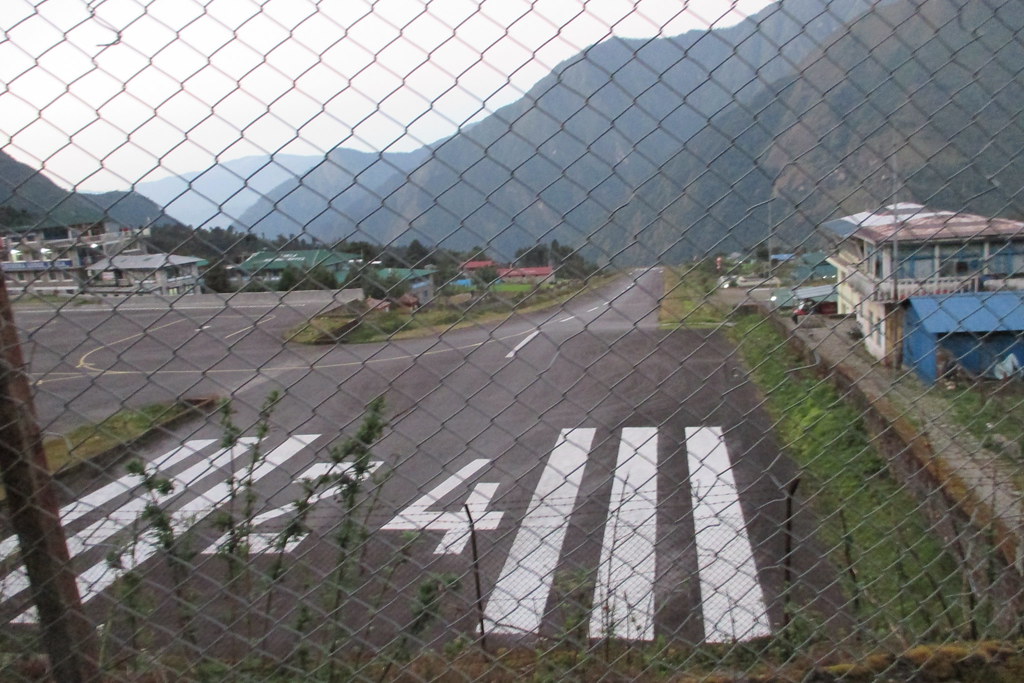
A view of the runway at the Lukla airport.
And a different view where you can see a little better how steep the runway is.
Friday Oct 12, 2018 #
Note
A relatively easy day with the downhills being somewhat benign. Ang Dawa helped me in the morning but by lunch it was clear I was fine and so I took back my pack and let him enjoy himself a bit. He was really a friendly guy and seemed to know every third person we passed and so I think he appreciated not having to keep track of where I was so much.
It was very interesting seeing all the people that had flown into Lukla that morning and were just starting out on their trek. They had no idea of the etiquette of the trail and were hogging it and not getting out of the way of the Sherpas with heavy loads or the yak trains. Many seemed completely unfit for the trail and I asked Paul, one of our guides, if some trekkers only intended to go to say Namche and not all the way to base camp. He didn't really know but agreed that many of the people we passed were not going to make it all the way regardless of whether they intended to or not.
We stayed at a really nice tea house in Lukla. They had electric blankets so no need for a sleeping bag! But the hot water (from solar panels) had already been used up by the time I tried to take a shower so I made do with just washing up in the sink. What was one more day of being grimy afterall.
Our relatively luxurious tea house in Lukla. Paul, the guy on the left leaning over, doing the room assignments and telling the Sherpas which bag to haul to which room. We were very well taken care of!
Thursday Oct 11, 2018 #
Note
This was an absolutely brutal day. There were two major downhills that seemed to go on forever. Ang Dawa helped me again carrying my pack for most of the day and helping me down the worst of the downhills. I was rocking any uphill we hit, but was painfully slow on the downhills.
I had my headlight in my daypack but made it to the tea house at Monjo just as it was starting to get dark so didn't need it - but it was close.
It was beautiful in places but all I could think about was keeping on going. Just a lot of mental effort to keep going and not get discouraged and not stop. It's hard to describe how hard this was in relation to the difficulties of the trek up the valley. On the way down, I was rarely breathing hard but I had to focus 100% so I didn't take a fall and it seemed like the downhills just went on forever. On the way up, I was breathing hard a lot of the time and at times it was just a slog and a mental battle to keep going. Two very different kinds of hard.
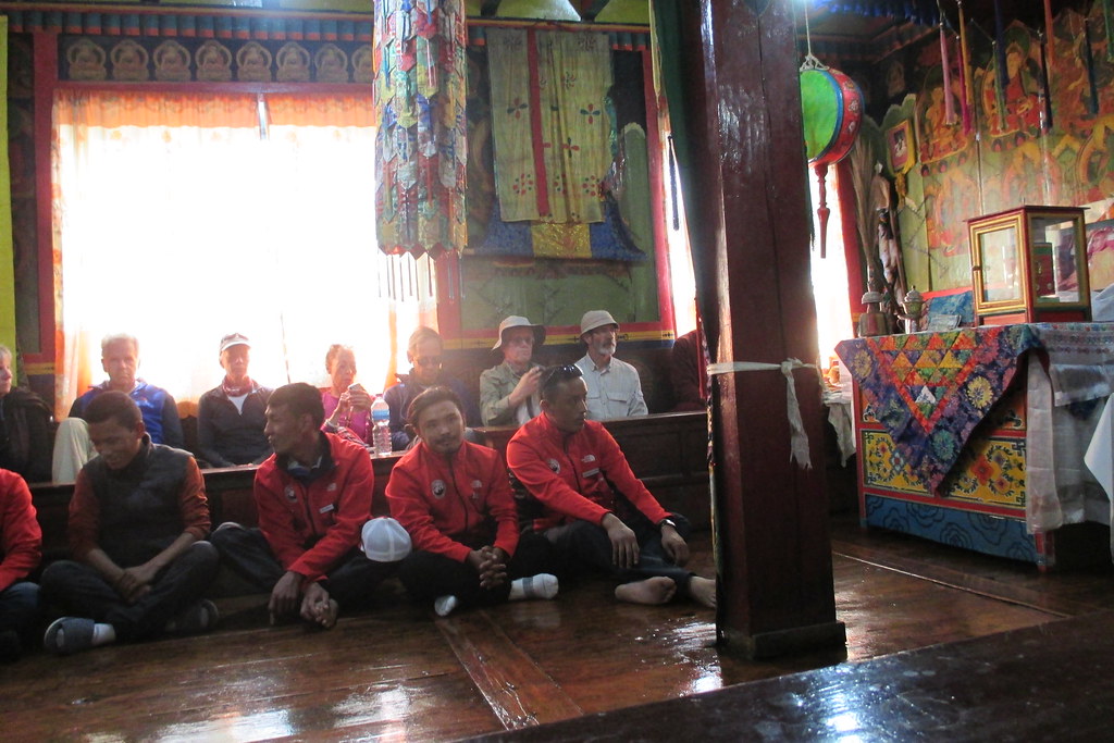
The Tengboche monastery.
A reasonably easy downhill section. You can see how quickly we got back in the forested area.
hiking 1:41:32 [3] 2.82 mi (36:00 / mi)
Wednesday Oct 10, 2018 #
map hiking 52:59 [3] 0.77 mi (1:08:49 / mi)
(Just a short bit of it - forgot to charge my watch and then didn't really care so much since it was just retracing the way in.)
Longish day with mostly downhills but nothing really bad. Took one bad fall, foot just slipped out from under me, but I landed on my pack so no big deal. It quickly became clear that I was a lot slower going down than I had been going up and so the guides were willing to do anything to help me keep moving. I only stopped when I felt like I needed to which meant I mostly kept going. So I would start out in the lead but then one by one everyone would pass me. And I had my eyes on my feet the whole time so not really appreciating the scenery as much on the way down.
Tuesday Oct 9, 2018 #
map hiking 54:46 [3] 0.82 mi (1:06:46 / mi) +24m 1:01:19 / mi
So Dean says unequivocally that all the Sherpas will be carrying day packs and that they want us to enjoy ourselves as much as possible. So Ang Dawa, one of the Sherpas, took my pack and I didn't need to feel guilty. Turns out he was one of the more experienced Sherpas and knew the ins and outs of the trail and several times took me on round about routes that might have been a little longer but avoided all sorts of ups and downs. And he quickly figured out what I could handle easily and what was difficullt for me (steep narrow downs) so he tried to help me avoid that. He was great and I totally put my trust in him. And he got me to Base Camp and it didn't seem to take much effort.
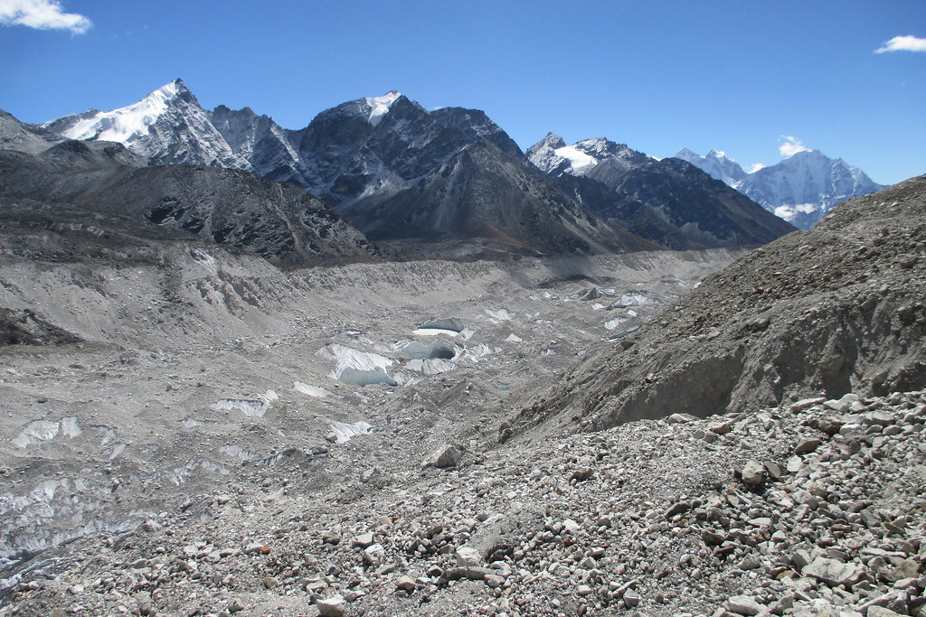
The final trek is kind of interesting since it's over some glaciers. There's a ridge line that has some great views that stays put, but the section before and after apparently shifts all the time. Got some glimpses of the very top of Everest on the way to base camp, but once at base camp it was hidden from view.
One of the decisions that WWT made was to stay overnight in Gorak Shep, get to base camp in the early morning and then hike out and down to Lobuche in the afternoon. This was a great way to do it since the weather in the morning is always the best. Also, it meant we had Base Camp pretty much to ourselves. We were lucky in that Lukla had been closed so that there were not a whole lot of other trekkers on our schedule. And most budget minded trekkers, hike to base camp from Lobuche getting there in the early afternoon. (We passed several groups on their was to base camp after we were already headed down.) There were two Russian dudes who had camped at base camp, but other than that there was no one else.
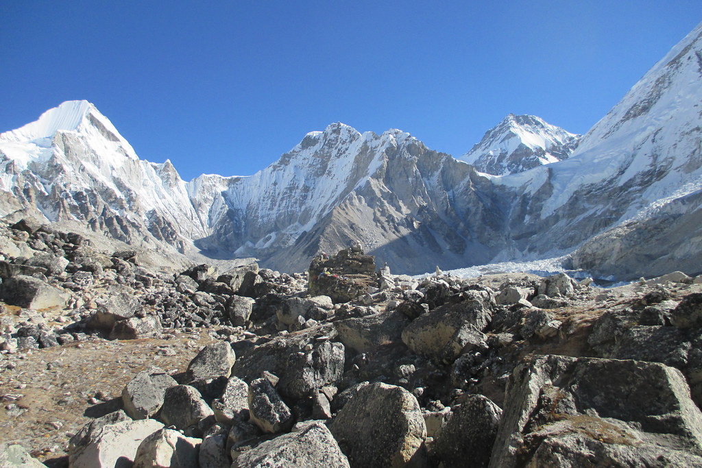
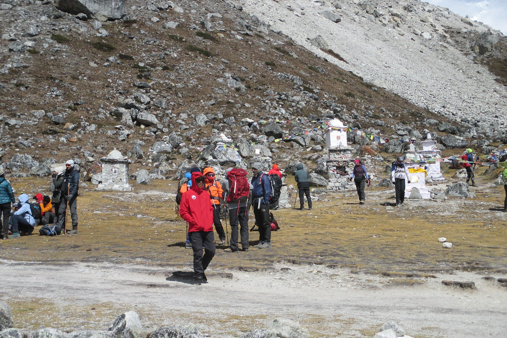
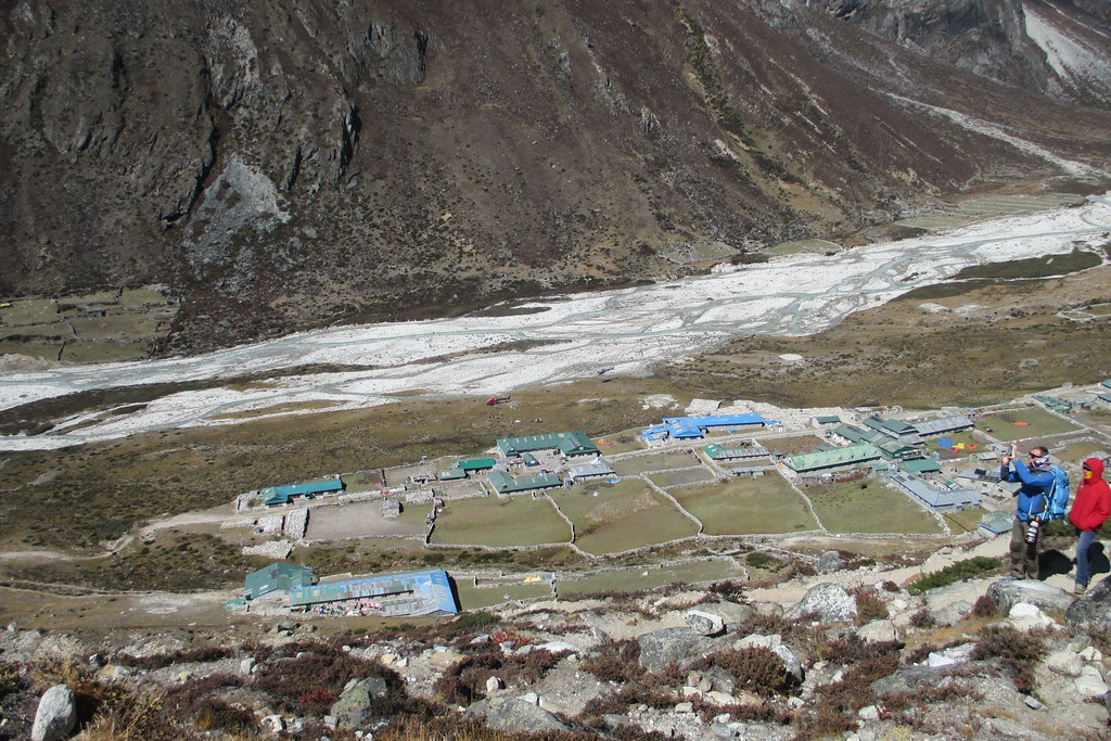
So base camp is really bizarre. There was no one there climbing so it was just an empty expanse of rocks. The rocks are continually moving as it's all over a glacier that is moving so from season to season it looks completely different. Apparently, many sherpas arrive a few weeks before the climbing season and dig out level spots for tents and the tents cover a huge expanse. But when we were there, there was nothing really to mark base camp other than a single stone, etched with Everest Base Camp 2018, on top of a big pile of stones with lots of prayer flags and scarves. So it was clear you were there, but there was nothing else around.
And the Khumbu Ice fall was off to the side, a little ways away from where we were - too far to want to go investigate. I was surprised at how steep it was; somehow in my mind I envisioned it as much flatter.
A couple in our group was celebrating their 20th anniversary - they actually signed up for the trip because the schedule had us getting to base camp on their anniversary. The Sherpas had planned a whole ceremony for them and it was so special. They burned some juniper that they had brought along and had some special tea and they had some rituals and draped the couple with the traditional scarves and sang some songs and it was just beautiful.
And then we took some group photos and the Sherpas did a Sherpa Dance and then it was time to go.
I didn't start my watch again for the trek out of base camp. it was about 3 hours to get to base camp but only 2 to get back to Gorak Shep where we had lunch and then another 3 hours or so to Lobuche. It was a reasonable hike out, not too steep and mostly downhill so easier on the lungs. A different Sherpa carried my pack after lunch - didn't really need them to but Dean was insisting so I said sure, why not.
On the trail to base camp.
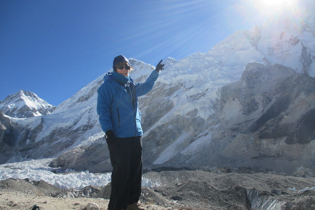
On the ridge with some views of the top of Everest. Ang Dawa told me to put my finger up and then he positioned himself so I was pointing at it. I thought it was going to be really corny but I kind of like it.

And then marker that says you've made it to base camp.
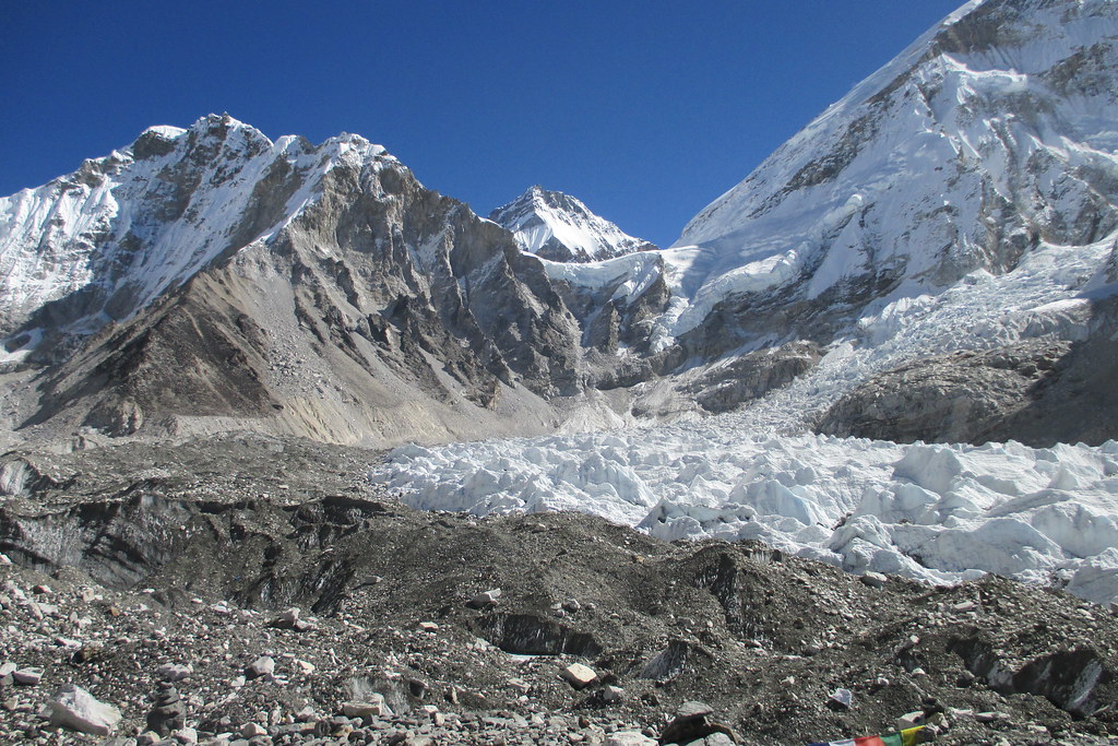
The Khumbu Icefall heading up the mountain.
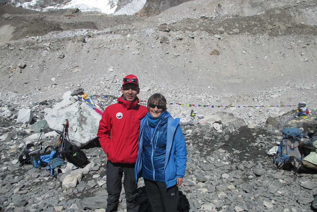
Me and Sherpa Ang Dawa who helped me up and then more importantly back down.
The ceremony down nefor the couple who was celebrating their 20th anniversary.
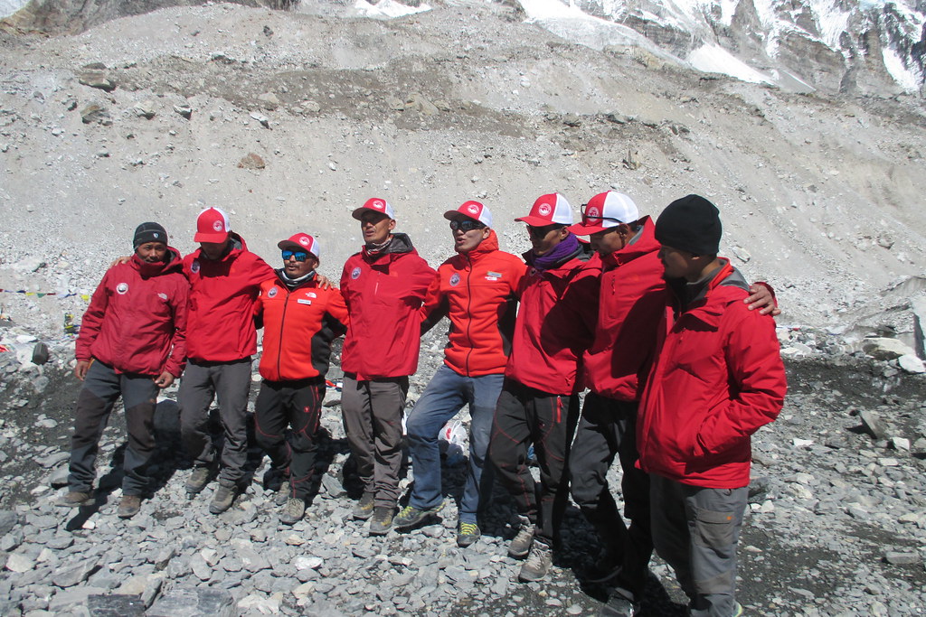
Our Sherpas doing their dance at base camp looking so spiffy in their red jackets and hats.
Monday Oct 8, 2018 #
map hiking 3:23:34 [3] 2.93 mi (1:09:29 / mi) +260m 54:28 / mi
Another stunning day with stunning scenery. Walked along a glacier for a while and then some serious ups and downs. About half way through the trek, we were going up a serious uphill and I was taking it slow and breathing hard and one of the Sherpas was waiting for me at one of the switchbacks and insisted on taking my daypack. I assume Dean (head guide) told him to do that and I had the good sense to say okay. Made the rest of the hike a little easier but it was still really, really difficult.
It's funny - I'm reading my journal and I wrote that it was a really hard day but I don't actually remember how hard it was. I remember how cold it was in the late afternoon and evening and I remember how beautiful it was in the morning when the sun would come out and light up all the mountains, but I don't remember how hard the hiking was. Guess I've managed to block that out. But I wrote "this is easily the hardest thing I've ever done. Today's hike was brutal" in my journal so I have to believe I was suffering. Glad I don't remember I guess.
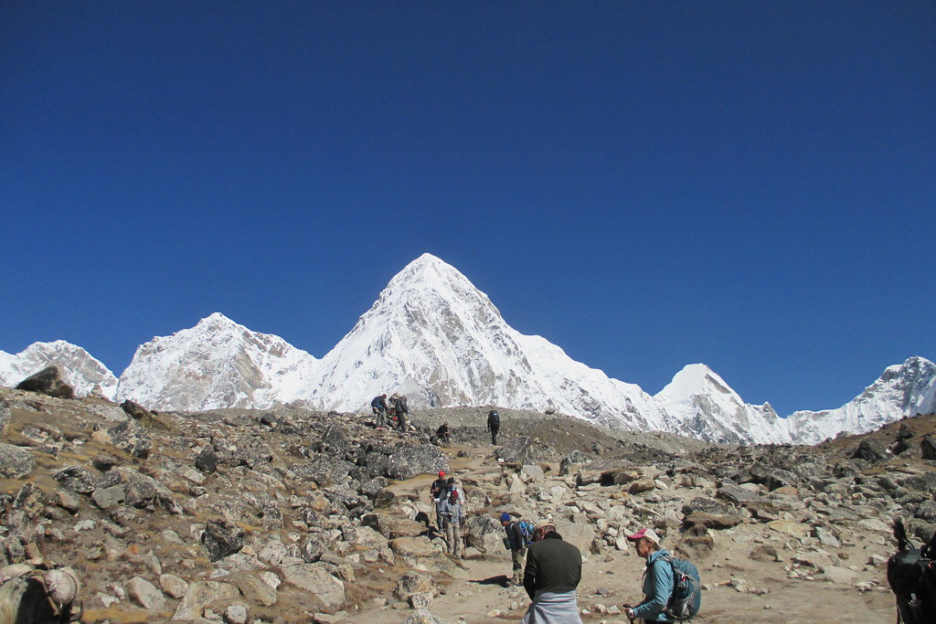
We got to the Gorak Shep tea house about noon. There was an optional hike up Kala Pattar and I opted to do a little bit of it. A few people - four in total - went all the way to the top but most of us turned around not too long into the climb. On a clear day there would have been great views of Everest, but like just about every day it was cloudy in the afternoon and so there were no views to be had.
While the tea house at Gorak Shep was easily the most basic and the rooms tiny, it was actually a little nicer than the one at Lobuche at least in terms of how warm it was. Lobuche sits in a valley and the cold air settles so Gorak Shep didn't seem all that bad in comparison. And the food was about the same as all the other tea houses so no real difference there. And my sleeping bag continued to be toasty warm. Funny, but for me it was way warmer if I had my socks off and just a thin shirt and no hat or gloves. Everyone else talked about sleeping in their jackets and hats and all their layers and for me that was way colder than with very little on. Did I mention how great my sleeping bag was?
Just a typical stunning view while trekking with the trail meandering up a small rise.
You can sort of see that the rocky stuff is all part of a glacier with some of the snow poking through in places.
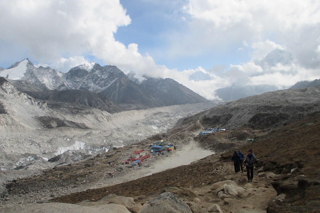
The view of Gorak Shep from up on Kala Pattar. There is a huge dry lake bed just visible which is where all the early climbs up Everest staged from.
Sunday Oct 7, 2018 #
map hiking 1:55:38 [3] 2.08 mi (55:36 / mi) +320m 37:36 / mi
Starting to really feel the altitude and hiking was just taking it out of me. The Sherpas kept asking if I wanted one of them to carry my day pack but I was stubborn and said no. But the last 15-20 minutes were really hard - just an overall feeling of tightness in my chest and it was impossible to take a deep breath. But I kept putting one foot in front of the other and eventually made it.
Nose started to get stuffed up as well - another high altitude symptom. Also, the air if very dry and the yaks and mules kick up lots of dust. The guides and Sherpas frequently have their buffs over their nose and mouth, but between fogging up my sun glasses and feeling like I couldn't get a deep breath I didn't manage to breathe through my buff very long. As a consequence have a bit of a sore throat. Hot water and honey has become my go to drink when we stop.
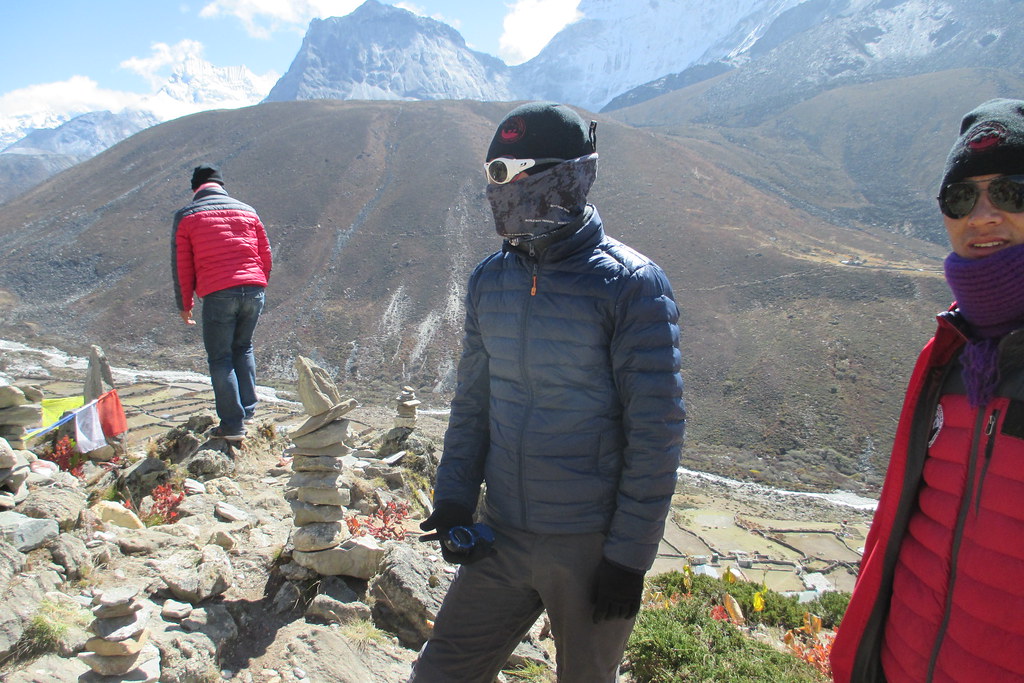
Pretty cold but stayed warm enough while hiking, taking off and putting on my hat, gloves and buff all day long.
This section is up in the tundra so very little green but beautiful, stark landscapes. We hiked next to a braided stream for most of the day with fantastic views of many of the big mountains all around.
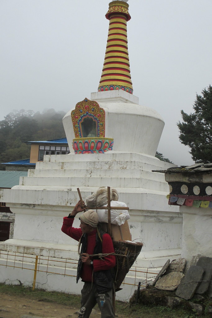
Midday we reached the Mani Stones, a really, really cool memorial site to Sherpas that have lost their lives. It was vast with stone towers and memorials all over the place. I think Mani Stones is a generic term for the stones that have the Buddhist mantra (Om mani padme hom) inscribed on them that are all along the whole trail and in all the monasteries, but this place was also called Mani Stones.
My knee brace locked up on me at one point during this hike. The braces I've had over the years do that and I know how to work it to unlock it but it usually means that it's on its way to not working any more. So this was very disconcerting, thinking that the brace might suddenly stop working at any moment. But there wasn't anything to do about it, so I just stuck with my live in moment and don't worry about what's in the future mindset and continued on. It locked up again and I fiddled again and it was fine again. And, in the how lucky can you be category, that was it. Never had any other problems.
Another really cold night but my sleeping bag continued to be like a furnace. Really thrilled with how warm it was. Broke out my big puffy winter jacket though to sit around in at dinner and to use at night when I had to nip down the hall to the bathroom. Another good decision in bringing that - not everyone had something that warm.
The start of another day of trekking. I had a plastic baggy tied over my bladder mouthpiece to try to keep it clean from all the yak dust and dung. It worked reasonably well.
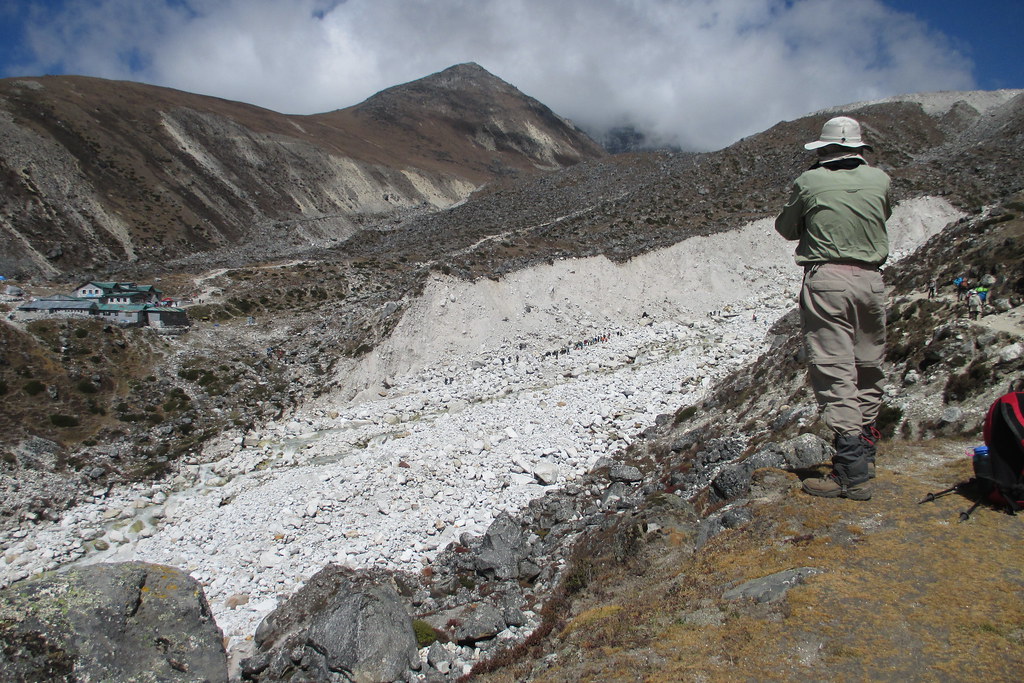
This is a tricky photo in terms of sense of scale. We had to cross over this glacial rock stuff (the white rocks) and if you look closely or zoom in you can see these tiny people are trekking down in those white rocks. So we had to work our way down and across and then back up the other side.
A view of the Mani Stones which were just up over the rise to the right of the buildings in the last photo.
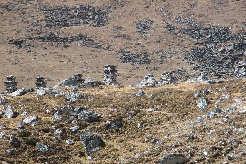
Another view of the Mani Stones just trying to give a sense of how large an area they covered.
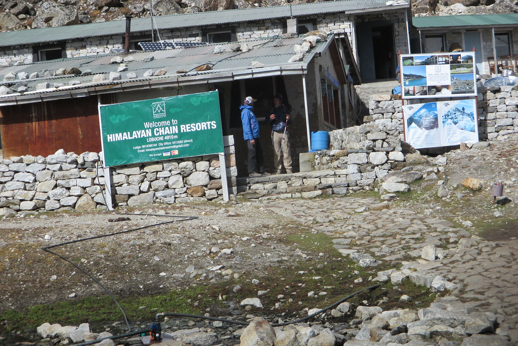
Our tea house in Lobuche.
Saturday Oct 6, 2018 #
map hiking 1:31:50 [3] 2.1 mi (43:44 / mi) +208m 33:26 / mi
We stayed two nights in Pheriche to acclimatize. In the morning of the second day we hiked up the ridge behind the village of Pheriche with several of us declining to make the final push up to the top of a small rise. I figured I'd done enough for the day and resting for the next day was a better choice.
In the afternoon we went to a lecture on high altitude sickness at the Himalayan Rescue Center in Pheriche where they have volunteer doctors on staff during the climbing seasons in the spring and fall. They have a clinic there that services all of the villages in the area and of course all of the climbers and trekkers.
Things were starting to get tough - the hiking each day was hard work, not so much on the muscles but on the breathing, it was cold in the evenings and the facilities were getting more and more basic. It was hard to make myself brush my teeth for example, I had to use my water bottle and the water was freezing cold and all I wanted to do was climb in my sleeping bag. So a lot of mental discipline to stay positive and not get discouraged. Luckily we had great weather and each morning we would wake to the sun burning off the clouds from the night before and just spectacular views of the mountains all around which made it easy to get up and go trekking. But it was definitely starting to be hard.
Yak dung being dried to use as fuel for the stoves that warmed the eating areas.
A look back down on Pheriche from where we climbed in the morning.
Pasang, the Sherpa in charge, standing next to a stone tower that Ang Dawa had just built. We decided that it was an appropriate tower for our MIT trek what with the cantilevered stone on top. The top of the hillside had a whole bunch of stone monuments, some simple and some elaborate, all over it. Note also how Pasang had the whole keep the buff over the nose and mouth thing down.
Friday Oct 5, 2018 #
map hiking 1:26:04 [3] 1.43 mi (1:00:12 / mi) +122m 47:35 / mi
This was an easy 2 hour or so trek but I forgot to start my watch and had trouble getting the satellites. Some more hiking along and across the steep ravines. This day was built in by WWT in case of problems - it could be combined with the day before or day after if necessary. But we were right on schedule so we got a bit of an easy day.
The tea house was one of the nicer ones. They were selling Snickers Bars for $3 a pop and I thought a Snickers was one thing my stomach would be happy with so I bought 3 and ate one and saved the other two for other days, Anything for sale had to be carried up the mountain whether by person or yak so prices reflected how far up the valley you were. Lower down they were only $2 and higher up $4 or $5.
In the afternoon, we hiked up the hill behind the tea house to visit another monastery and to also help with acclimatization. But the hike was advertised as an easy "walk-about" so I didn't bring my poles. Big mistake - this was a very steep hillside and I had major issues getting back down. One of the Sherpas, Pasang, went in front of me and one of the guides, Patrick, went behind me and between leaning on Pasang and Patrick grabbing my pack I managed to get down with only a few slips and slides. We collectively agreed that I would take my poles on any future walk no matter how benignly it was described!
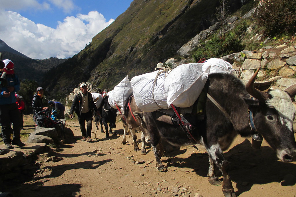
Our yak train coming by.

A view from one of the suspension bridges. You can also see how we're losing the forest and getting more into just scrub bushes.
At the monastery. It's amazing how beautiful and colorful and well maintained these monasteries are so far from what we think of as civilization. I guess you put resources into what's important to youl
map hiking 55:04 [3] 1.21 mi (45:31 / mi) +124m 34:30 / mi
More GI issues overnight so feeling a little weak to start out. We were high enough in the valley that we were mostly out of the trees and only small bushes around. And there were hardly any villages other than the ones we were staying in. So very different from lower down in the valley.
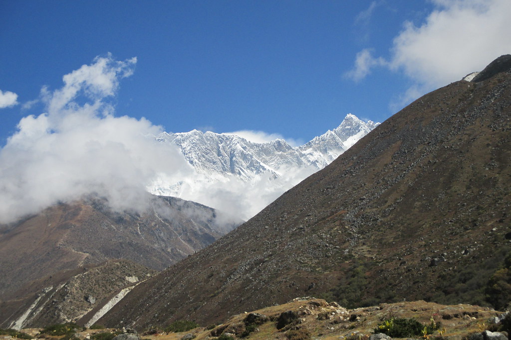
A really great hike with phenomenal views of all sorts of mountains like Ama Dablam and Nuptse (but not Everest). Not too long of a hike and we are taking a second day in Pheriche to acclimatize. But it's still hard work climbing 1000 ft. at this altitude and it's also getting colder and harder to stay warm.
I think this track is the first half so we must have stopped for lunch somewhere. My journal is a bit vague.
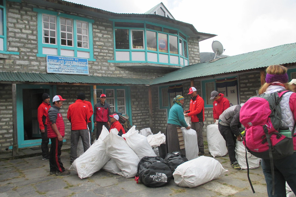
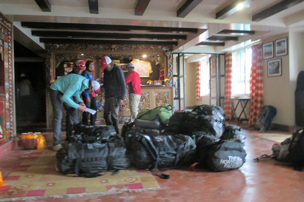
Getting the bags ready for the yaks - a morning ritual. We each had one of the black North Face duffles which they would out in a white bag and then usually three would go on a yak. The woman in the center in the green sweater, Mingma, was in charge of the yak operation.
Yes, we did have to go up that trail in the distance climbing the hillside.
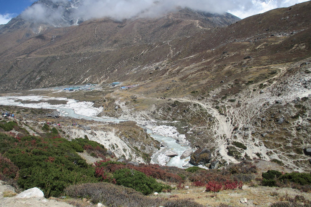
In the distance you can see the blue roof tops of Pheriche. But first we had to climb down to the river to cross it.
Wednesday Oct 3, 2018 #
map hiking 1:52:00 [3] 1.65 mi (1:07:53 / mi) +35m 1:03:39 / mi
It was interesting getting up in the morning and seeing that the town was surrounded by these tall snow covered peaks. When we arrived the afternoon before they were all hidden in the clouds and there was no sense at all that they were there. Very cool to wake up to completely different views.
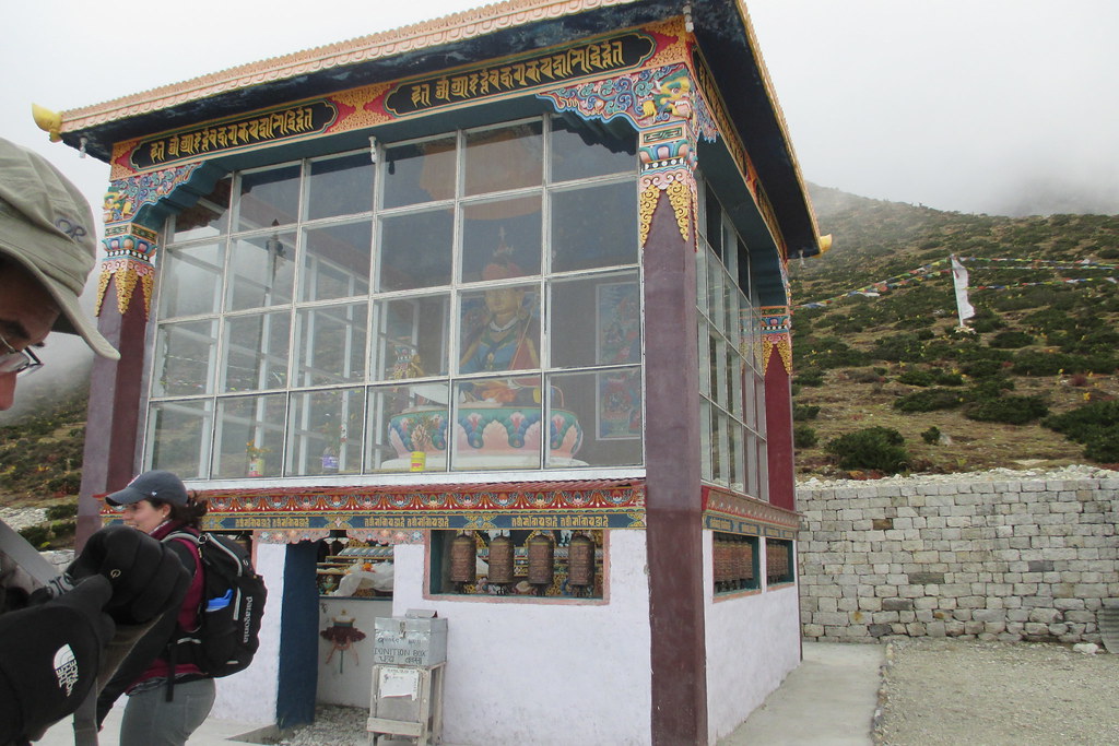
First we visited a Buddhist monastery. There was a monk there and he did a ceremony and a blessing and gave each of us a red string that he blessed and tied loosely around our necks. These apparently are good luck and no one took theirs off for the whole trip. We then hiked to the National Park headquarters and actually got some views of Everest. The clouds had started rolling in though so it was just glimpses here and there. We also visited the Sherpa museum which was pretty cool.
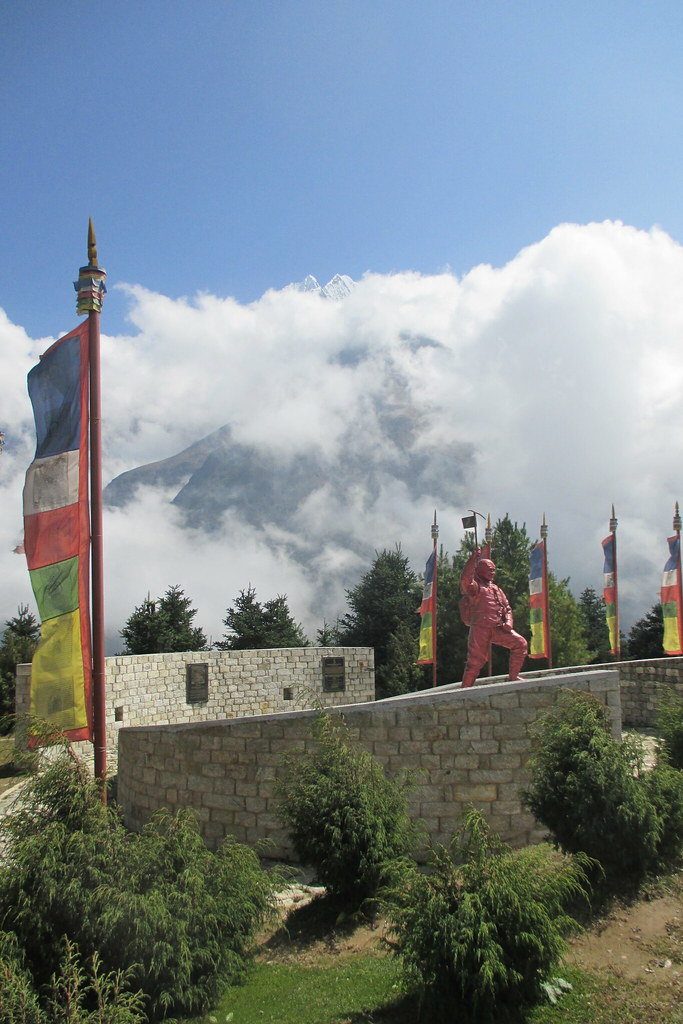
A word about our Sherpas. There were 20 MIT trekkers and 4 western guides. There were only supposed to be 3 but the 4th was a woman, the significant other of the head guide (and owner of the trekking company WWT) and she was scheduled to climb Ama Dablam which is a 22,500 ft mountain that we could see for much of the trek right after the trek. She actually didn't come all the way down with us, but met the rest of her climbing team the day before we finished and headed back up for the climb.
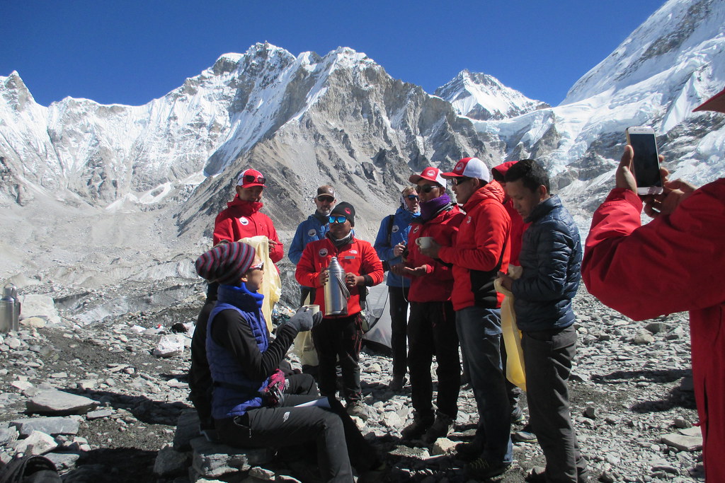
And then there were 10 Sherpas that assisted with the trek and 4 more Sherpas that took care of the yaks that transported all out gear. So Sherpa is the familiy name of everyone from that region of Nepal. The 10 that assisted with the trek did everything from filter our water, to serving us tea and coffee, helping serve all the meals, staying with stragglers on the trail and carrying the daypacks of those that needed help. Assisting on a trek like ours was a very good job and they were so professional. They really took to heart the idea of trying to help us have as good a time as possible. And the trekking was a piece of cake for them - here we were huffing and puffing and putting one foot in front of the other and they were singing and laughing and jumping from rock to rock. Just incredible. We'd finish the trek for the day and collapse in the tea house, and they would get to work serving us tea and hot water and refilling our water bottles and helping get the meals ready and served. And they were always smiling. And of the 10 Sherpas, they were all somehow related - the brother of the wife of someone, or the son-in-law of the brother of someone, etc. It was wild. But because of that, they were like family and you could tell they just loved what they were doing and they were a team.
In the monastery with the monk that did the blessing hidden behind the square post.
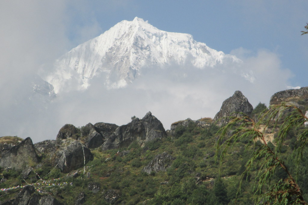
Not Everest, but some other mountain that would peek out from behind the clouds up above Namche Bazaar.
View of Everest from the Sagamartha National Park Headquarters - it's way, way in the background just poking up above the clouds.
map hiking 5:29:57 [3] 6.9 mi (47:49 / mi) +618m 37:25 / mi
This was a hard day. The beginning part was fine, contouring around the hillside above Namche with a lot of rolling ups and downs (more ups than downs), but then a grueling down to the river where we stopped for lunch. The down was really difficult and mentally exhausting.
After lunch we crossed the river on another suspension bridge and then climbed about 2000 ft up to the Tengboche Monastery. All I could think about on the way up was that I was going to have to come down the trail on the way out and as hard as it was going up (around 12,250 ft at the top) it was going to be just as hard coming down. Eventually though I told myself to stop worrying, I should focus on the here and now and enjoy myself. That helped.
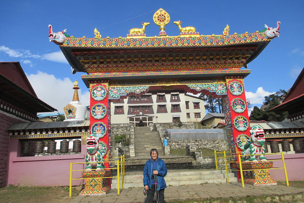
The monastery was another elaborate Buddhist monastery but it was very cold inside and I had gotten a bit sweaty on the climb up and didn't have an extra layer to put on or a hat or gloves so I was pretty chilled by the time we left. Lesson learned - put extra layers in my day pack. Anyway, the monk was not there so we didn't stay too long. I think this was one of the oldest monasteries in Nepal and had some relics that were supposedly from a Yeti. Afterwards, we hiked to Deboche through a really cool rhododendron forest arriving at our tea house pretty late.
This was the first time that I was cold in the evening. The rooms in the tea houses are not heated and since we arrived late in the day the sun was already behind the hills so the rooms were pretty cold. The common eating room is heated but it wasn't all that warm so I was in my medium puffy jacket all through dinner. For meals we would order off the menu - the menus were pretty similar at all the tea houses. I would usually have soup of some sort and potatoes or spaghetti of some sort and maybe get a dessert of canned fruit cocktail if I was feeling especially hungry. My stomach was always a little iffy for the whole of the trip and so I tried to stick to bland things as much as possible. I also was very conscious of the fact that I kept thinking I could eat more than I actually could so tried not to order too much,
This was the first night that I really tested my sleeping bag. I was so cold when I went to bed that I jumped into my bag with lots of layers on and lay there shivering for a while. Then I remembered that the only way to warm the bag was to not have many layers on and so I stripped down to one layer and soon enough I was toasty warm. So warm that I had to unzip the zippers to let in some cool air. That was a nice problem to have!
No bathroom in my room but only a little ways down the hall, so I would jump out of my sleeping bag and put on my down booties (a last minute addition to my duffle that I used a lot!) and jacket, race down to the bathroom and back, and jump back in the bag. (The diamox I was taking for help with the altitude meant several trips a night.) And that bag would warm me right up. Did I mention my sleeping bag was really warm? I had a liner that would give me an extra 15 degrees of warmth that I never had to use. This was a real treat knowing that I had this really warm sleeping bag.
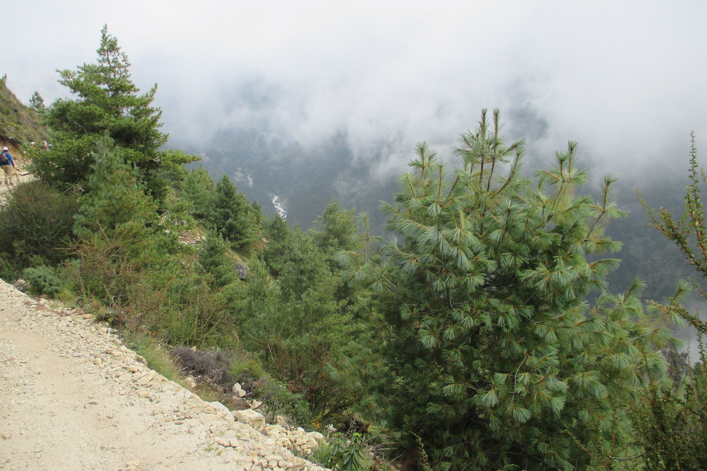
The trail out of Namche Bazaar - very steep hillside with the trail cut into it. If you zoom in (right click on the photo and select view image) you can see that the little ribbon of white is the river way down below. Later that day we had to climb down to that river to cross it and go back up the other side.
Part of the monastery at Tangboche (I have a better picture on the way down) with a random Sherpa taking a rest from carrying his heavy load.
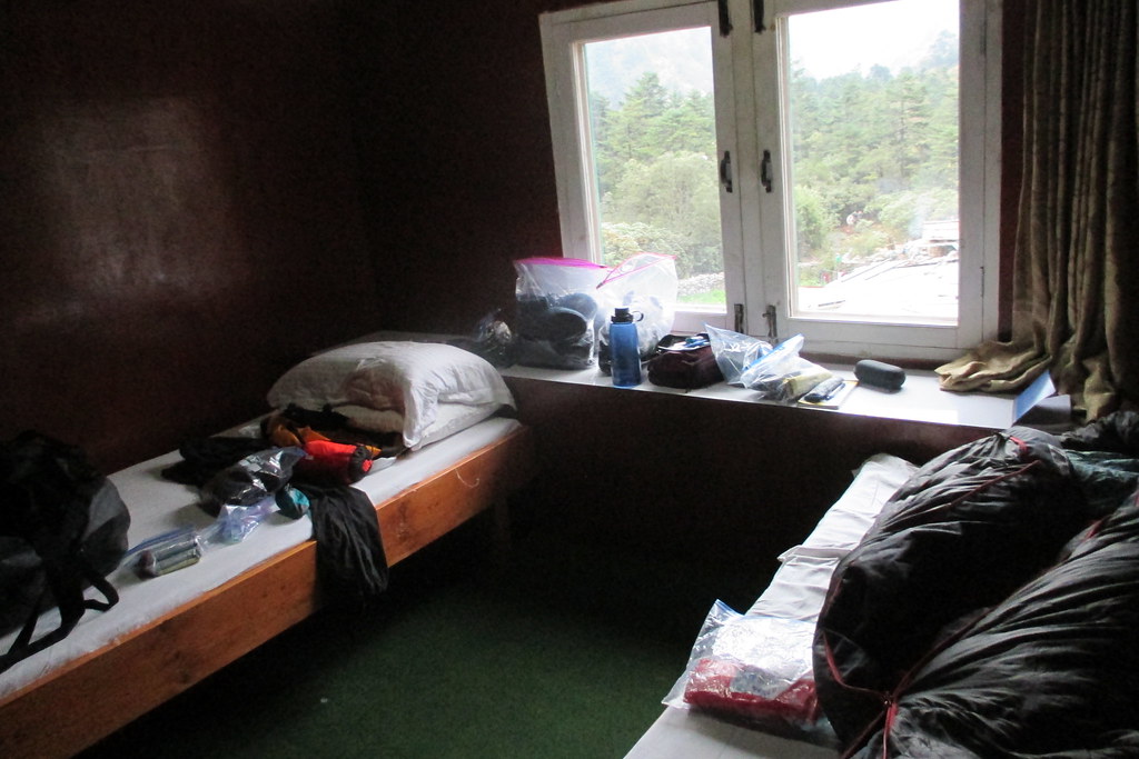
My room at the tea house in Deboche; fairly typical with two bunks (I had to pay extra to have a room to myself) which meant all my stuff spread on one bed and my sleeping bag on the other.
The view out my window. A few of our yaks tethered to the ground and behind them some local villagers who are building a new tea house and are hand chipping away at stones to make them usable in the construction.
Monday Oct 1, 2018 #
map hiking 2:26:57 [3] 3.57 mi (41:10 / mi) +326m 32:04 / mi
Anyway, this is the first day of trekking from Phakding to Monjo. WWT (World Wide Trekking - the tour company that was used) knew that the airport at Lukla is frequently closed due to weather and so they start all their treks with helicopters to Phakding. This was a good call since Lukla was closed the day we were starting, it had been closed for much of the week before and was closed for a couple days after we started. But we had helicopter reservations so we were going to go. Unfortunately, everything was very backed up and so it took most of the day to get all of us shuttled out of Kathmandu and to Phakding. We needed 4 helicopters to move us all and two groups went and then we had to wait for those 2 helicopters to return to take the next two groups. I was in the last group and I was pretty miserable. I was afraid to eat or drink anything and the public bathrooms are pretty scummy so I didn't want to use them (you have to carry your own toilet paper and it was 50/50 whether there would be a toilet or just a hole in the ground). Anyway, I was feeling pretty miserable but trying to just endure and we finally got airborne. It was a pretty cool helicopter ride looking down and seeing the country side as we started to fly up the valley. No great views though since everything was clouded in (hence the airport being closed). By the time we got Phakding, the other three groups has started trekking to where we would stay that night so it was just the five of us on the final helicopter plus a couple of the guides and several sherpas.
And I was struggling. I couldn't really tell if it was from being at altitude (9000 feet), being out of shape or being sick but part way in they had one of the sherpas take my day pack which helped a bit. At one point though I said I need a bathroom and I need it now and they found one I could use. For this part of the trek, we were hiking through small village after small village so finding someplace that would let me use a bathroom wasn't too hard although I suspect they had to pay a couple dollars. The rest of the trek is a bit of a blur but eventually made it to our first tea house.
The tea house was pretty good with my room having it's own bathroom and even a shower, although no hot water. The beds were comfortable and although they had sheets and comforters I just used my sleeping bag. Meals were in a common room and we actually ordered off a menu although with my innards still unsettled I think I had rice and plain potatoes not wanting to risk anything else.
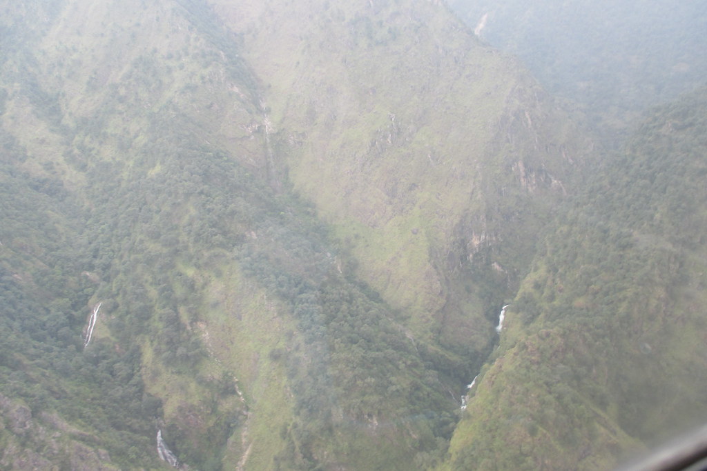
A very bad picture from the helicopter that gives a sense of the steepness of the terrain.
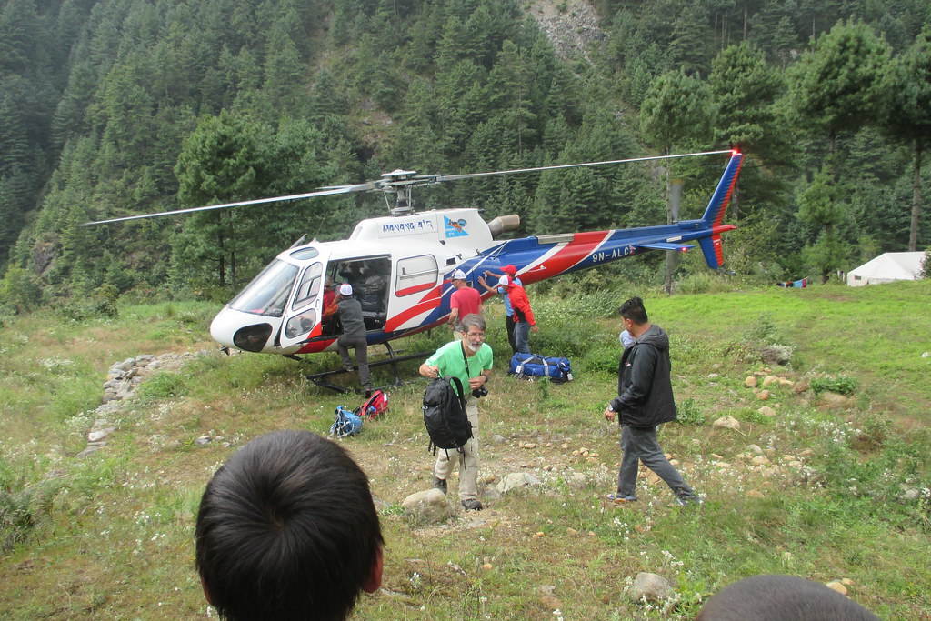
Our ultra sophisticated landing pad for the helicopter!
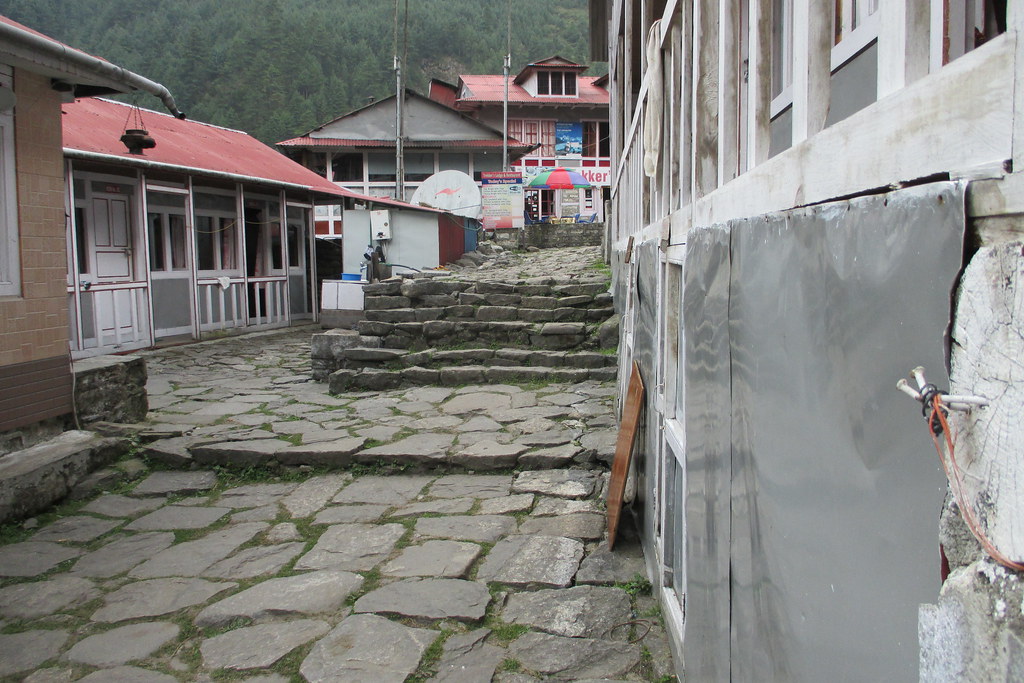
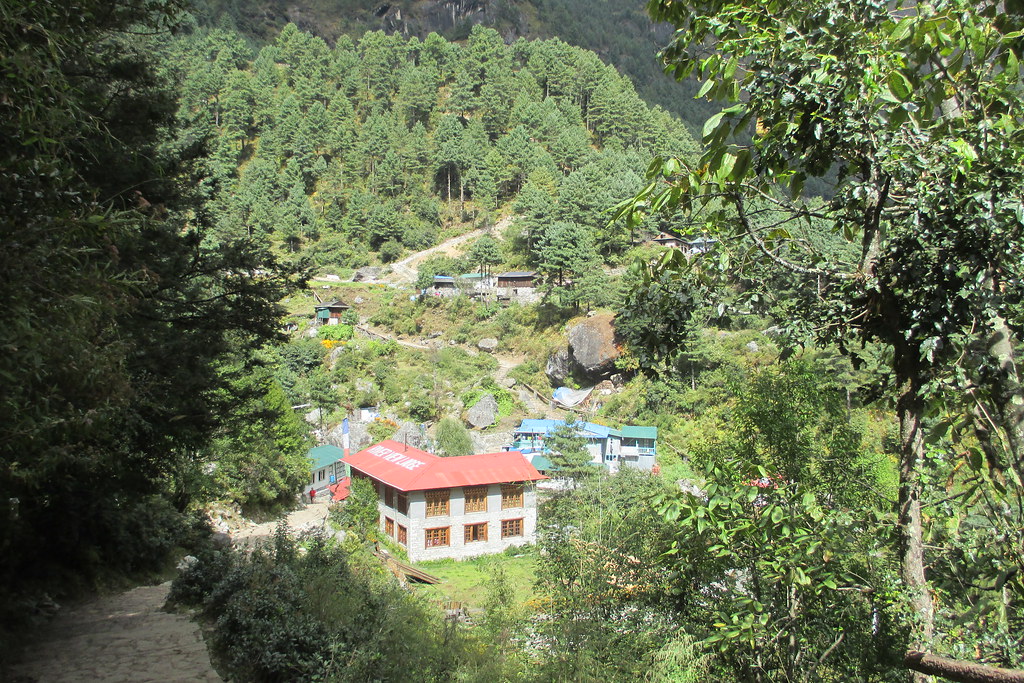
And the start of the "trail" in Phakding. This was typical trail when passing through a village - stone walkway with lots of steps.
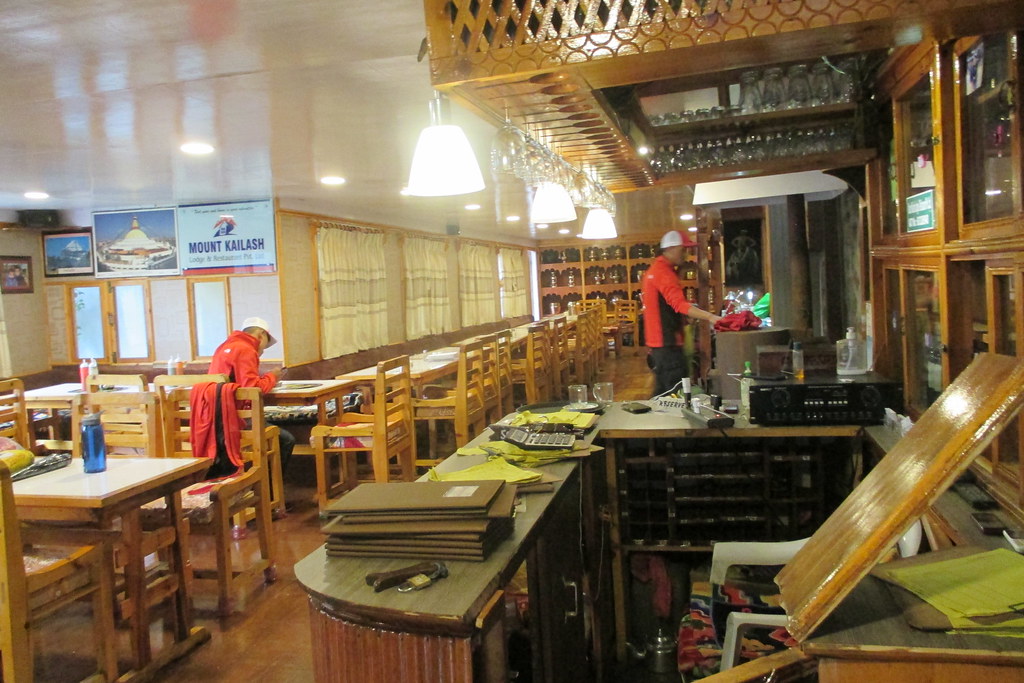
The common room in our tea house in Monjo with two of our Sherpas. The Sherpas had all sorts of gear provided by WWT including these red jackets and hats so they really stood out.
map hiking 2:44:18 [3] 2.68 mi (1:01:18 / mi) +569m 36:57 / mi
Felt much better when I got up in the morning and everyone commented on how much better I looked so I guess I really was pretty sick the day before. Carried my own pack and the trekking seemed straightforward - I won't say easy because we climbed about 2200 ft. and ended up at 11,550 ft so there was a lot of huffing and puffing going on but I felt pretty good. The trail is really interesting - about half of it is stone steps. Just a gorgeous hike though along a really steep ravine. The trail crossed back and forth across the ravine a couple of times on these massive cable suspension bridges. Lots of beautiful waterfalls and the river with the milky sea green color from the glacier runoff roaring along down below.
So after climbing for what seems like ages you come around a corner in the trail and there just clinging to this hillside is a massive town. Just breath-taking.
The tea house in Namche was excellent - showers with hot water and actually outlets in the rooms. And they would do laundry for $1 an item. Most of the tea house would charge you a fee to charge items at the main desk. And I actually had cell service.
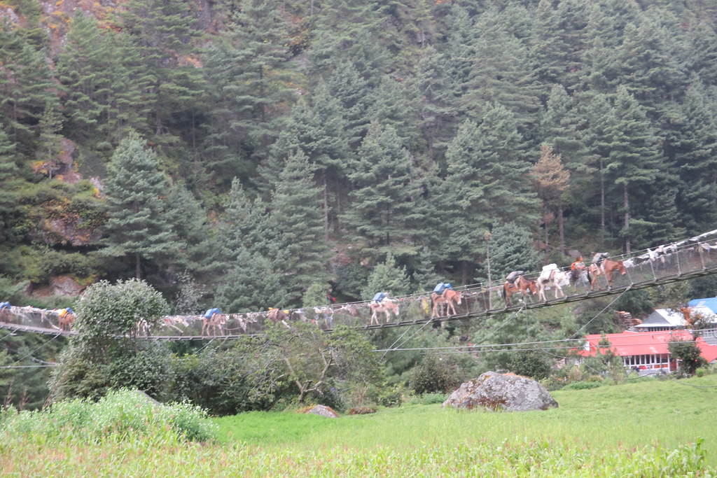
One of the many cable bridges we would cross on our way up the valley, this one with a mule train coming towards us. You definitely didn't want to meet a mule or yak train on the bridge; it was scary enough on the trail where you would squeeze yourself to the hillside to let them pass.
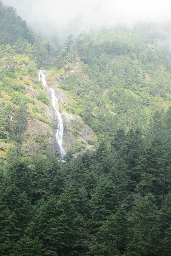
One of many beautiful waterfalls on the way up the valley,
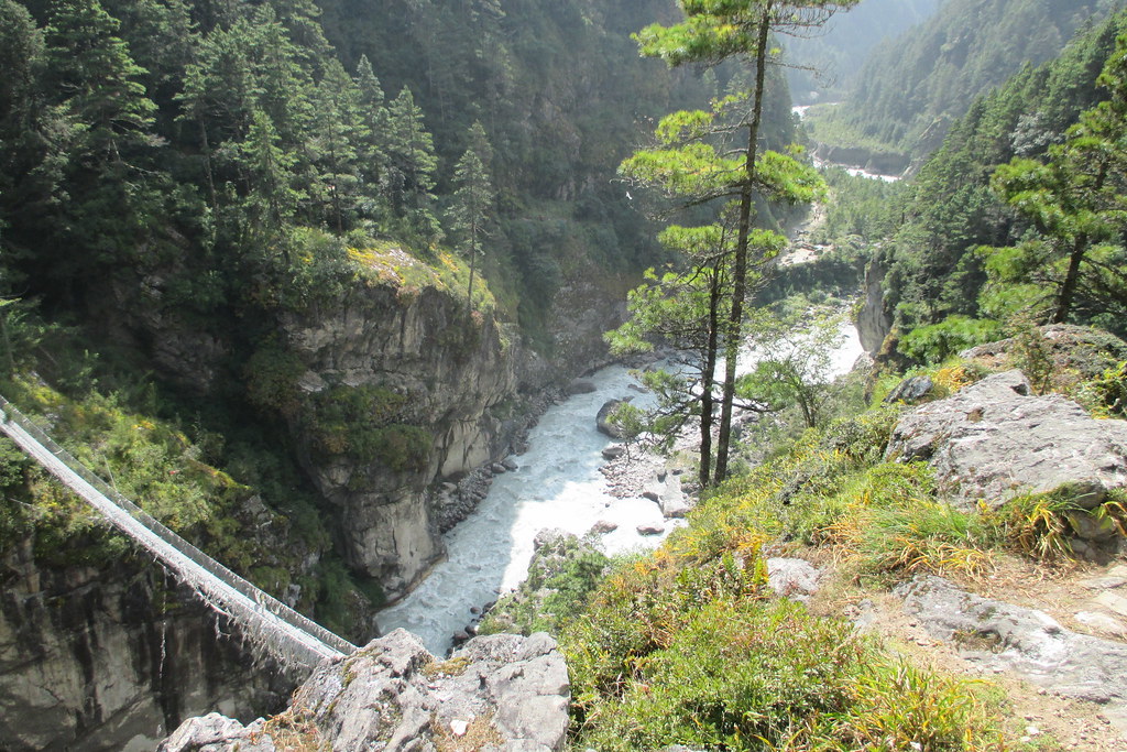
A view of one of the cable bridges we crossed looking down after climbing up the hill on the far side.
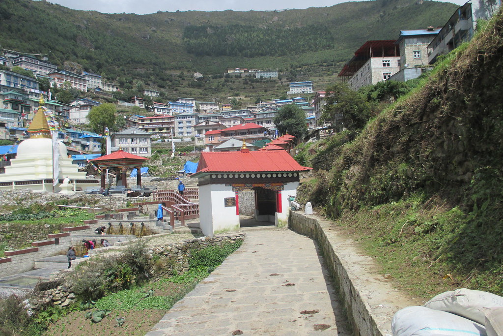
Coming around the corner in the trail to find Namche Bazaar nestled in the hillside.